

This map has been created and designed for business or reference use. Clear and clean colors & fonts matched with cartographic research makes this Arizona Zip Code Map with Counties easily readable and useful. The map shows the 15 counties of Arizona and the borders of the over 500 zip codes across the Grand Canyon State.
This map is rolled and shipped in a sturdy cardboard tube.
AZWM114
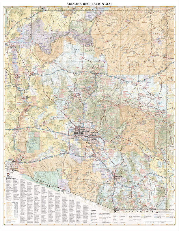
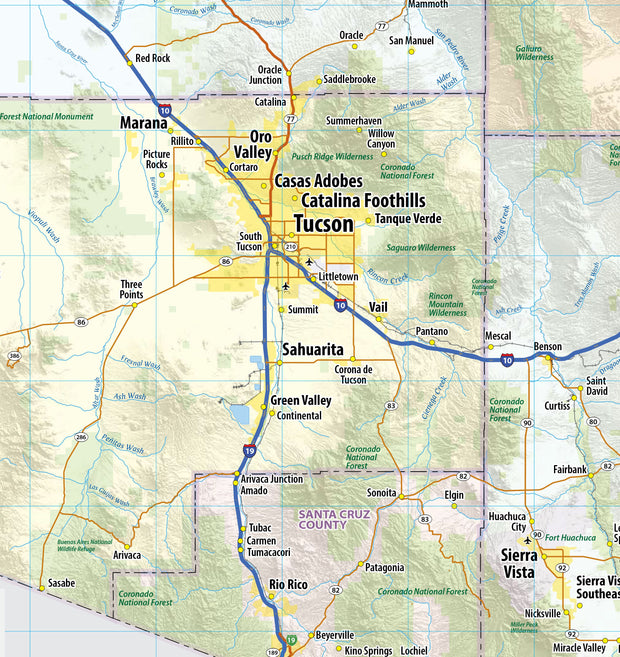
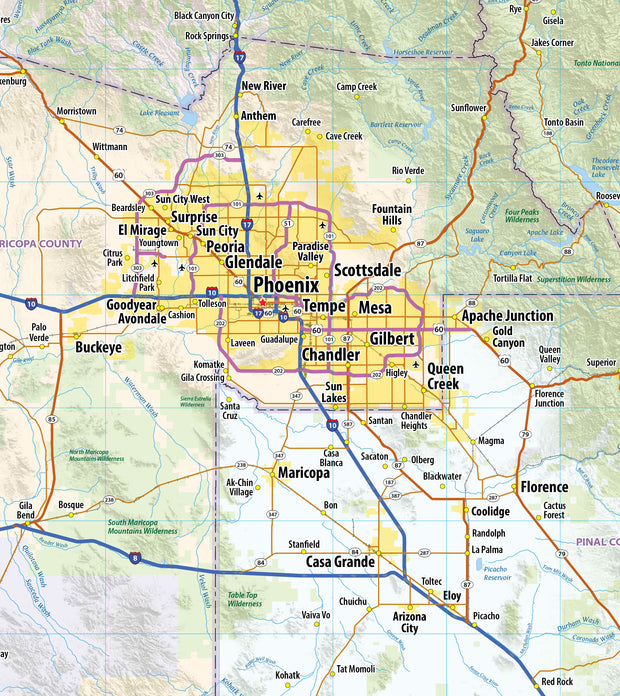
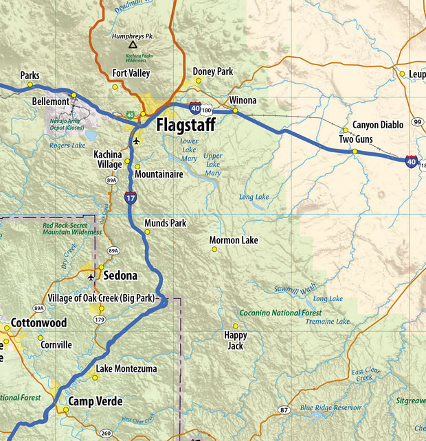
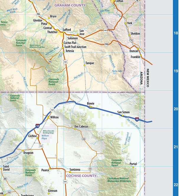
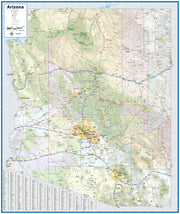
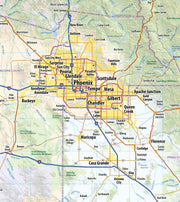
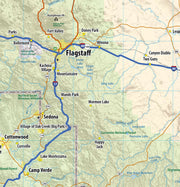
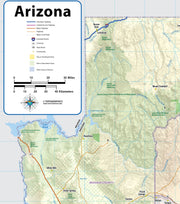
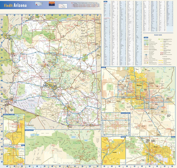
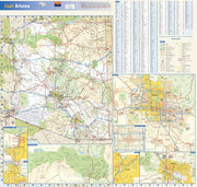
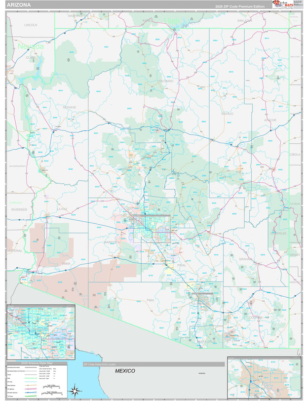
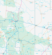
Arizona contains some of the world’s most fascinating natural landscapes and scenic drives, from the Grand Canyon in the north to the Sonoran Desert in the south. This wall map illustrates The Grand Canyon State’s vast network highways, public lands, and recreation opportunities.
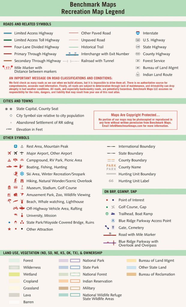
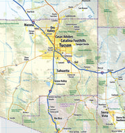
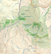
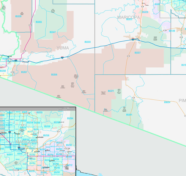
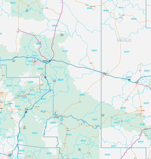
If outdoor adventure and recreation is your thing, this is the map for you. This map is loaded with points of interest from camping sites, hiking trails, fishing spots, and bird watching locations ( see legend shown on 2nd picture) this map depicts all the best recreation locations. Not only functional this exquisite map uses shaded relief to portray the land a technique which combines shading with elevation tints that portray landforms much more clearly than contour lines. These techniques and elevation colors make mountains, highlands and valleys immediately obvious.
Beautiful as well as functional this map will look great in a home, office, cabin, RV or wherever you choose to hang it.
This map is rolled and shipped in a sturdy cardboard tube.
AZWM006
This exquisite wall map of Arizona uses shaded relief to portray the land and combines shading with elevation tints that portray landforms much more clearly than contour lines. These techniques and elevation colors make mountains, highlands and valleys immediately obvious.
This map also includes a city index making this map both highly functional and decorative. Perfect for a home office, conference room or dispatch office, this map fits all your Arizona mapping needs.
This wall map of Arizona shows counties, cities, towns, major roads, highways, and major areas of interest.
This map is rolled and shipped in a sturdy cardboard tube.
AZWM002
This colorful, easy-to-read state map of Arizona identifies all major thoroughfares, secondary roads, freeway interchanges, rest areas, distance markers, landmarks, recreational areas, and more. Shaded relief on the state map provides a three-dimensional sense of Arizona’s topography. Detailed inset maps of Bullhead City, Flagstaff, Phoenix, Tucson, and Yuma are based on the latest street information from our cartographic experts. An up-to-date inset of Grand Canyon National Park provides must-see information on this popular tourist destination. County and city indices make it simple to locate even the smallest town.
This map is rolled and shipped in a sturdy cardboard tube.
AZWM001
Description
Rand McNally's state wall map of Arizona is ideal for anyone needing a comprehensive representation of the area for planning, routing, or reference. It is an excellent choice for business and sales strategy, urban development, social work outreach, education, and marketing. State residents, businesses, and government offices are sure to find this wonderful reference tool irreplaceable.
The laminated wall map is printed with UV-resistant ink to help prevent color fading.
Map details include federal, state, and county highways, county boundaries, cities and towns, major waterways, state/national parks, campsites, exit numbers, rest areas, military installations, airports, golf courses, universities, and much more.
You will also find a city/county index on the map, a comprehensive map legend, a distance chart with mileages between various cities, and a mileage/driving times map.
This truly complete wall map even includes a hanging kit with rails for easy mounting just about anywhere.
Coverage Area
Inset maps: Bullhead City, Flagstaff, Grand Canyon National Park, Lake Havasu City, Petrified Forest National Park, Phoenix & Vicinity, Central Phoenix, Prescott, Sierra Vista, Tucson, Downtown Tucson, Yuma
This map is rolled and shipped in a sturdy cardboard tube.
AZWM007-1
Save money on our full line of wall maps from one of the industry leaders in wall maps. These always up to date, eye catching wall maps come in a variety of sizes and finishing options sure to meet your specific mapping needs.
Features include:
This map is rolled and shipped in a sturdy cardboard tube.