
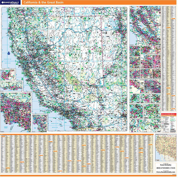
CAWM002
This colorful, easy-to-read state map of California identifies all major thoroughfares, secondary roads, freeway interchanges, distance markers, landmarks, recreational areas, and more. Shaded relief on the state map provides a three-dimensional sense of California’s topography. County and city indices make it simple to locate even the smallest town.
This map is rolled and shipped in a sturdy cardboard tube.
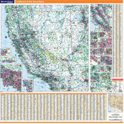
CAWM001
This map is rolled and shipped in a sturdy cardboard tube.


CAWM002
Description
Rand McNally's state wall map of California is ideal for anyone needing a comprehensive representation of the area for planning, routing, or reference. It is an excellent choice for business and sales strategy, urban development, social work outreach, education, and marketing. State residents, businesses, and government offices are sure to find this wonderful reference tool irreplaceable.
The laminated wall map is printed with UV-resistant ink to help prevent color fading.
Map details include federal, state, and county highways, county boundaries, cities and towns, major waterways, state/national parks, campsites, exit numbers, rest areas, military installations, airports, golf courses, universities, and much more.
You will also find a city/county index on the map, a comprehensive map legend, a distance chart with mileages between various cities, and a mileage/driving times map.
This truly complete wall map even includes a hanging kit with rails for easy mounting just about anywhere.
Coverage Area
Inset maps: Bakersfield, Coachella Valley: Palm Springs to Indio, Fresno, Joshua Tree National Park, Kings Canyon National Park & Sequoia National Park, Lake Tahoe Region, Lancaster/Palmdale, Lassen Volcanic National Park, Los Angeles/The Inland Empire & Vicinity, Central Los Angeles, Monterey Bay Area: Santa Cruz/Monterey, Modesto, Oceanside, Oxnard/Ventura, Redding, Sacramento & Vicinity, San Diego & Vicinity, Central San Diego, San Francisco Bay Area: San Francisco/Oakland/San Jose, Central San Francisco, Santa Barbara, Santa Rosa, Stockton, Wine Country Region, and Yosemite National Park.
This map is rolled and shipped in a sturdy cardboard tube.
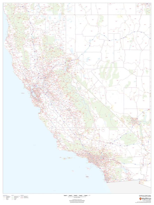

CAWM003
This map of California shows ZIP codes overlaid on a road map. Base map features include county boundaries, major road network features, and state and national parks and conservation areas.
This map is rolled and shipped in a sturdy cardboard tube.

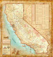
CAWM006
California Antique Wall Map
Introducing the California Antique Wall Map/Mural. Beautifully illustrated with subtle antique parchment and earth tone hues, the detail is highly legible with borders clearly defined. In this unique Antique style, this map can be used for general reference, to track current events, or as a piece of art. Decorators will find the color scheme works beautifully with dark wood furniture and trim. With flexible sizes this mural is a designer's delight.
This California Antique Wall Map features:
This map is rolled and shipped in a sturdy cardboard tube.