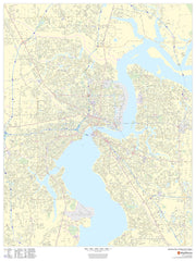
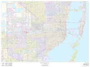
This portrait-oriented map of central Jacksonville, Florida shows detailed street level information including extensive street labeling. Ideal for planning of deliveries, home services, sales territories, real estate and much more. Base map features include all roads with major roads and highways labelled; neighborhood names; railways; high level land use such as parks and recreation areas, industrial areas and hospital campuses; and a variety of points of interest including schools, libraries, stadiums, museums, border crossings and more.
Jacksonville Wall Map
FLWM109-1
Regular price
$59.95
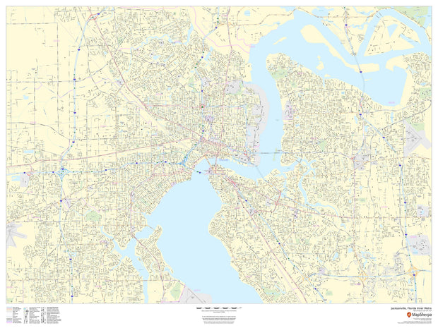
This portrait-oriented map of central Jacksonville, Florida shows detailed street level information including extensive street labeling. Ideal for planning of deliveries, home services, sales territories, real estate and much more. Base map features include all roads with major roads and highways labelled; neighborhood names; railways; high level land use such as parks and recreation areas, industrial areas and hospital campuses; and a variety of points of interest including schools, libraries, stadiums, museums, border crossings and more.
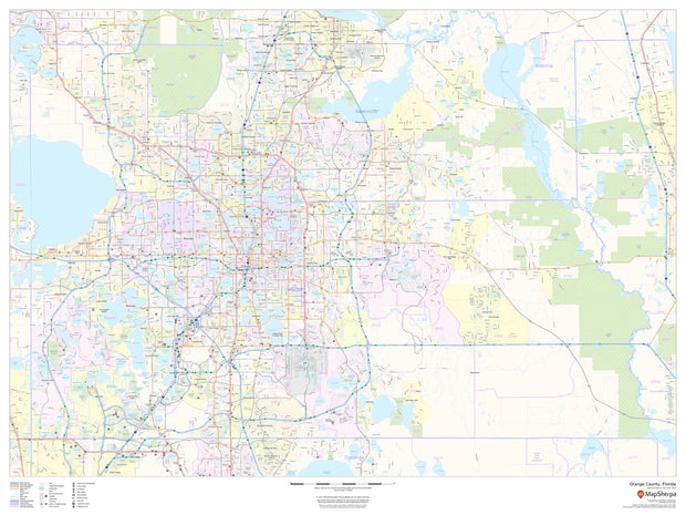
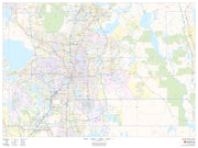
Orange County, Florida Wall Map
FLWM108-1
Regular price
$59.95
This map of Orange County, Florida shows regional level information. Base map features include highways and major roads with labelling; neighborhood names; railways; high level land use such as parks and recreation areas, industrial areas and hospital campuses; and a selection of points of interest including transportation hubs like airports and train stations, tourist information, police stations and shopping centres. ZIP code boundaries are shown as a secondary map feature.
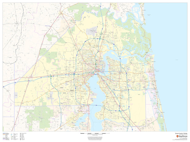
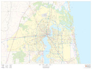
Duval County Wall Map
FLWM107-1
Regular price
$59.95
This map of Duval County, Florida shows regional level information. Base map features include highways and major roads with labelling; neighborhood names; railways; high level land use such as parks and recreation areas, industrial areas and hospital campuses; and a selection of points of interest including transportation hubs like airports and train stations, tourist information, police stations and shopping centres. ZIP code boundaries are shown as a secondary map feature.
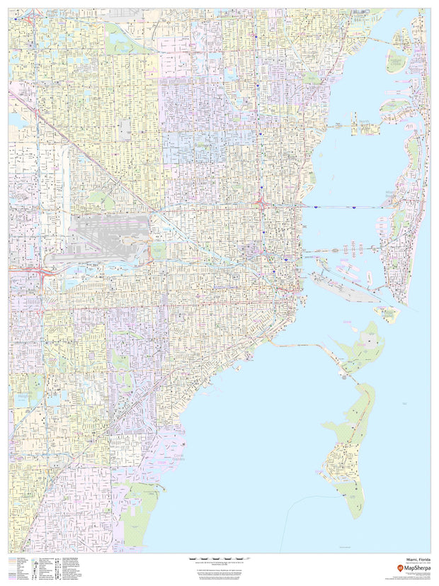
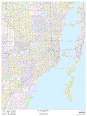
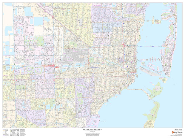
Miami Wall Map
FLWM106-1
Regular price
$59.95
This portrait-oriented map of Miami, Florida shows detailed street level information including extensive street labeling. Ideal for planning of deliveries, home services, sales territories, real estate and much more. Base map features include all roads with major roads and highways labelled; neighborhood names; railways; high level land use such as parks and recreation areas, industrial areas and hospital campuses; and a variety of points of interest including schools, libraries, stadiums, museums, border crossings and more.
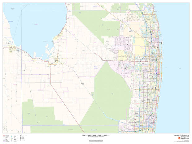
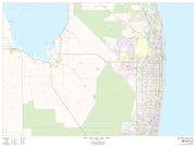
Palm Beach County Wall Map
FLWM105-1
Regular price
$59.95
This map of Palm Beach County, Florida shows regional level information. Base map features include highways and major roads with labelling; railways; high level land use such as parks and recreation areas; and a selection of points of interest including transportation hubs like airports and train stations, tourist information and police stations. ZIP code boundaries are shown as a secondary map feature.
Pinellas County Wall Map
FLWM104-1
Regular price
$59.95
This map of Pinellas County, Florida shows regional level information. Base map features include highways and major roads with labelling; neighborhood names; railways; high level land use such as parks and recreation areas, industrial areas and hospital campuses; and a selection of points of interest including transportation hubs like airports and train stations, tourist information, police stations and shopping centers. ZIP code boundaries are shown as a secondary map feature.
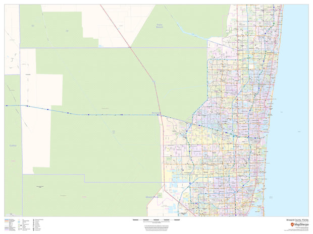
Broward County Wall Map
FLWM103-1
Regular price
$59.95
This map of Broward County, Florida shows regional level information. Base map features include highways and major roads with labelling; neighborhood names; railways; high level land use such as parks and recreation areas, industrial areas and hospital campuses; and a selection of points of interest including transportation hubs like airports and train stations, tourist information, police stations and shopping centres. ZIP code boundaries are shown as a secondary map feature.
Hillsborough County Wall Map
FLWM102-1
Regular price
$59.95
This map of Hillsborough County, Florida shows regional level information. Base map features include highways and major roads with labelling; railways; high level land use such as parks and recreation areas; and a selection of points of interest including transportation hubs like airports and train stations, tourist information and police stations. ZIP code boundaries are shown as a secondary map feature.
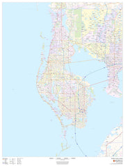
Miami Wall Map
FLWM100-1
Regular price
$59.95
This landscape-oriented map of Miami, Florida shows detailed street level information including extensive street labeling. Ideal for planning of deliveries, home services, sales territories, real estate and much more. Base map features include all roads with major roads and highways labelled; neighborhood names; railways; high level land use such as parks and recreation areas, industrial areas and hospital campuses; and a variety of points of interest including schools, libraries, stadiums, museums, border crossings and more.
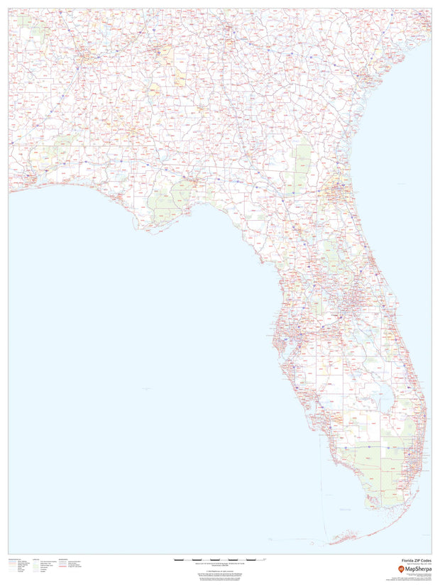
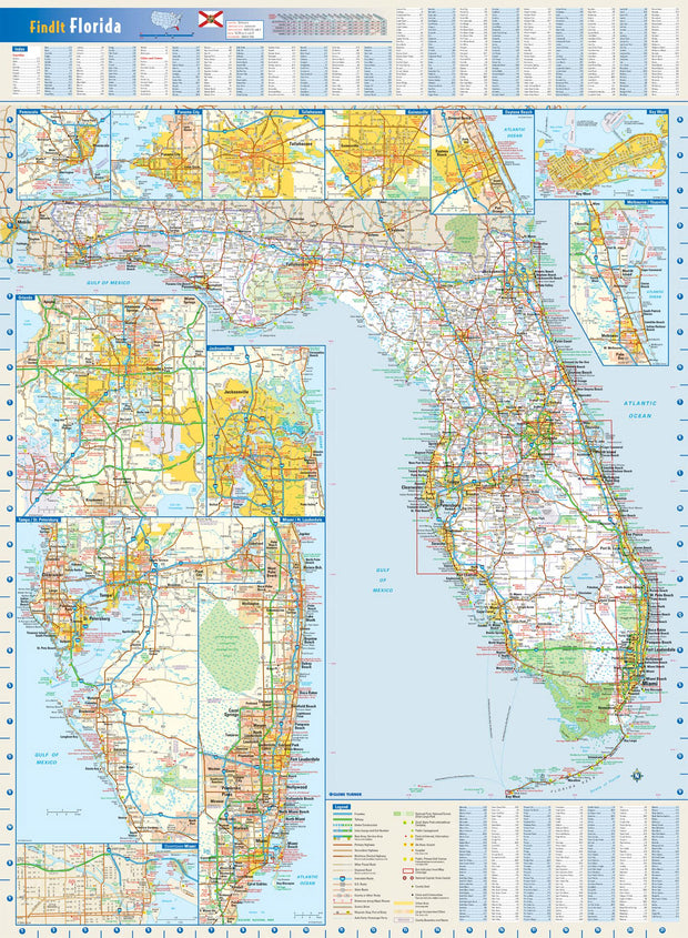
Florida Zip Code Map
FLWM003-1
Regular price
$59.95
This map of Florida shows ZIP codes overlaid on a road map. Base map features include county boundaries, major road network features, and state and national parks and conservation areas.
36"W x 48"H
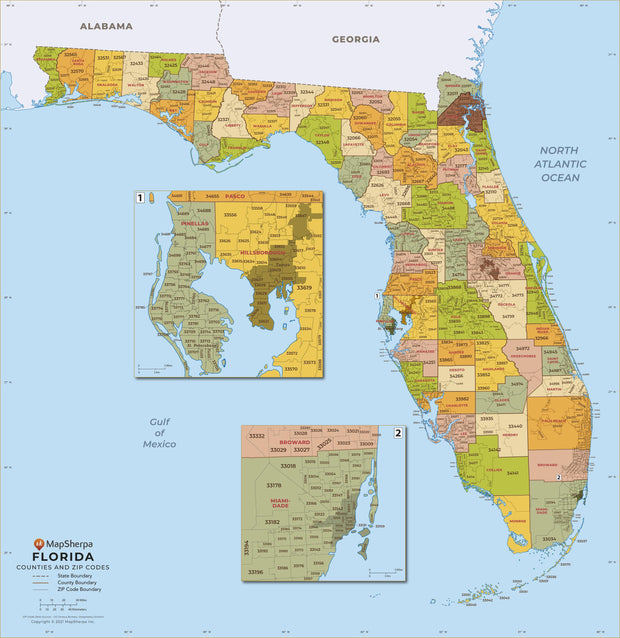
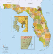
Florida Zip Code Map with Counties
FLWM005-1
Regular price
$39.95
This map has been created and designed for business or reference use. Clear and clean colors & fonts matched with cartographic research makes this Florida Zip Code Map with Counties easily readable and useful. The map shows the 67 counties of Florida and the borders of the over 900 zip codes across the Sunshine State.
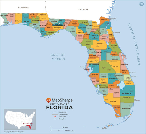
Florida County Map
FLWM004-1
Regular price
$29.95
This map has been created and designed for reference or business use. Clear and clean colors & fonts matched with cartographic research makes this map of Florida Counties Map easily readable and useful. The map shows the 67 counties of Florida and their borders across the Sunshine State.
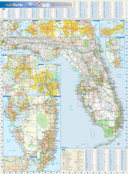
Florida Wall Map by Globe Turner
FLWM002-1
Regular price
$29.95
This colorful, easy-to-read state map of Florida identifies all major thoroughfares, secondary roads, freeway interchanges, rest areas, distance markers, landmarks, recreational areas, and more. Shaded relief on the state map provides a three-dimensional sense of Florida's topography. Detailed city inset maps of Daytona Beach, Gainesville, Jacksonville, Key West, Melbourne/Titusville, Miami/Fort Lauderdale, Orlando, Panama City, Pensacola, Tallahassee, and Tampa/St. Petersburg are based on the latest street information from our cartographic experts. An up-to-date inset of downtown Miami provides detailed information on the central business district. County and city indices make it simple to locate even the smallest town.