Skip to content
  • Home
  • Choose A State
    • Alabama
    • Alaska
    • Arizona
    • Arkansas
    • California
    • Colorado
    • Connecticut
    • Delaware
    • Florida
    • Georgia
    • Hawaii
    • Idaho
    • Illinois
    • Indiana
    • Iowa
    • Kansas
    • Kentucky
    • Louisiana
    • Maine
    • Maryland
    • Massachusetts
    • Michigan
    • Minnesota
    • Mississippi
    • Missouri
    • Montana
    • Nebraska
    • Nevada
    • New Hampshire
    • New Jersey
    • New Mexico
    • New York
    • North Carolina
    • North Dakota
    • Ohio
    • Oklahoma
    • Oregon
    • Pennsylvania
    • Rhode Island
    • South Carolina
    • South Dakota
    • Tennessee
    • Texas
    • Utah
    • Vermont
    • Virginia
    • Washington
    • Washington, DC
    • West Virginia
    • Wisconsin
    • Wyoming
    • USA Maps
  • Choose A Category
    • US Regional Maps
    • USA Maps
    • Educational Maps
      • US, World & Continents Combo Pull Down Maps
    • Topographic Maps
      • Any USA Topographic Map
      • Alabama Topographic Maps
      • Arizona Topographic Maps
      • Arkansas Topographic Maps
      • California Topographic Maps
      • Colorado Topographic Maps
      • Delaware Topographic Maps
      • Florida Topographic Maps
      • Georgia Topographic Maps
      • Hawaii Topographic Maps
      • Idaho Topographic Maps
      • Illinois Topographic Maps
      • Indiana Topogrpahic Maps
      • Iowa Topographic Maps
      • Kansas Topographic Maps
      • Kentucky Topographic Maps
      • Louisiana Topographic Maps
      • Maine Topographic Maps
      • Maryland Topographic Maps
      • Massachusetts Topographic Maps
      • Michigan Topographic Maps
      • Minnesota Topographic Maps
      • Mississippi Topographic Maps
      • Missouri Topographic Maps
      • Montana Topographic Maps
      • Nebraska Topographic Maps
      • Nevada Topographic Maps
      • New Hampshire Topographic Maps
      • New Jersey Topographic Maps
      • New Mexico Topographic Maps
      • New York Topographic Maps
      • North Carolina Topographic Maps
      • North Dakota Topographic Maps
      • Ohio Topographic Maps
      • Oklahoma Topographic Maps
      • Oregon Topographic Maps
      • Pennsylvania Topographic Maps
      • Rhode Island Topographic Maps
      • South Carolina Topographic Maps
      • South Dakota Topographic Maps
      • Tennessee Topographic Maps
      • Texas Topographic Maps
      • Utah Topographic Maps
      • Vermont Topographic Maps
      • Virginia Topographic Maps
      • Washington Topographic Maps
      • West Virginia Topographic Maps
      • Wisconsin Topographic Maps
      • Wyoming Topographic Maps
    • World Wall Maps
    • International Maps
    • War Maps
  • Helpful Info
    • Our Printing Process
    • Shipping
    • Returns
    • Purchase Orders
    • Custom Maps
  • Log in
Cart
American Map Store American Map Store
Log in Search Cart
Home / Florida: Wall Maps

Florida: Wall Maps

Florida Wall Maps

  • View all
  • Florida
  • Florida City Wall Maps
  • Florida: Wall Maps
Quick view
Orlando Metro Area Wall Map
from $79.95
Quick view
Miami and South Florida Metro Area Wall Map
from $79.95
Quick view
Florida by Topographic Maps
from $79.95
Quick view
Palm Beach County Wall Map
from $74.95
Quick view
Pinellas County Wall Map
from $74.95
Quick view
Florida County Map
from $74.95
Quick view
Jacksonville Wall Map (portrait)
from $64.95
Quick view
Jacksonville Wall Map
from $64.95
Quick view
Orange County, Florida Wall Map
from $64.95
Quick view
Duval County Wall Map
from $64.95
Quick view
Miami Wall Map (portrait)
from $64.95
Quick view
Broward County Wall Map
from $64.95
Quick view
Hillsborough County Wall Map
from $64.95
Quick view
Miami Wall Map
from $64.95
Quick view
Florida Zip Code Map
from $64.95
Quick view
Miami - Dade County Wall Map
from $59.99
Quick view
Florida Zip Code Map with Counties
from $49.95
Quick view
Florida Wall Map by Globe Turner
from $49.95
Previous 1 2
Orlando Metro Area Wall Map

Orlando Metro Area Wall Map

FLWM123

Regular price $79.95
Our Orlando Metro Area wall map shows a 30 by 40 mile area centered on Orlando. It Includes the communities of Sanford, Apopka, Altamonte Springs, Oviedo, Winter Park, Kissimmee, and resort areas. Features shown include cities, towns, counties, highways and major and secondary roads, zip codes, and major points of interest. Note: due to the vast extent of this map, local street names are not shown. 

This map is rolled and shipped in a sturdy cardboard tube.

Miami and South Florida Metro Area Wall Map

Miami and South Florida Metro Area Wall Map

FLWM121

Regular price $79.95
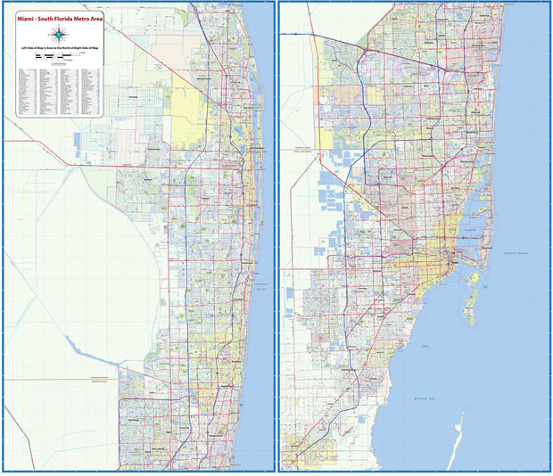
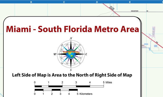
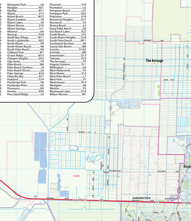
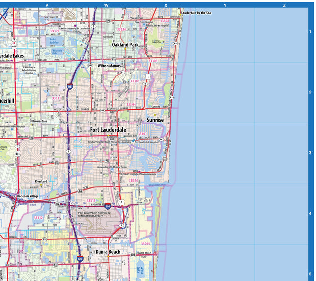
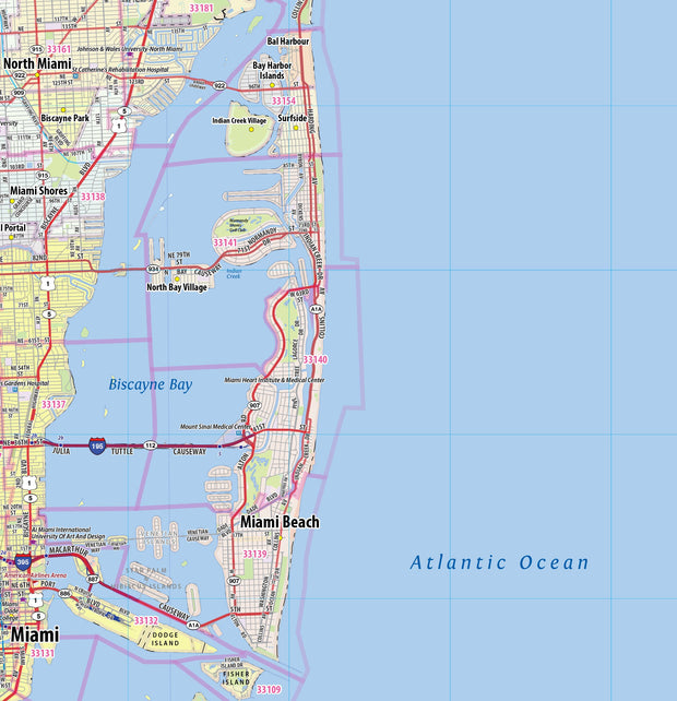
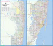
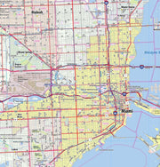
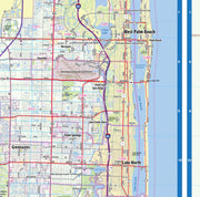
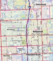
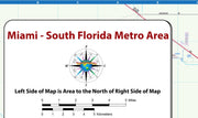
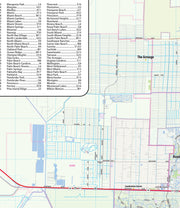
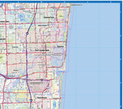
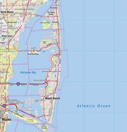
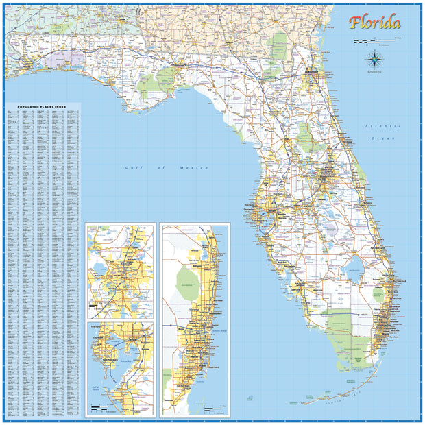
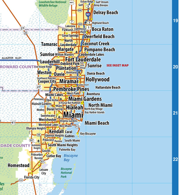
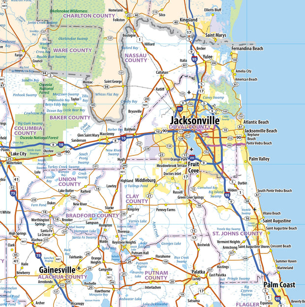
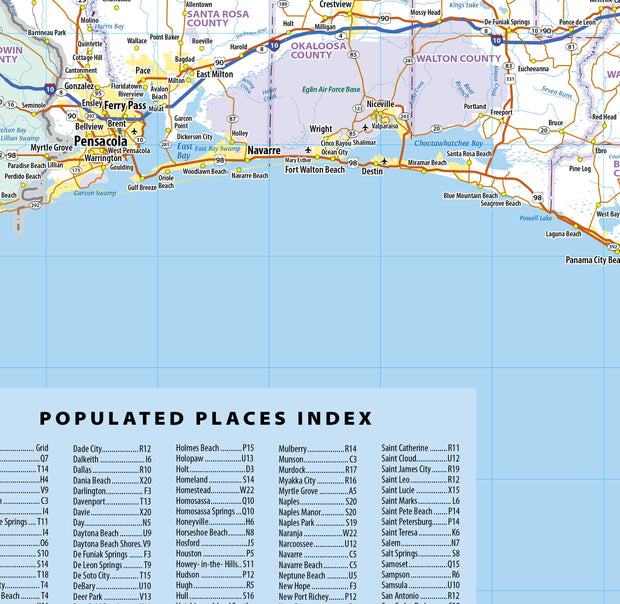
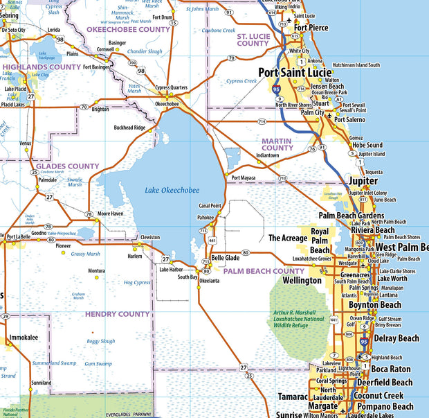
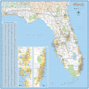
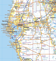
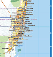
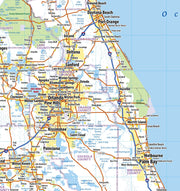
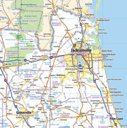
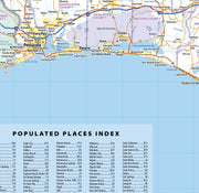
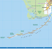
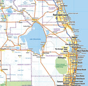
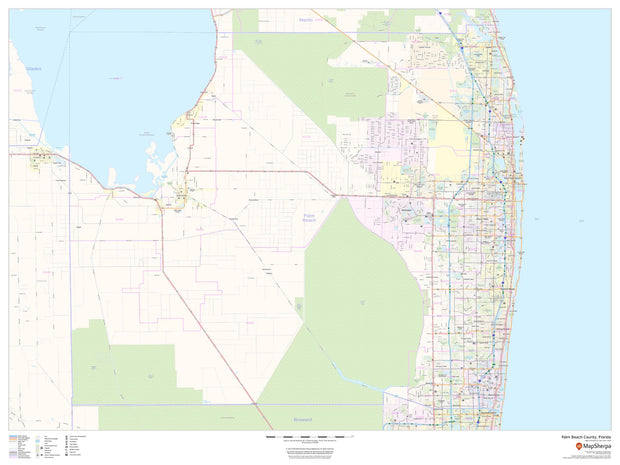
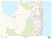
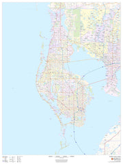
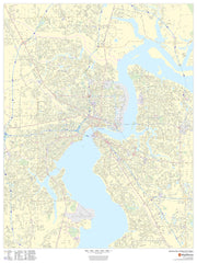
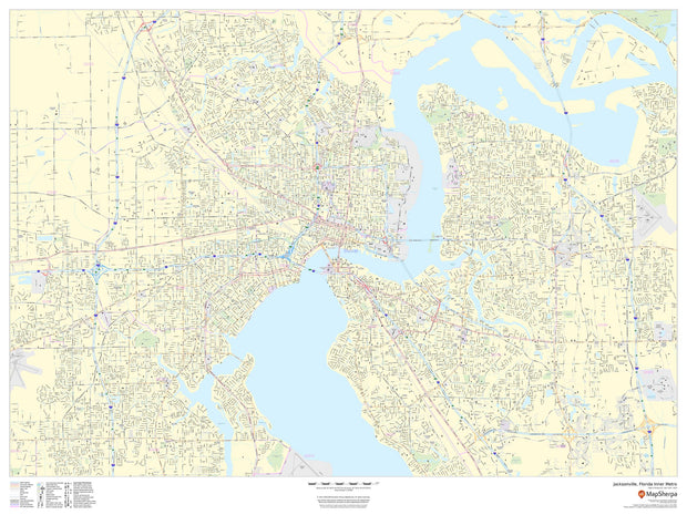
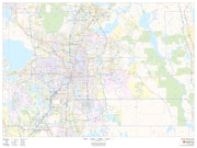
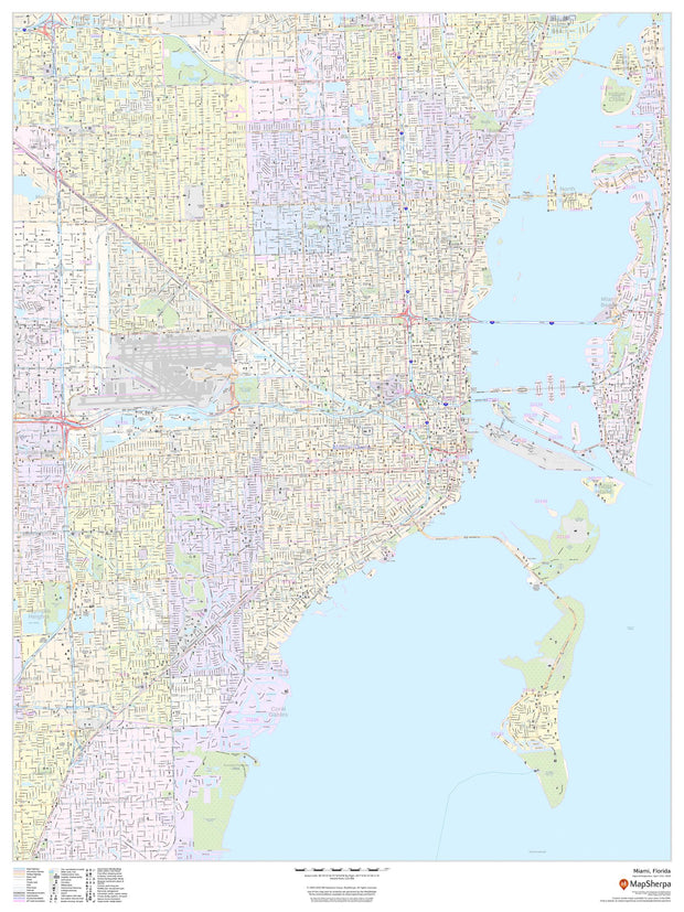
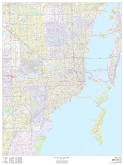
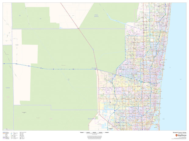
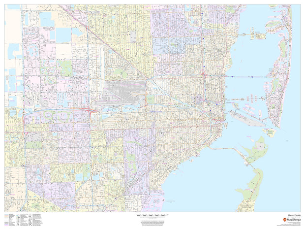
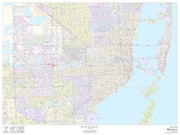
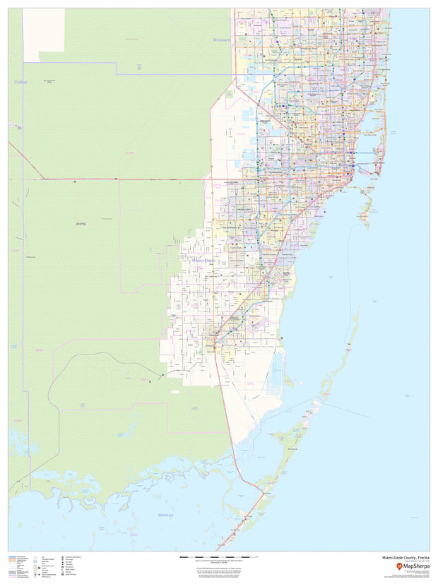
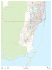
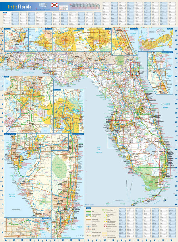
Our Greater Miami Metro Area Wall Map shows the area from Jupiter south to Homestead, Florida, including West Palm Beach, Lake Worth, Boynton Beach, Delray Beach, Boca Raton, Deerfield Beach, Pompano Beach, Fort Lauderdale, Hialeah, and Miami, among others.
 
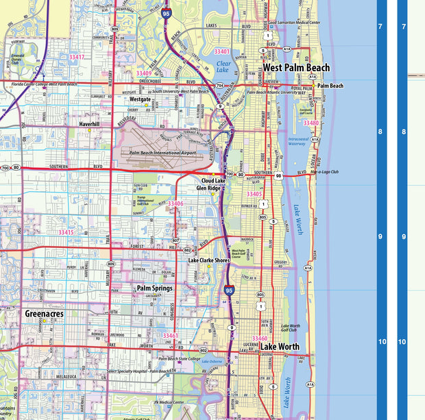
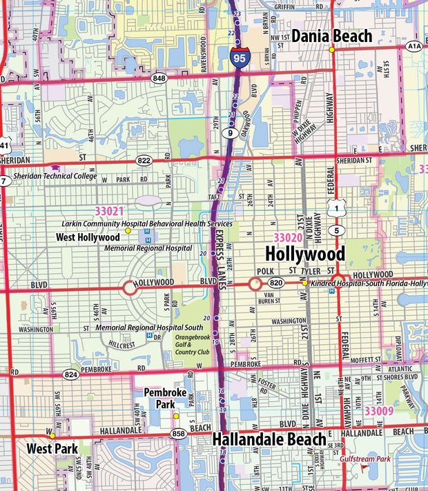
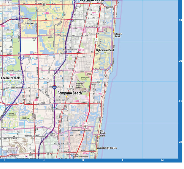
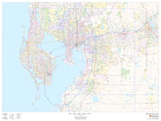
The map is divided into 2 vertical strips to display this region at the largest possible scale. Cities, towns, and major roads are labeled, as well as many points of interest and zip codes. 

This map is rolled and shipped in a sturdy cardboard tube.

Florida by Topographic Maps

Florida by Topographic Maps

FLWM007

Regular price $79.95

Our paper or laminated map of Florida shows counties, towns, cities, and major highways. This map is a great tool for visualizing the entire state. More detailed insets are included for Orlando, Tampa Bay, and the Miami - West Palm Beach corridor. 

This map also includes a city index making this map both highly functional and decorative. Perfect for a home office, conference room or dispatch office, this map fits all your Florida mapping needs.

This map is rolled and shipped in a sturdy cardboard tube.

Palm Beach County Wall Map

Palm Beach County Wall Map

FLWM105

Regular price $74.95

This map of Palm Beach County, Florida shows regional level information. Base map features include highways and major roads with labelling; railways; high level land use such as parks and recreation areas; and a selection of points of interest including transportation hubs like airports and train stations, tourist information and police stations. ZIP code boundaries are shown as a secondary map feature.

This map is rolled and shipped in a sturdy cardboard tube.

Pinellas County Wall Map

Pinellas County Wall Map

FLWM104

Regular price $74.95

This map of Pinellas County, Florida shows regional level information. Base map features include highways and major roads with labelling; neighborhood names; railways; high level land use such as parks and recreation areas, industrial areas and hospital campuses; and a selection of points of interest including transportation hubs like airports and train stations, tourist information, police stations and shopping centers. ZIP code boundaries are shown as a secondary map feature.

This map is rolled and shipped in a sturdy cardboard tube.

Florida County Map
Florida County Map

Florida County Map

FLWM004

Regular price $74.95

This map has been created and designed for reference or business use. Clear and clean colors & fonts matched with cartographic research makes this map of Florida Counties Map easily readable and useful. The map shows the 67 counties of Florida and their borders across the Sunshine State.

This map is rolled and shipped in a sturdy cardboard tube.

Jacksonville Wall Map (portrait)

Jacksonville Wall Map (portrait)

FLWM110

Regular price $64.95

This portrait-oriented map of central Jacksonville, Florida shows detailed street level information including extensive street labeling. Ideal for planning of deliveries, home services, sales territories, real estate and much more. Base map features include all roads with major roads and highways labelled; neighborhood names; railways; high level land use such as parks and recreation areas, industrial areas and hospital campuses; and a variety of points of interest including schools, libraries, stadiums, museums, border crossings and more.

This map is rolled and shipped in a sturdy cardboard tube.

Jacksonville Wall Map

Jacksonville Wall Map

FLWM109

Regular price $64.95

This portrait-oriented map of central Jacksonville, Florida shows detailed street level information including extensive street labeling. Ideal for planning of deliveries, home services, sales territories, real estate and much more. Base map features include all roads with major roads and highways labelled; neighborhood names; railways; high level land use such as parks and recreation areas, industrial areas and hospital campuses; and a variety of points of interest including schools, libraries, stadiums, museums, border crossings and more.

This map is rolled and shipped in a sturdy cardboard tube.

Orange County, Florida Wall Map

Orange County, Florida Wall Map

FLWM108

Regular price $64.95

This map of Orange County, Florida shows regional level information. Base map features include highways and major roads with labelling; neighborhood names; railways; high level land use such as parks and recreation areas, industrial areas and hospital campuses; and a selection of points of interest including transportation hubs like airports and train stations, tourist information, police stations and shopping centers. ZIP code boundaries are shown as a secondary map feature.

This map is rolled and shipped in a sturdy cardboard tube.


Duval County Wall Map

Duval County Wall Map

FLWM107

Regular price $64.95

This map of Duval County, Florida shows regional level information. Base map features include highways and major roads with labelling; neighborhood names; railways; high level land use such as parks and recreation areas, industrial areas and hospital campuses; and a selection of points of interest including transportation hubs like airports and train stations, tourist information, police stations and shopping centers. ZIP code boundaries are shown as a secondary map feature.

This map is rolled and shipped in a sturdy cardboard tube.

Miami Wall Map (portrait)

Miami Wall Map (portrait)

FLWM106

Regular price $64.95

This portrait-oriented map of Miami, Florida shows detailed street level information including extensive street labeling. Ideal for planning of deliveries, home services, sales territories, real estate and much more. Base map features include all roads with major roads and highways labelled; neighborhood names; railways; high level land use such as parks and recreation areas, industrial areas and hospital campuses; and a variety of points of interest including schools, libraries, stadiums, museums, border crossings and more.

This map is rolled and shipped in a sturdy cardboard tube.

Broward County Wall Map

Broward County Wall Map

FLWM103

Regular price $64.95

This map of Broward County, Florida shows regional level information. Base map features include highways and major roads with labelling; neighborhood names; railways; high level land use such as parks and recreation areas, industrial areas and hospital campuses; and a selection of points of interest including transportation hubs like airports and train stations, tourist information, police stations and shopping centers. ZIP code boundaries are shown as a secondary map feature.

This map is rolled and shipped in a sturdy cardboard tube.

Hillsborough County Wall Map

Hillsborough County Wall Map

FLWM102

Regular price $64.95

This map of Hillsborough County, Florida shows regional level information. Base map features include highways and major roads with labelling; railways; high level land use such as parks and recreation areas; and a selection of points of interest including transportation hubs like airports and train stations, tourist information and police stations. ZIP code boundaries are shown as a secondary map feature.

This map is rolled and shipped in a sturdy cardboard tube.

Miami Wall Map
Miami Wall Map

Miami Wall Map

FLWM100

Regular price $64.95

This landscape-oriented map of Miami, Florida shows detailed street level information including extensive street labeling. Ideal for planning of deliveries, home services, sales territories, real estate and much more. Base map features include all roads with major roads and highways labelled; neighborhood names; railways; high level land use such as parks and recreation areas, industrial areas and hospital campuses; and a variety of points of interest including schools, libraries, stadiums, museums, border crossings and more.

This map is rolled and shipped in a sturdy cardboard tube.

Florida Zip Code Map

Florida Zip Code Map

FLWM003

Regular price $64.95

This map of Florida shows ZIP codes overlaid on a road map. Base map features include county boundaries, major road network features, and state and national parks and conservation areas.

This map is rolled and shipped in a sturdy cardboard tube.

Miami - Dade County Wall Map

Miami - Dade County Wall Map

FLWM101

Regular price $64.95

This map of Miami-Dade County, Florida shows regional level information. Base map features include highways and major roads with labelling; railways; high level land use such as parks and recreation areas; and a selection of points of interest including transportation hubs like airports and train stations, tourist information and police stations. ZIP code boundaries are shown as a secondary map feature.

This map is rolled and shipped in a sturdy cardboard tube.

Florida Zip Code Map with Counties

Florida Zip Code Map with Counties

FLWM005

Regular price $49.95

This map has been created and designed for business or reference use. Clear and clean colors & fonts matched with cartographic research makes this Florida Zip Code Map with Counties easily readable and useful. The map shows the 67 counties of Florida and the borders of the over 900 zip codes across the Sunshine State.

This map is rolled and shipped in a sturdy cardboard tube.

Florida Wall Map by Globe Turner

Florida Wall Map by Globe Turner

FLWM002

Regular price $49.95

This colorful, easy-to-read state map of Florida identifies all major thoroughfares, secondary roads, freeway interchanges, rest areas, distance markers, landmarks, recreational areas, and more. Shaded relief on the state map provides a three-dimensional sense of Florida's topography. Detailed city inset maps of Daytona Beach, Gainesville, Jacksonville, Key West, Melbourne/Titusville, Miami/Fort Lauderdale, Orlando, Panama City, Pensacola, Tallahassee, and Tampa/St. Petersburg are based on the latest street information from our cartographic experts. An up-to-date inset of downtown Miami provides detailed information on the central business district. County and city indices make it simple to locate even the smallest town.

This map is rolled and shipped in a sturdy cardboard tube.

Powered by Shopify

Main menu

  • Home
  • Choose A State
  • Choose A Category
  • Helpful Info

More Stuff Here

  • Custom Maps
  • Purchase Orders
  • Search for Product
  • Shipping
  • Refunds & returns
  • Contact Us

Join AMS Newsletter

Sign-up for Discounts, Coupons, New Product Arrivals and Recent News.

Powered by Shopify

  • american express
  • apple pay
  • diners club
  • discover
  • google pay
  • master
  • paypal
  • visa

All of our maps have a Free Shipping Option!