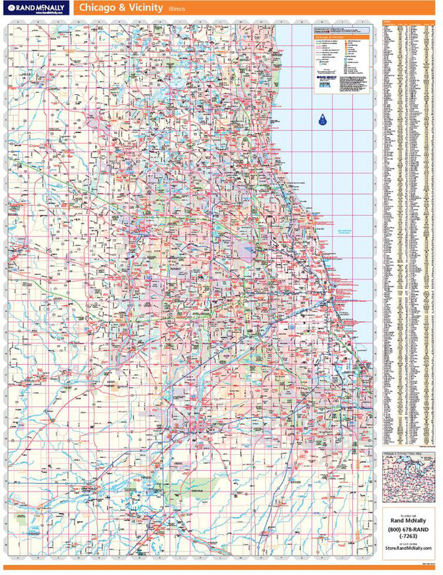
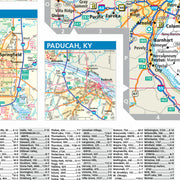
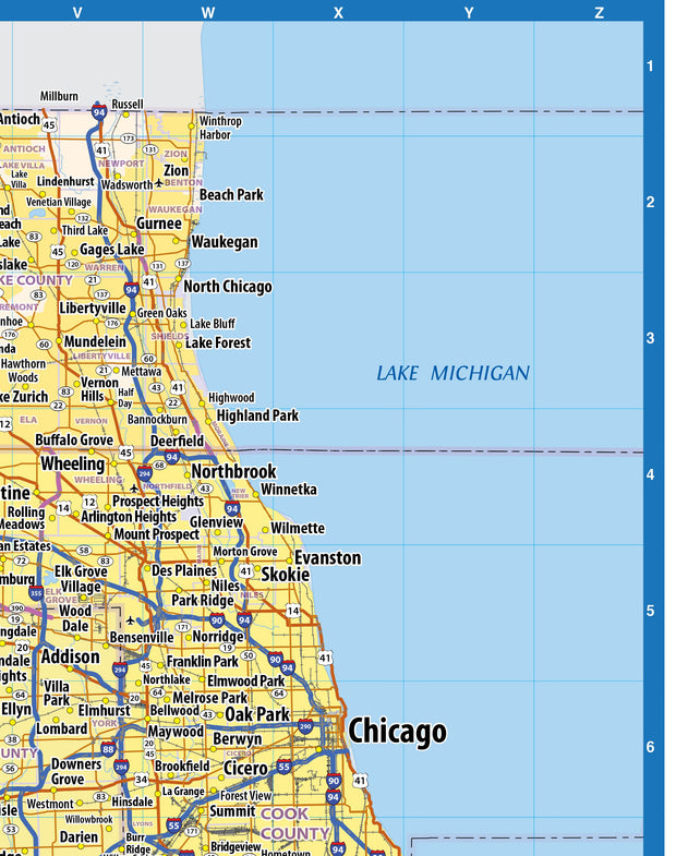
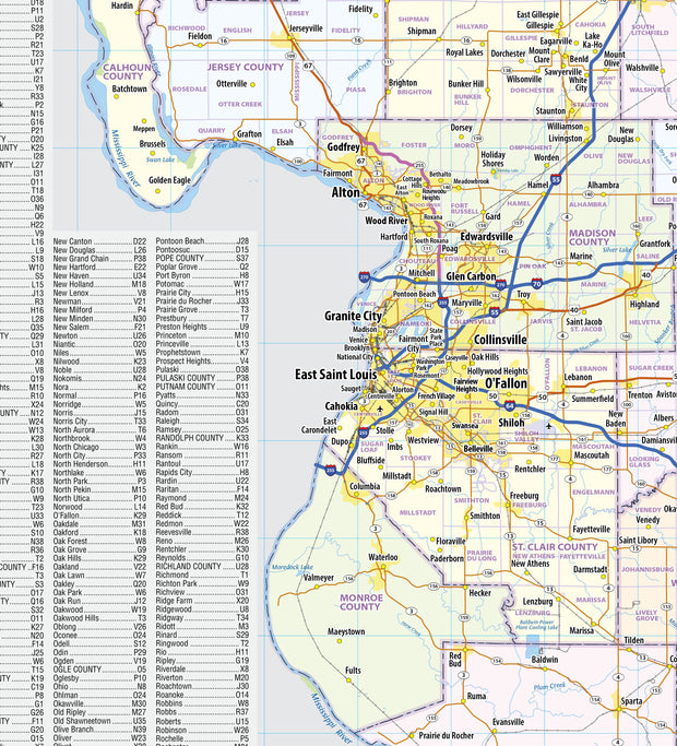
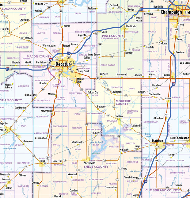
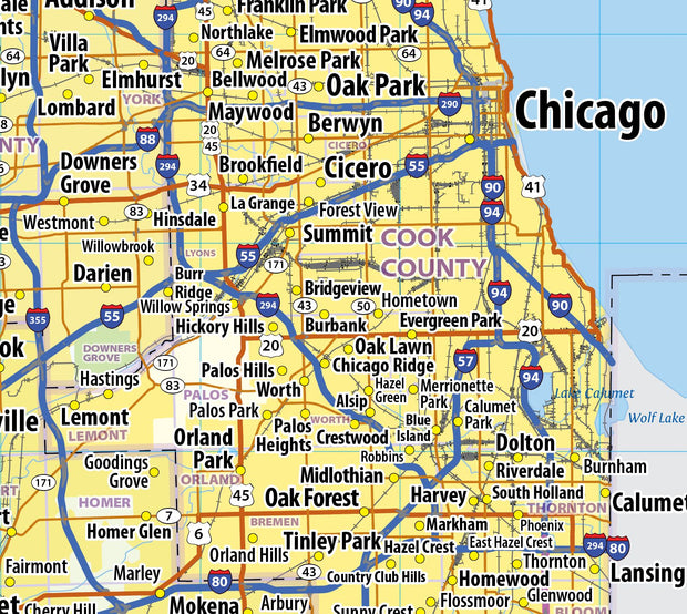
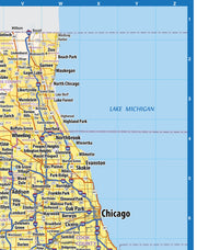
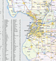
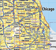
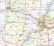
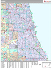
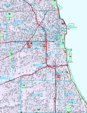
This detailed reference map combines two maps in one - a regional map of the Chicagoland area plus a street-level map of downtown Chicago. The regional map shows the area's cities and towns, highways and roads, and a variety of points of interest. Joliet, Aurora, Elgin, and Highland Park are among the suburbs near Chicago that are featured on this map. The highly detailed inset of the Chicago central business district shows highways, streets, parks, landmarks, and other points of interest. The Loop, Printer's Row, Chinatown, and the Near North are among the neighborhoods shown on this map.
Rand McNally's wall map of Chicago and vicinity is ideal for anyone needing a comprehensive representation of the area for planning, routing, or reference. It's a great choice for business and sales strategy, urban development, social work outreach, education, and marketing. Windy City residents, businesses, and government offices are sure to find this wonderful reference tool irreplaceable.
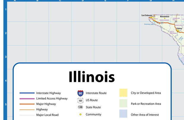
The laminated wall map is printed with UV-resistant ink to help prevent color fading.
Map details include state highways, federal highways, county highways, county boundaries, city shading, cities and towns, major waterways, state/national parks, campsites, exit numbers, rest areas, military installations, airports, golf courses, universities, and much more.
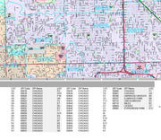
You'll also find a complete index of all the roads highways, cities, counties and points of interests on the map.
This truly complete wall map even includes a hanging kit with rails for easy mounting just about anywhere.
Coverage Area
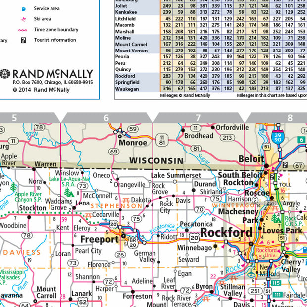
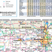
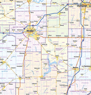
Coverage area extends approximately 96 miles north-to-south and 76 miles east-to-west and is roughly bounded by Walworth, WI; east to Kenosha, WI; south to Schneider, IL; and west to Ransom, IL.
Product Details
Dimensions: 46" x 60";
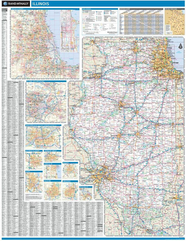
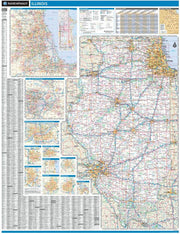
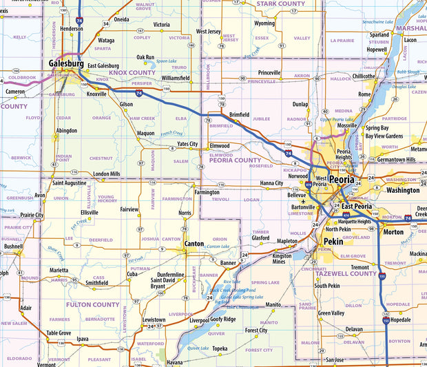
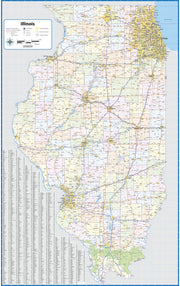
Illinois by Rand McNally
ILWM001
Regular price
$229.00
Laminated with Hanging Rails
46" W x 60" H
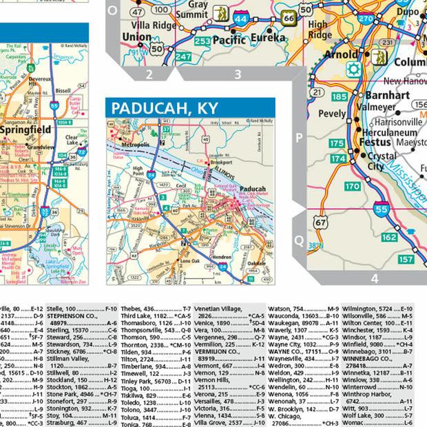
Index of Counties and Cities
Fully Indexed Counties, Cities, Mileage Chart
Inset Maps of All Major Cities
Free Shipping!
Illinois Wall Map by Topographics
ILWM007-1
Regular price
$119.95
Laminated wall map of Illinois, showing counties, towns, cities, villages, hamlets, major roads and highways. Includes community index. Map comes rolled in a sturdy tube.
42" W x 66" H
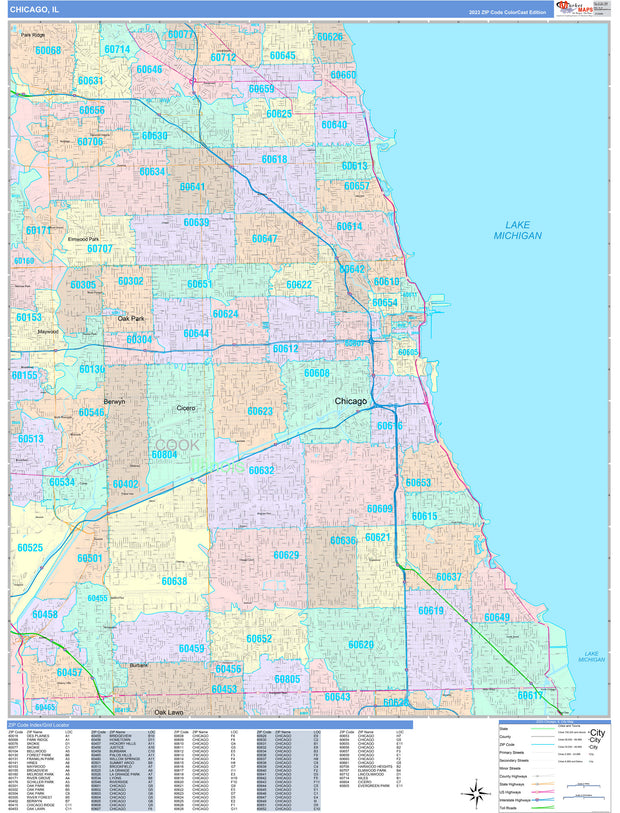
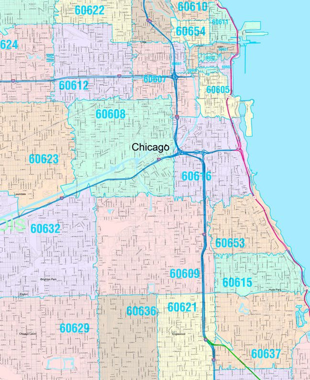
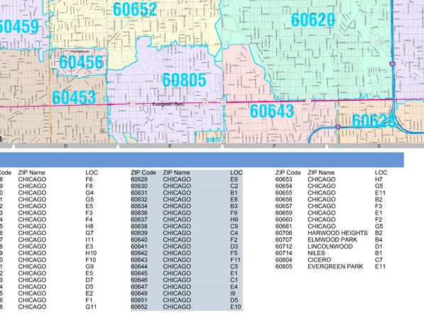
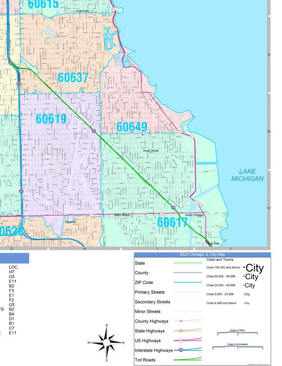
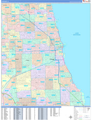
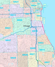
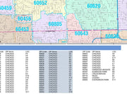
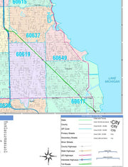
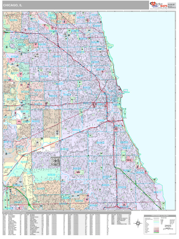
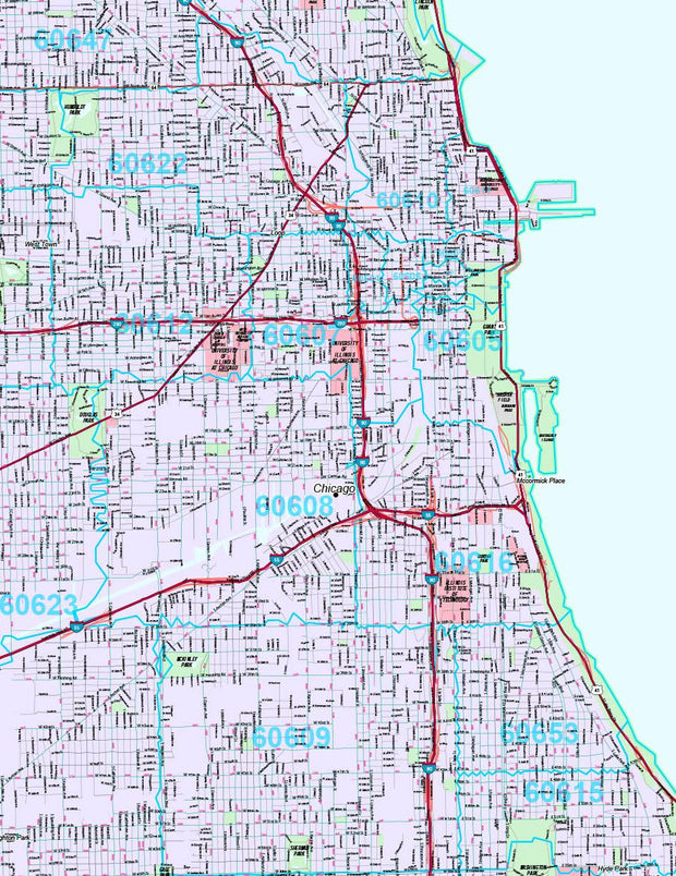
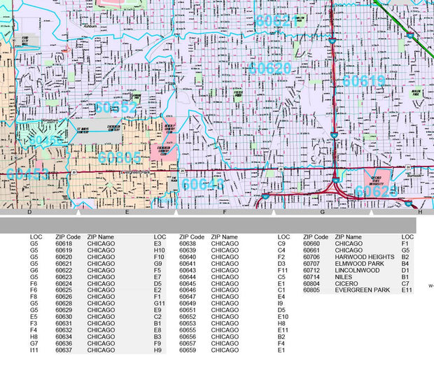
Color Cast Zip Code Style Wall Map of Chicago, IL by Market Maps
ILWM106CC-1
Regular price
$118.75
Save money on our full line of wall maps from one of the industry leaders in wall maps. These always up to date, eye catching wall maps come in a variety of sizes and finishing options sure to meet your specific mapping needs.
Features include:
Interstate/Us/State Highways
5-Digit ZIP Codes
County Names and boundaries
Cities and Towns as applicable
All water
ZIP Code index with grid locator
Premium Style Wall Map of Chicago, IL by Market Maps
ILWM105-4
Regular price
$118.75
Save money on our full line of wall maps from one of the industry leaders in wall maps. These always up to date, eye catching wall maps come in a variety of sizes and finishing options sure to meet your specific mapping needs.