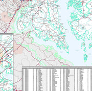
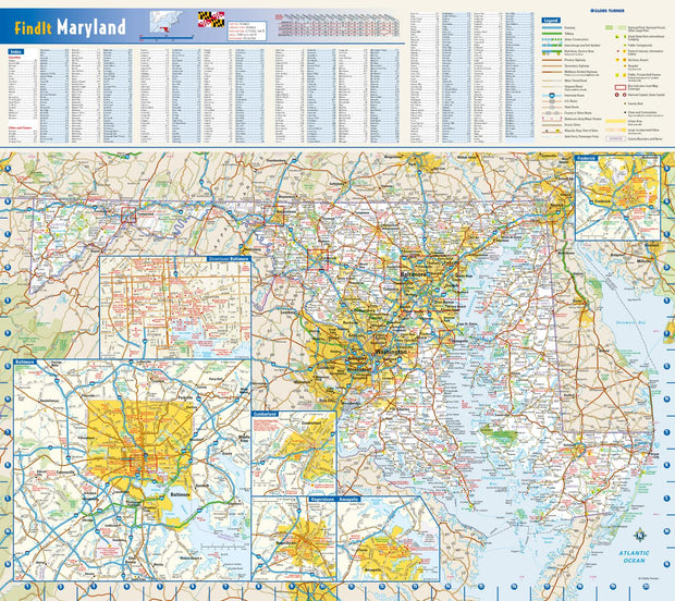
Save money on our full line of wall maps from one of the industry leaders in wall maps. These always up to date, eye catching wall maps come in a variety of sizes and finishing options sure to meet your specific mapping needs.
Features include:
Interstate/Us/State Highways
5-Digit ZIP Codes
County Names and boundaries
Cities and Towns as applicable
All water
Institutions
Cemetery
Airports
Golf Courses
Parks
Populated Places Shaded
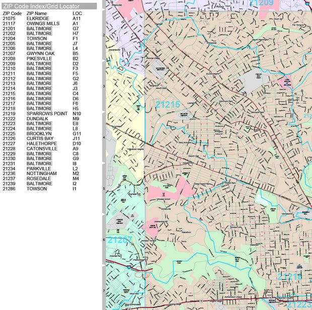
ZIP Code index with grid locator
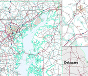
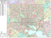
Maryland Wall Map by Globe Turner
MDWM002-1
Regular price
$29.95
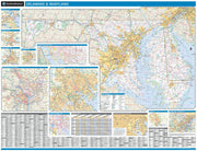
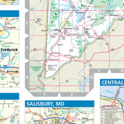
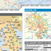
This colorful, easy-to-read state map of Maryland identifies all major thoroughfares, secondary roads, freeway interchanges, rest areas, distance markers, landmarks, recreational areas, and more. Shaded relief on the state map provides a three-dimensional sense of Maryland's topography. Detailed city inset maps of Annapolis, Baltimore, Cumberland, Frederick, and Hagerstown are based on the latest street information from our cartographic experts. County and city indices make it simple to locate even the smallest town.
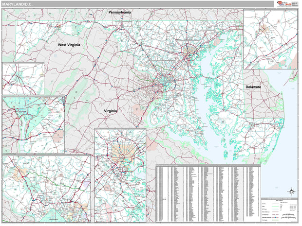
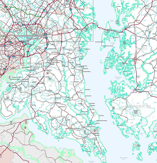
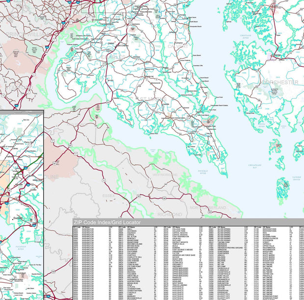
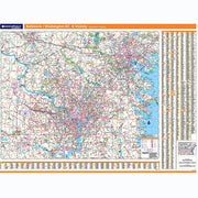
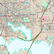
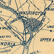
Baltimore & DC Regional Map by Rand McNally
DCWM101
Regular price
$229.00
Laminated with Hanging Rails
60" W x 46" H
Index of Counties and Cities
Fully Indexed Counties, Cities, Mileage Chart
Inset Maps of All Major Cities
Free Shipping!
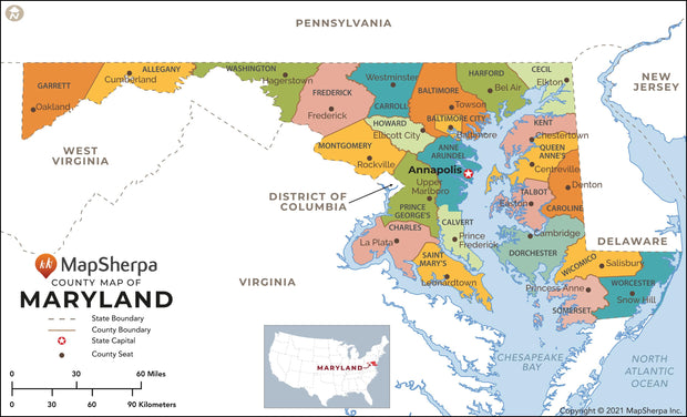
Maryland County Map
MDWM004-1
Regular price
$29.95
This map has been created and designed for reference or business use. Clear and clean colors & fonts matched with cartographic research makes this map of Maryland Counties Map easily readable and useful. The map shows the 64 counties of Maryland and their borders across the Old Line State.
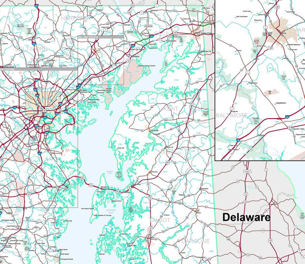
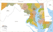
Maryland Zip Code Map with Counties
MDWM005-1
Regular price
$39.95
This map has been created and designed for business or reference use. Clear and clean colors & fonts matched with cartographic research makes this Maryland Zip Code Map with Counties easily readable and useful. The map shows the 24 counties of Maryland and the borders of the 467 zip codes across the Old Line State.
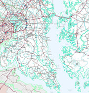
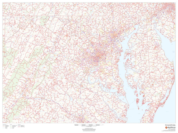
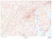
Maryland Zip Code Map
MDWM003-1
Regular price
$59.95
This map of Maryland shows ZIP codes overlaid on a road map. Base map features include municipality and county boundaries, major road network features, and state and national parks and conservation areas.
48"W x 36"H
Premium Style Wall Map of Baltimore by Market Maps
MDWM100-1
Regular price
$118.75
Save money on our full line of wall maps from one of the industry leaders in wall maps. These always up to date, eye catching wall maps come in a variety of sizes and finishing options sure to meet your specific mapping needs.
Features include:
Interstate/Us/State Highways
5-Digit ZIP Codes
County Names and boundaries
Cities and Towns as applicable
All water
Institutions
Cemetery
Airports
Golf Courses
Parks
Populated Places Shaded
ZIP Code index with grid locator
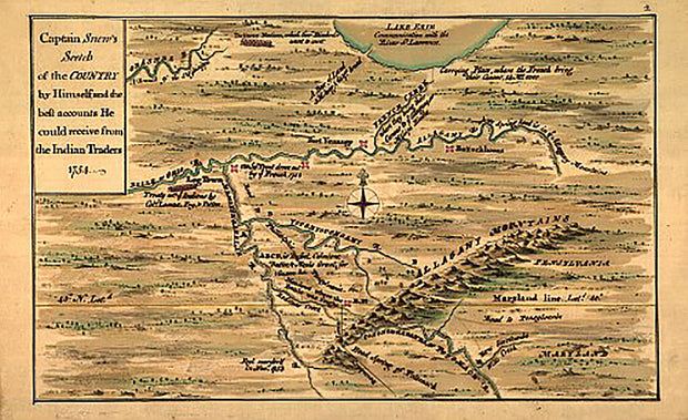
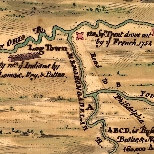
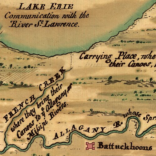
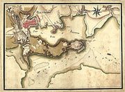
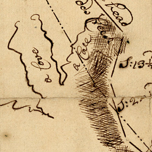
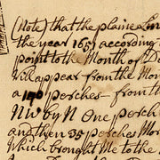
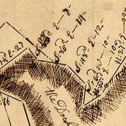
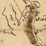
Captain Snow's scetch of the forts of western Pennsylvania, northern Virginia and northern Maryland, 1754
PA00023
Regular price
$39.95
Captain Snow's scetch of the forts of western Pennsylvania, northern Virginia and northern Maryland, 1754 This beautiful antique map reproduction is printed on heavy acid-free stock with fade proof inks and is excellent for framing.
26"W x 16"H
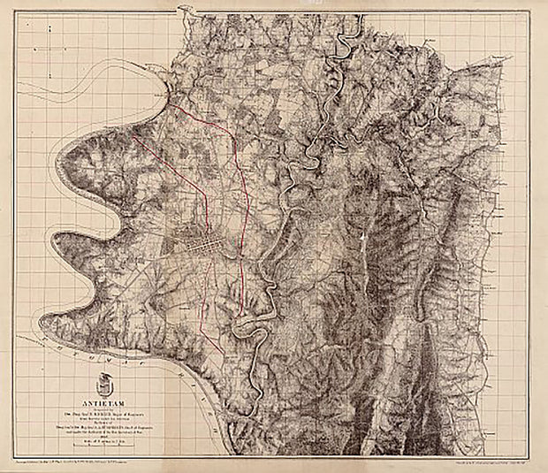
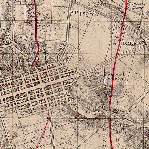
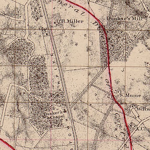
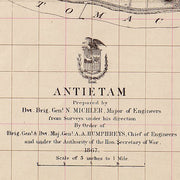
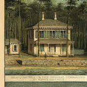
Antietam prepared by Bvt. Brig. Genl. N. Michler
MDCW002
Regular price
$39.95
Antietam prepared by Bvt. Brig. Genl. N. Michler This beautiful antique map reproduction is printed on heavy acid-free stock with fade proof inks and is excellent for framing.
27"W x 23"H
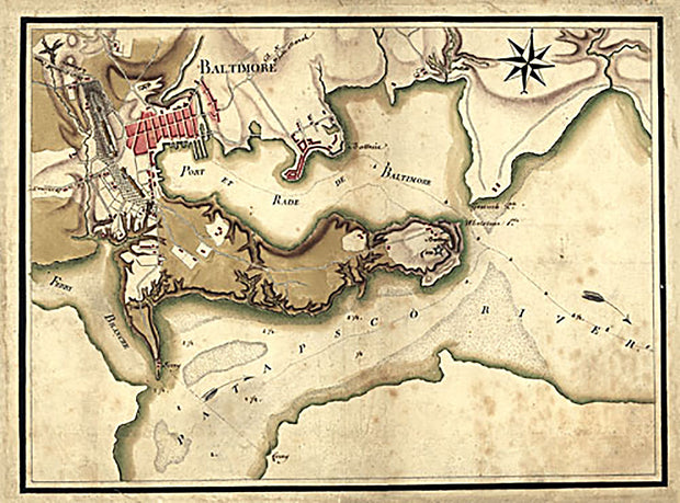
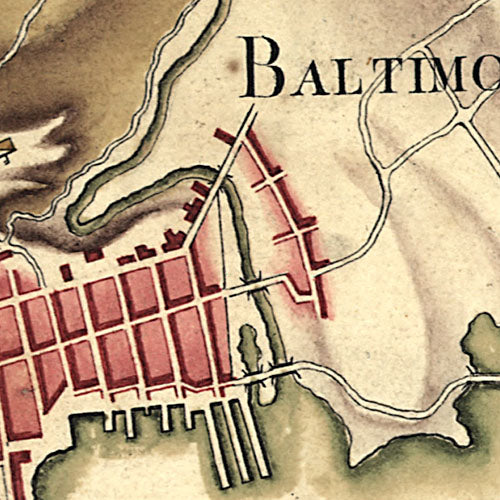
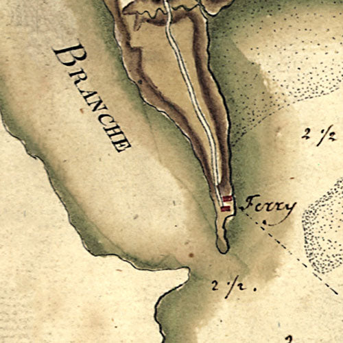
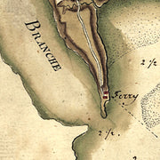
Ville, port, et rade de Baltimore dans le Maryland, 1781
MD00030
Regular price
$39.95
Ville, port, et rade de Baltimore dans le Maryland. Berthier, Louis-Alexandre, 1753-1815. CREATED/PUBLISHED 1781
This beautiful antique map reproduction is printed on heavy acid-free stock with fade proof inks and is excellent for framing Ville, port, et rade de Baltimore dans le Maryland. Berthier, Louis-Alexandre, 1753-1815. CREATED/PUBLISHED 1781
This beautiful antique map reproduction is printed on heavy acid-free stock with fade proof inks and is excellent for framing.
19"W x 14"H
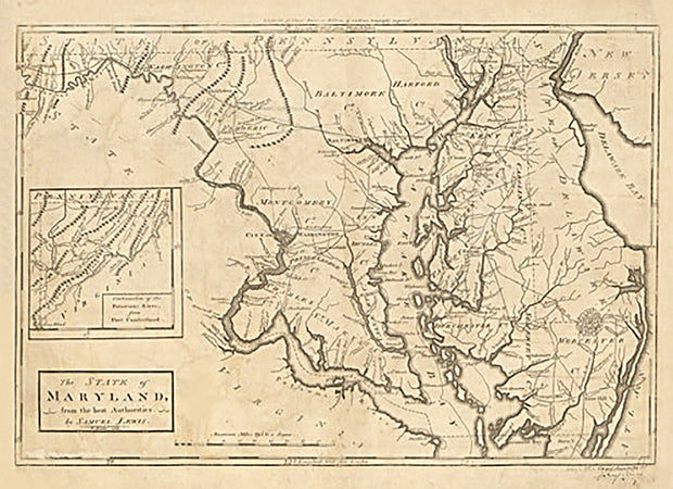
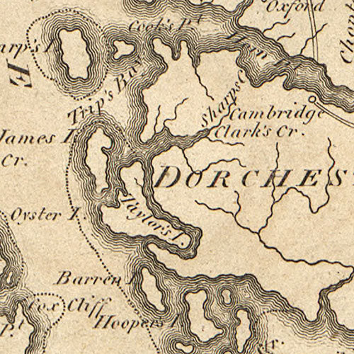
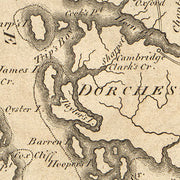
The State of Maryland from the best authorities, 1795
MD00029
Regular price
$39.95
The State of Maryland from the best authorities. W. Barker, sculp. Lewis, Samuel, 1753 or 1754-1822. CREATED/PUBLISHED Philadelphia, M. Carey, 1795 This beautiful antique map reproduction is printed on heavy acid-free stock with fade proof inks and is excellent for framing The State of Maryland from the best authorities. W. Barker, sculp. Lewis, Samuel, 1753 or 1754-1822. CREATED/PUBLISHED Philadelphia, M. Carey, 1795
This beautiful antique map reproduction is printed on heavy acid-free stock with fade proof inks and is excellent for framing
19"W x 14"H
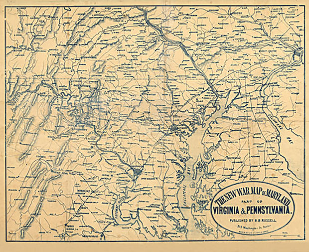
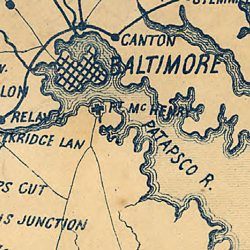
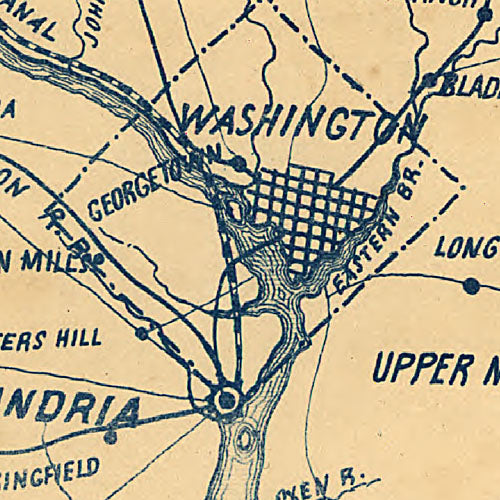
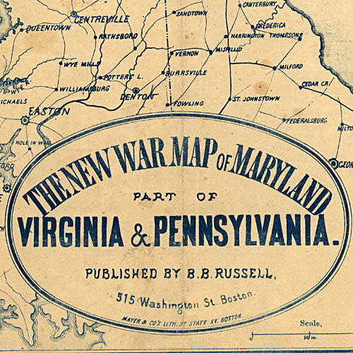
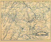
The new war map of Maryland, part of Virginia & Pennsylvania, 1863
MD00028
Regular price
$39.95
The new war map of Maryland, part of Virginia & Pennsylvania Mayer & Co's., lith., Boston. Russell, B. B. (Benjamin B.) CREATED/PUBLISHED Boston, B. B. Russell, 1863
This beautiful antique map reproduction is printed on heavy acid-free stock with fade proof inks and is excellent for framing The new war map of Maryland, part of Virginia & Pennsylvania Mayer & Co's., lith., Boston. Russell, B. B. (Benjamin B.) CREATED/PUBLISHED Boston, B. B. Russell, 1863
This beautiful antique map reproduction is printed on heavy acid-free stock with fade proof inks and is excellent for framing
26"W x 21"H
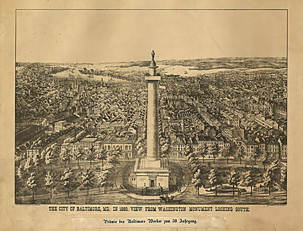
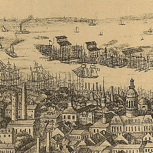
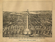
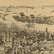
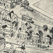
The city of Baltimore, Maryland, 1880
MD00027
Regular price
$39.95
The city of Baltimore City, Md. in 1880 : View from Washington Monument looking south / A. Sachse & Co. Lithographers & Printers. A. Sachse & Co. CREATED/PUBLISHED Baltimore., Maryland : A. Sachse & Co., Baltimore & Eutaw Sts., 1880. SUMMARY Bird's-eye view of Baltimore, Maryland looking south from the Washington Monument. This beautiful antique map reproduction is printed on heavy acid-free stock with fade proof inks and is excellent for framing The city of Baltimore City, Md. in 1880 : View from Washington Monument looking south / A. Sachse & Co. Lithographers & Printers. CREATED/PUBLISHED Baltimore., Maryland : A. Sachse & Co., Baltimore & Eutaw Sts., 1880. SUMMARY Bird's-eye view of Baltimore, Maryland looking south from the Washington Monument.
This beautiful antique map reproduction is printed on heavy acid-free stock with fade proof inks and is excellent for framing
29"W x 22"H
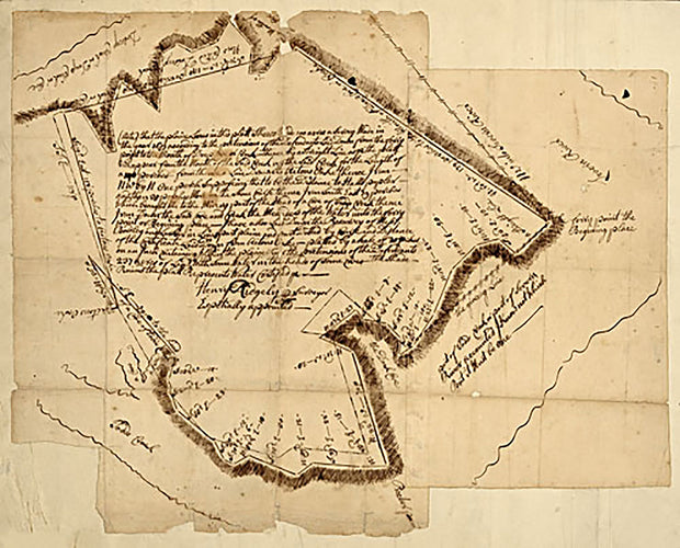
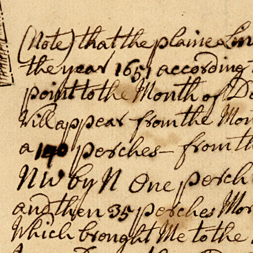
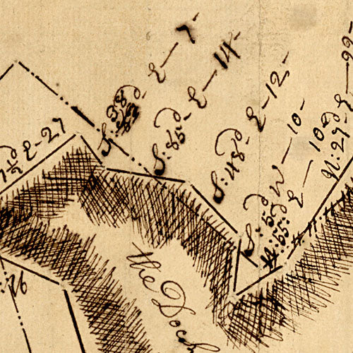
Survey of Annapolis, 1690
MD00026
Regular price
$39.95
Survey of Annapolis Ridgely, Henry. CREATED/PUBLISHED 1690 This beautiful antique map reproduction is printed on heavy acid-free stock with fade proof inks and is excellent for framing Survey of Annapolis Ridgely, Henry. CREATED/PUBLISHED 1690
This beautiful antique map reproduction is printed on heavy acid-free stock with fade proof inks and is excellent for framing
20"W x 16"H
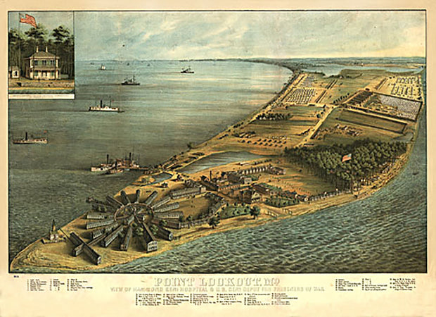
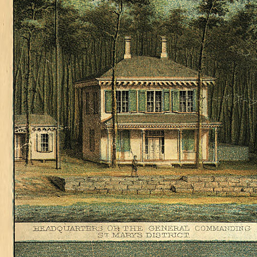
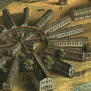
Point Lookout, Maryland, 1864
MD00025
Regular price
$39.95
Point Lookout, Md. View of Hammond Genl. Hospital & U.S. genl. depot for prisoners of war Lith. by E. Sachse & Co., Baltimore. Everett, George (Publisher) CREATED/PUBLISHED Point Lookout 1864. This beautiful antique map reproduction is printed on heavy acid-free stock with fade proof inks and is excellent for framing Point Lookout, Md. View of Hammond Genl. Hospital & U.S. genl. depot for prisoners of war Lith. by E. Sachse & Co., Baltimore. Everett, George (Publisher) CREATED/PUBLISHED Point Lookout 1864.
This beautiful antique map reproduction is printed on heavy acid-free stock with fade proof inks and is excellent for framing
26"W x 19"H
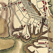
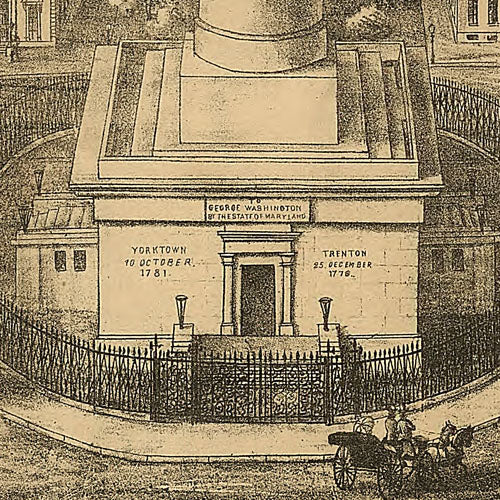
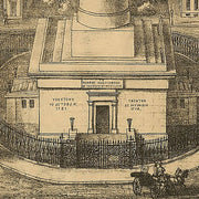
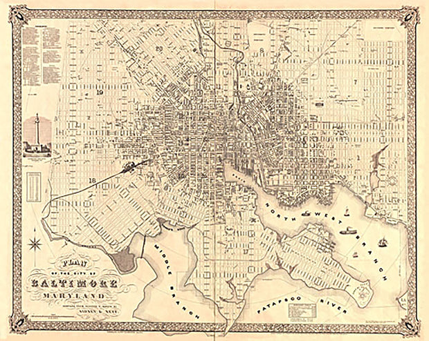
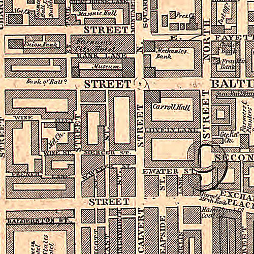
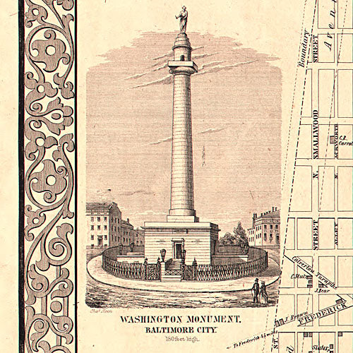
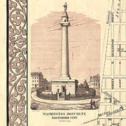
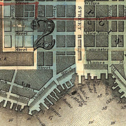
Plan of the city of Baltimore, Maryland, 1851
MD00024
Regular price
$39.95
Plan of the city of Baltimore, Maryland / compiled from records and surveys by Sidney and Neff. Sidney & Neff. CREATED/PUBLISHED [S.l.] : published by Lloyd van Derveer, 1851. NOTES Includes index, population chart and view of Washington Monument. Shows wards. This beautiful antique map reproduction is printed on heavy acid-free stock with fade proof inks and is excellent for framing Plan of the city of Baltimore, Maryland / compiled from records and surveys by Sidney and Neff. Sidney & Neff. CREATED/PUBLISHED [S.l.] : published by Lloyd van Derveer, 1851. NOTES Includes index, population chart and view of Washington Monument. Shows wards.
This beautiful antique map reproduction is printed on heavy acid-free stock with fade proof inks and is excellent for framing
31"W x 25"H
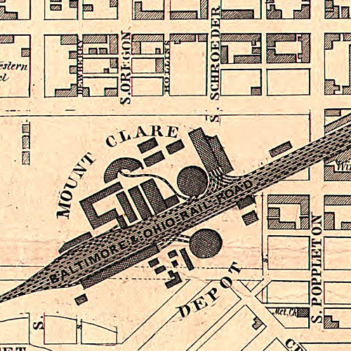
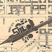
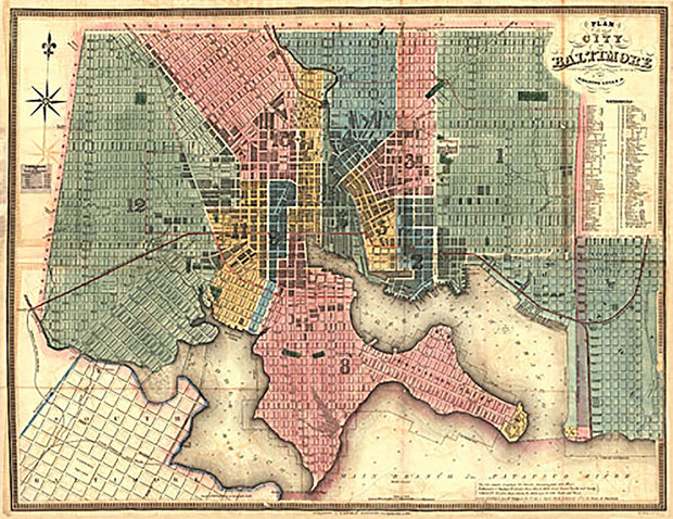
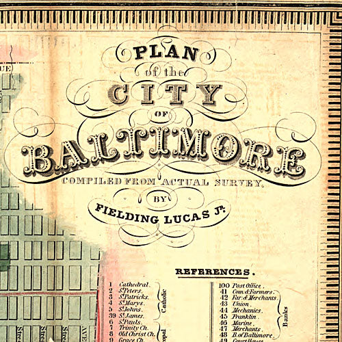
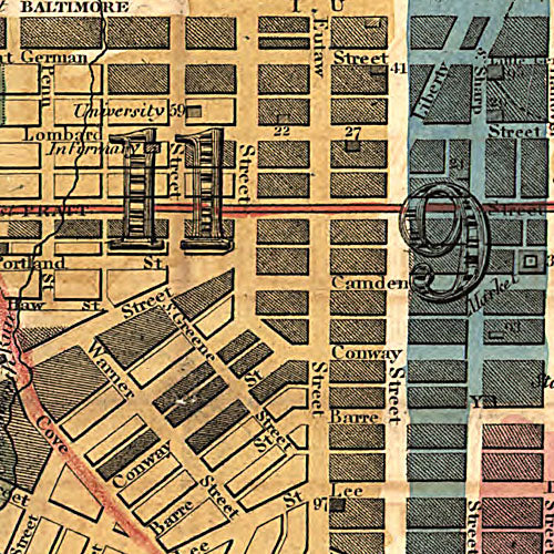
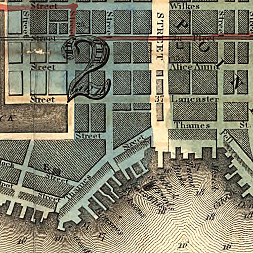
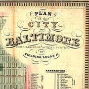
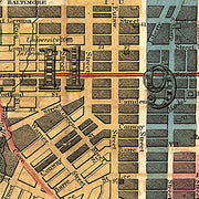
Plan of the city of Baltimore compiled from actual survey, 1822
MD00023
Regular price
$39.95
Plan of the city of Baltimore compiled from actual survey by Fielding Lucas, Jr., 1822. Lucas, Fielding, Jr., 1781-1854. CREATED/PUBLISHED Improved to 1836. Baltimore, 1836. NOTES Shows wards. Includes index to points of interest. This beautiful antique map reproduction is printed on heavy acid-free stock with fade proof inks and is excellent for framing Plan of the city of Baltimore compiled from actual survey by Fielding Lucas, Jr., 1822. Lucas, Fielding, Jr., 1781-1854. CREATED/PUBLISHED Improved to 1836. Baltimore, 1836. NOTES Shows wards. Includes index to points of interest.
This beautiful antique map reproduction is printed on heavy acid-free stock with fade proof inks and is excellent for framing
26"W x 20"H
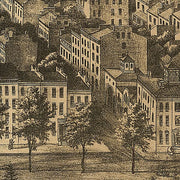
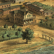
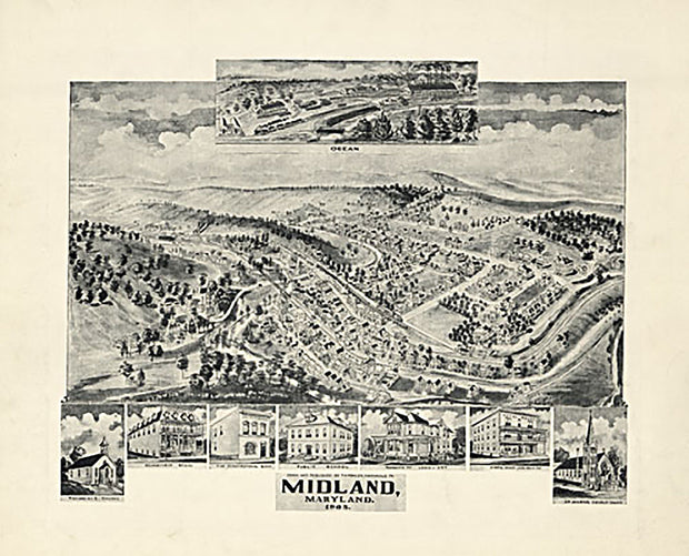
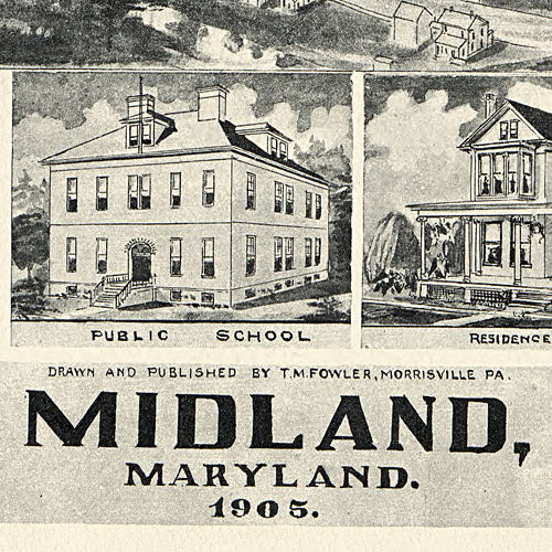
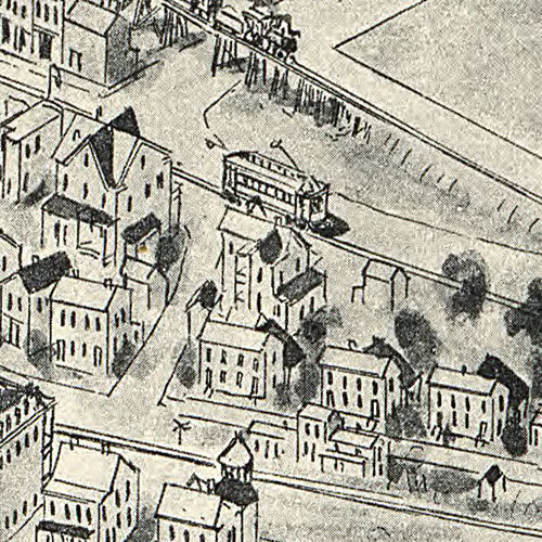
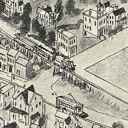
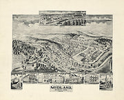
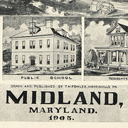
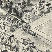
Midland, Maryland, 1905
MD00022
Regular price
$39.95
Midland, Maryland / drawn and published by T.M. Fowler, Morrisville, Pa. Fowler, T. M. 1842-1922. (Thaddeus Mortimer), NOTES Aerial view of village. Relief shown by shading and landform drawings. Includes inset view of "Ocean" village and illustrations of prominent buildings. This beautiful antique map reproduction is printed on heavy acid-free stock with fade proof inks and is excellent for framing Midland, Maryland / drawn and published by T.M. Fowler, Morrisville, Pa. Fowler, T. M. 1842-1922. (Thaddeus Mortimer), NOTES Aerial view of village. Relief shown by shading and landform drawings. Includes inset view of "Ocean" village and illustrations of prominent buildings.
This beautiful antique map reproduction is printed on heavy acid-free stock with fade proof inks and is excellent for framing