
NCWM100
Coverage area extends approximately 63 miles north-to-south and 55 miles east-to-west and is roughly bounded by Hickory, NC; east to Salisbury, NC; south to Monroe, NC; west to York, SC.
This map is rolled and shipped in a sturdy cardboard tube.


NCWM001
Description
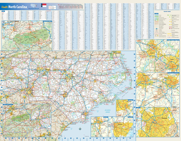
Rand McNally's state wall map of North Carolina is ideal for anyone needing a comprehensive representation of the area for planning, routing, or reference. It is an excellent choice for business and sales strategy, urban development, social work outreach, education, and marketing. State residents, businesses, and government offices are sure to find this wonderful reference tool irreplaceable.
The laminated wall map is printed with UV-resistant ink to help prevent color fading.
Map details include federal, state, and county highways, county boundaries, cities and towns, major waterways, state/national parks, campsites, exit numbers, rest areas, military installations, airports, golf courses, universities, and much more.
You will also find a city/county index on the map, a comprehensive map legend, a distance chart with mileages between various cities, and a mileage/driving times map.
This truly complete wall map even includes a hanging kit with rails for easy mounting just about anywhere.
Coverage Area
Inset maps: Asheville, Charlotte & Vicinity, Fayetteville, Great Smoky Mountains National Park, Hickory, The Triad: Greensboro/Winston-Salem/High Point, The Triangle: Raleigh/Durham/Chapel Hill, and Wilmington.
This map is rolled and shipped in a sturdy cardboard tube.
NCWM002
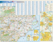
This colorful, easy-to-read state map of North Carolina identifies all major thoroughfares, secondary roads, freeway interchanges, rest areas, distance markers, landmarks, recreational areas, and more. Shaded relief on the state map provides a three-dimensional sense of North Carolina's topography. Detailed city inset maps of Asheville, Charlotte, Fayetteville, Greensboro/Winston-Salem, Raleigh/Durham, and Wilmington are based on the latest street information from our cartographic experts. An inset of Great Smoky Mountains National Park provides must-see information on this recreational area. County and city indices make it simple to locate even the smallest town.
This map is rolled and shipped in a sturdy cardboard tube.
NCWM003
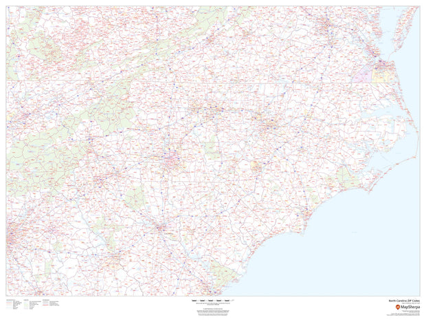
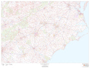
This map of North Carolina shows ZIP codes overlaid on a road map. Base map features include county boundaries, major road network features, and state and national parks and conservation areas.
This map is rolled and shipped in a sturdy cardboard tube.
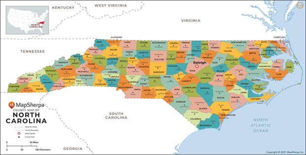

NCWM004
This map has been created and designed for reference or business use. Clear and clean colors & fonts matched with cartographic research makes this map of North Carolina Counties Map easily readable and useful. The map shows the 100 counties of North Carolina and their borders across the Tar Heel State.
This map is rolled and shipped in a sturdy cardboard tube.
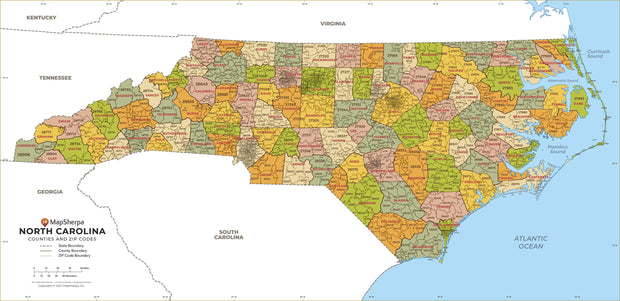
NCWM005
This map has been created and designed for business or reference use. Clear and clean colors & fonts matched with cartographic research makes this North Carolina Zip Code Map with Counties easily readable and useful. The map shows the 100 counties of North Carolina and the borders of the 802 zip codes across the Tar Heel State.
This map is rolled and shipped in a sturdy cardboard tube.