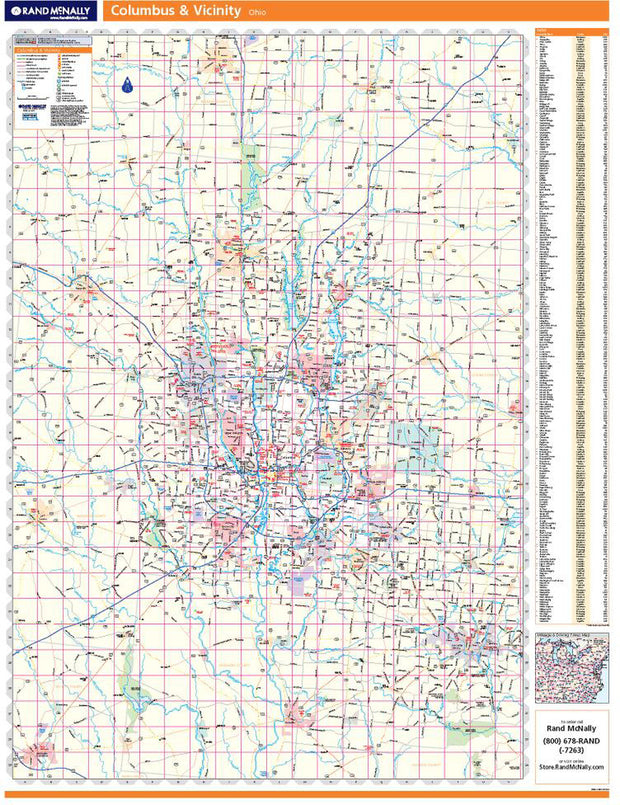
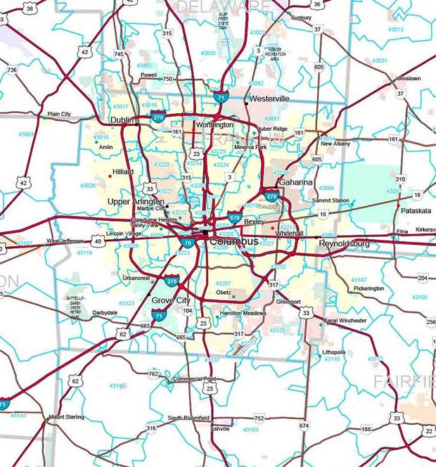
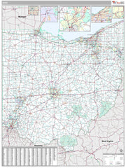
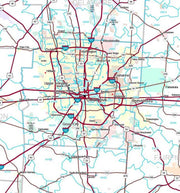
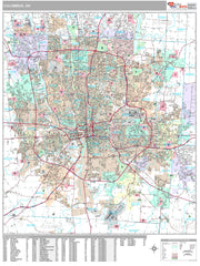
Rand McNally's regional wall map of Columbus is ideal for anyone needing a comprehensive representation of the area for planning, routing, or reference. It's a great choice for business and sales strategy, urban development, social work outreach, education, and marketing. Columbus residents, businesses, and government offices are sure to find this wonderful reference tool irreplaceable.
The laminated wall map is printed with UV-resistant ink to help prevent color fading.
Map details include state highways, federal highways, county highways, county boundaries, city shading, cities and towns, major waterways, state/national parks, campsites, exit numbers, rest areas, military installations, airports, golf courses, universities, and much more.
You'll also find a city/county index on the map and a driving times map between major cities in the region.
This truly complete wall map even includes a hanging kit with rails for easy mounting just about anywhere.
Coverage Area
Coverage area extends approximately 77 miles north-to-south and 53 miles east-to-west and is roughly bounded by New Bloomington, OH; east to Fredericktown, OH; south to Lancaster, OH; and west to Washington Court House, OH.
Product Details
Dimensions: 60" x 46"
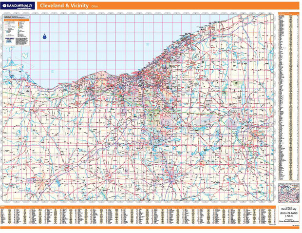
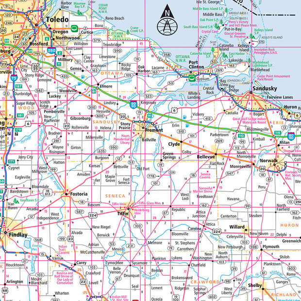
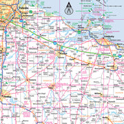
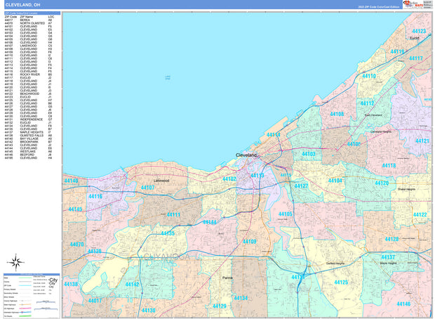
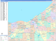
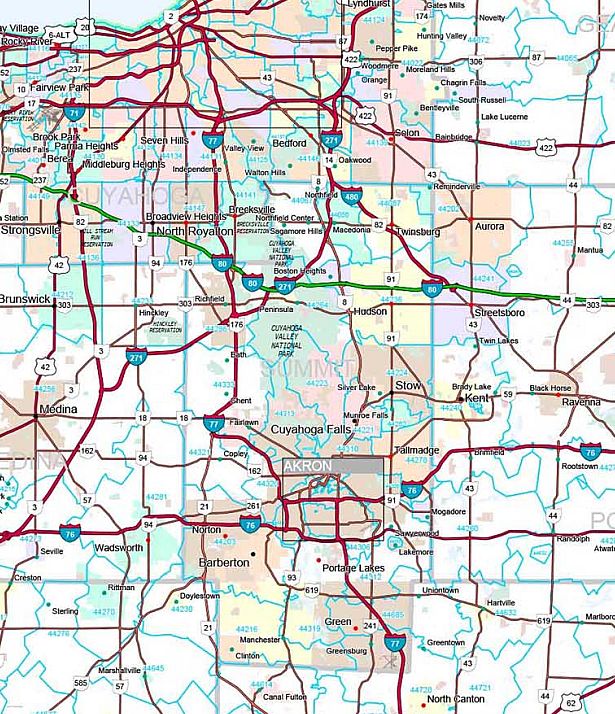
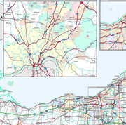
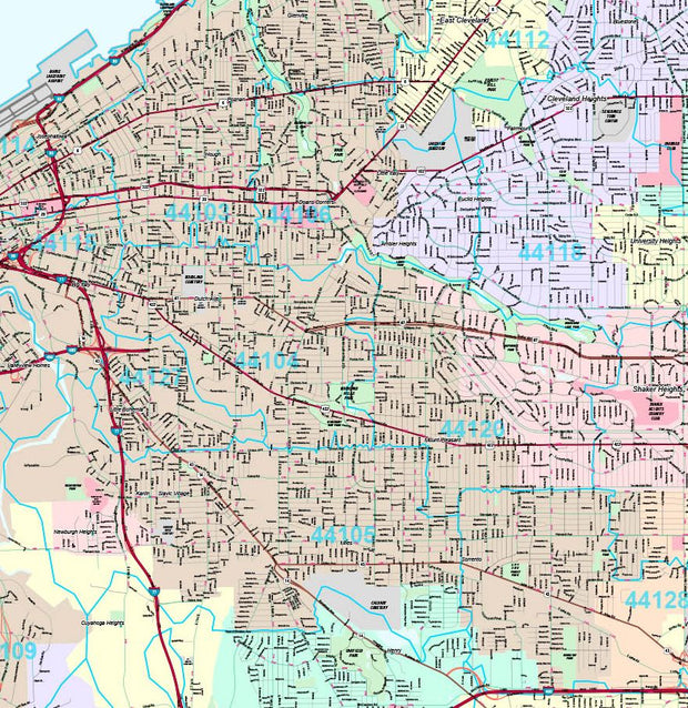
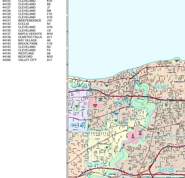
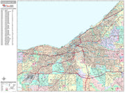
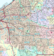
Cleveland Regional by Rand McNally
OHWM101
Regular price
$229.00
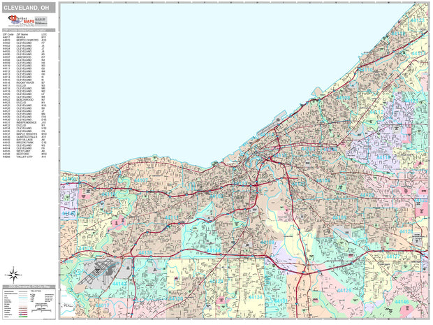
Rand McNally's regional wall map of Cleveland is ideal for anyone needing a comprehensive representation of the area for planning, routing, or reference. It's a great choice for business and sales strategy, urban development, social work outreach, education, and marketing. Cleveland residents, businesses, and government offices are sure to find this wonderful reference tool irreplaceable.
The laminated wall map is printed with UV-resistant ink to help prevent color fading.
Map details include state highways, federal highways, county highways, county boundaries, city shading, cities and towns, major waterways, state/national parks, campsites, exit numbers, rest areas, military installations, airports, golf courses, universities, and much more.
You'll also find a city/county index on the map and a driving times map between major cities in the region.
This truly complete wall map even includes a hanging kit with rails for easy mounting just about anywhere.
Coverage Area
Coverage area extends approximately 94 miles north-to-south and 138 miles east-to-west and is roughly bounded by Sandusky, OH, east to Ashtabula, OH, south to East Palestine, OH, west to Galion, OH.
Product Details
Dimensions: 60" x 46
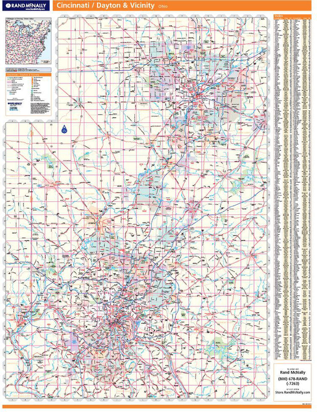
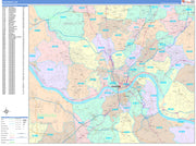
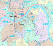
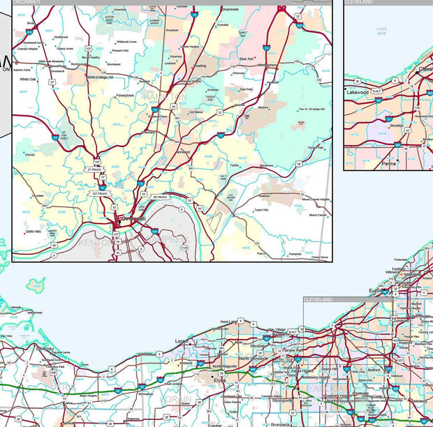
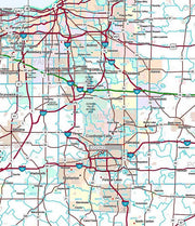
Cincinnati - Dayton Regional by Rand McNally
OHWM100
Regular price
$229.00
Rand McNally's regional wall map of Cincinnati/Dayton is ideal for anyone needing a comprehensive representation of the area for planning, routing, or reference. It's a great choice for business and sales strategy, urban development, social work outreach, education, and marketing. Cincinnati and Dayton residents, businesses, and government offices are sure to find this wonderful reference tool irreplaceable.
The laminated wall map is printed with UV-resistant ink to help prevent color fading.
Map details include state highways, federal highways, county highways, county boundaries, city shading, cities and towns, major waterways, state/national parks, campsites, exit numbers, rest areas, military installations, airports, golf courses, universities, and much more.
You'll also find a city/county index on the map and a driving times map between major cities in the region.
This truly complete wall map even includes a hanging kit with rails for easy mounting just about anywhere.
Coverage Area
Coverage area extends approximately 73 miles north-to-south and 52 miles east-to-west and is roughly bounded by Eldorado, OH; east to Enon, OH; south to Hamersville, OH; and west to Aurora, IN.
Product Details
Dimensions: 60" x 46"
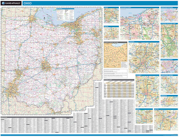
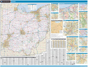
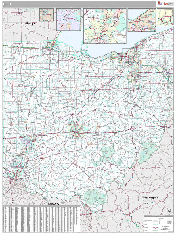
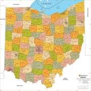
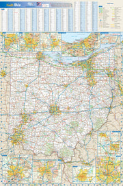
Ohio by Rand McNally
OHWM001
Regular price
$229.00
Laminated with Hanging Rails
60" W x 46" H
Index of Counties and Cities
Fully Indexed Counties, Cities, Mileage Chart
Inset Maps of All Major Cities
Free Shipping!
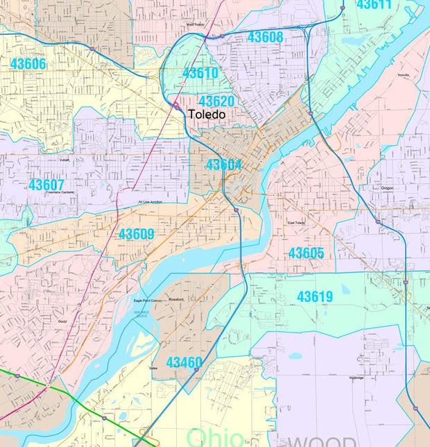
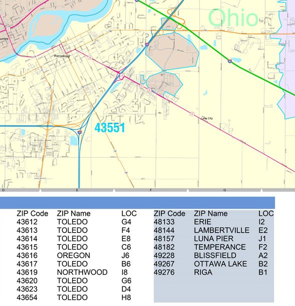
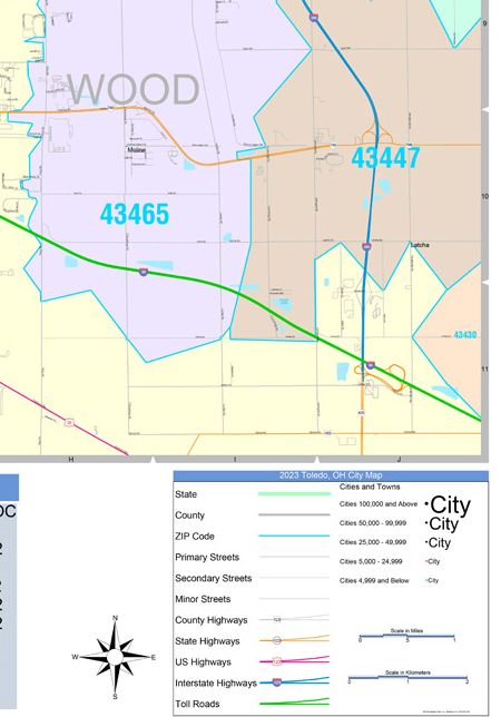
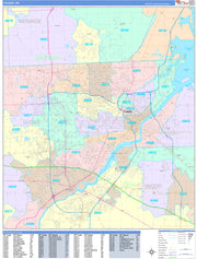
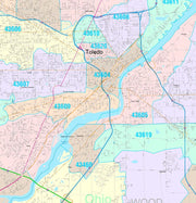
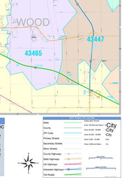
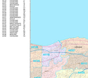
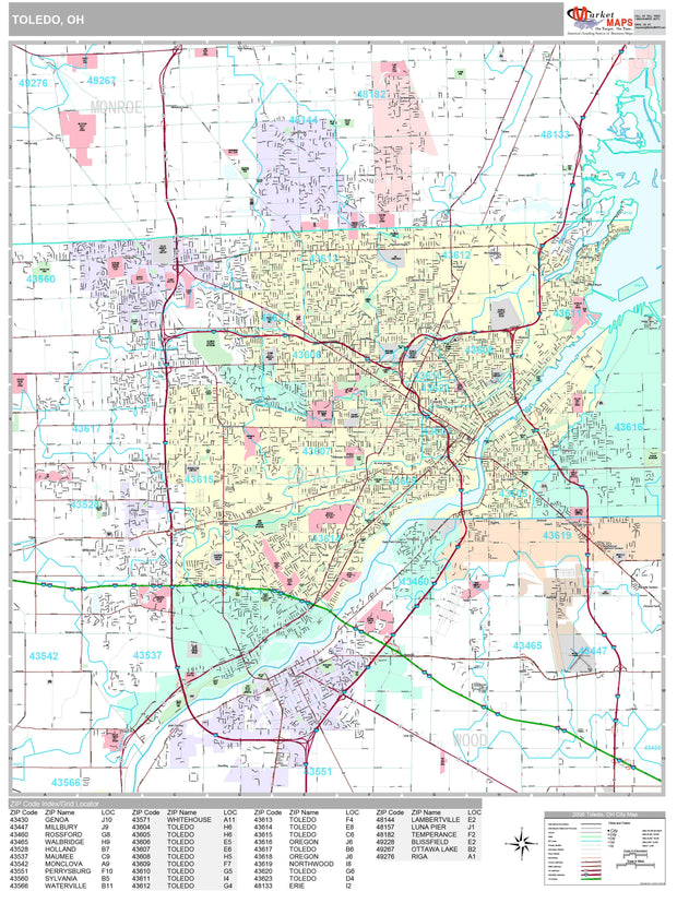
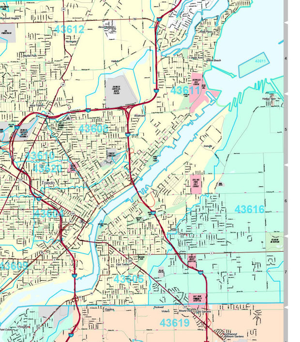
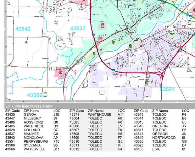
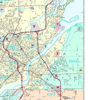
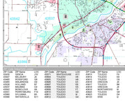
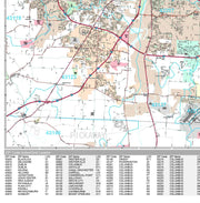
Color Cast Zip Code Style Wall Map of Toledo, OH by Market Maps
OHWM107CC-1
Regular price
$118.75
Save money on our full line of wall maps from one of the industry leaders in wall maps. These always up to date, eye catching wall maps come in a variety of sizes and finishing options sure to meet your specific mapping needs.
Features include:
Interstate/Us/State Highways
5-Digit ZIP Codes
County Names and boundaries
Cities and Towns as applicable
All water
ZIP Code index with grid locator
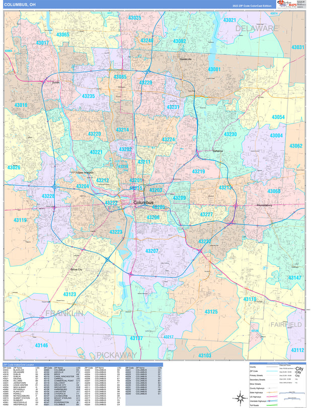
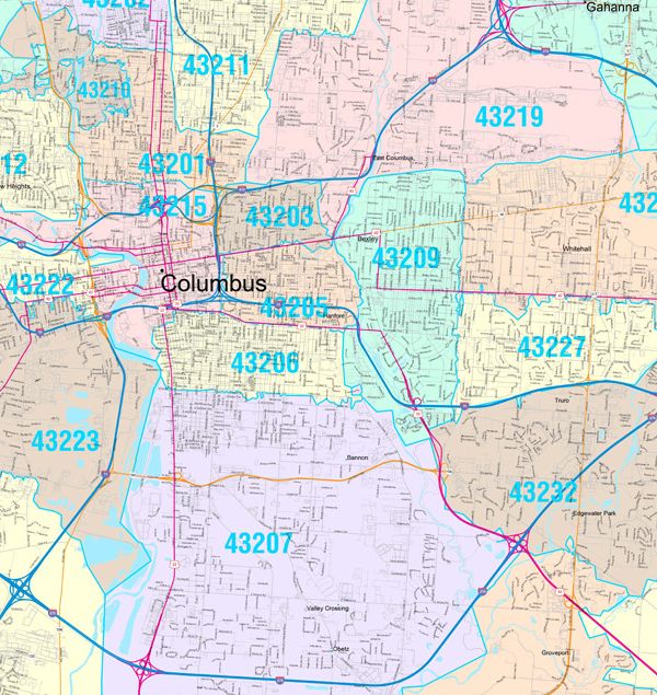
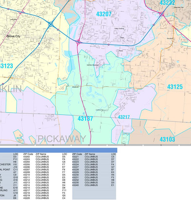
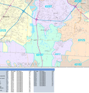
Color Cast Zip Code Style Wall Map of Columbus, OH by Market Maps
OHWM106CC-1
Regular price
$118.75
Save money on our full line of wall maps from one of the industry leaders in wall maps. These always up to date, eye catching wall maps come in a variety of sizes and finishing options sure to meet your specific mapping needs.
Features include:
Interstate/Us/State Highways
5-Digit ZIP Codes
County Names and boundaries
Cities and Towns as applicable
All water
ZIP Code index with grid locator
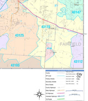
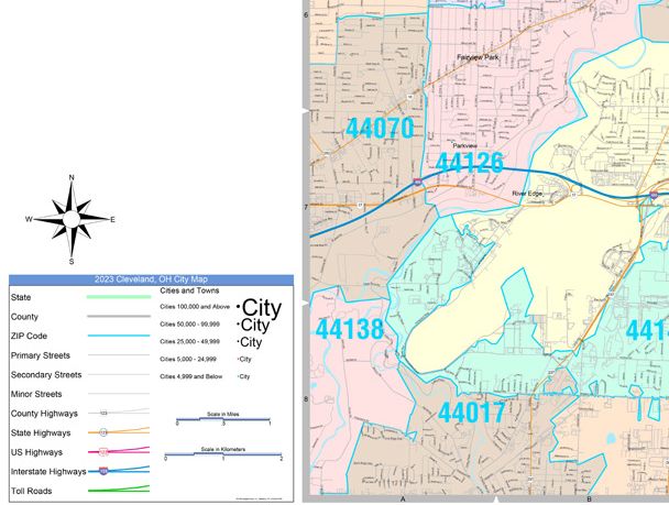
Color Cast Zip Code Style Wall Map of Cleveland by Market Maps
OHWM105CC-1
Regular price
$118.75
Save money on our full line of wall maps from one of the industry leaders in wall maps. These always up to date, eye catching wall maps come in a variety of sizes and finishing options sure to meet your specific mapping needs.
Features include:
Interstate/Us/State Highways
5-Digit ZIP Codes
County Names and boundaries
Cities and Towns as applicable
All water
ZIP Code index with grid locator
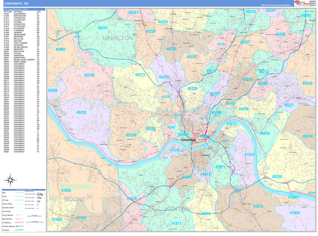
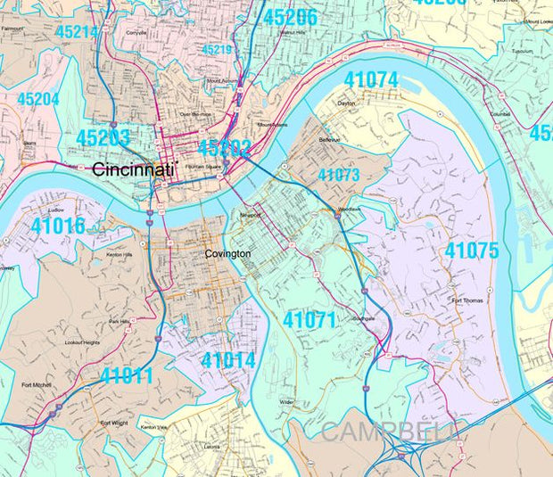
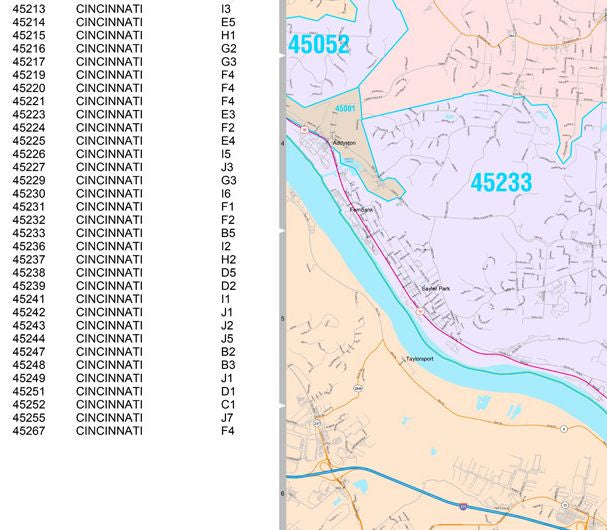
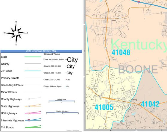
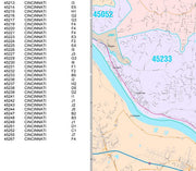
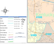
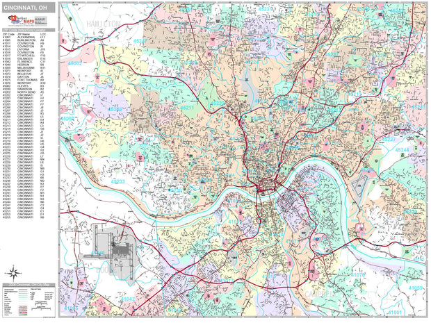
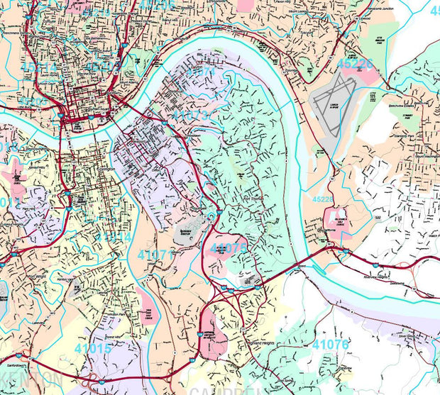
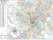
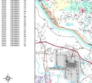
Color Cast Zip Code Style Wall Map of Cincinnati by Market Maps
OHWM104CC-1
Regular price
$118.75
Save money on our full line of wall maps from one of the industry leaders in wall maps. These always up to date, eye catching wall maps come in a variety of sizes and finishing options sure to meet your specific mapping needs.
Features include:
Interstate/Us/State Highways
5-Digit ZIP Codes
County Names and boundaries
Cities and Towns as applicable
All water
ZIP Code index with grid locator
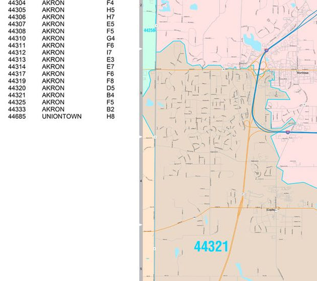
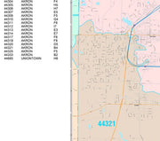
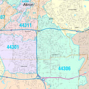
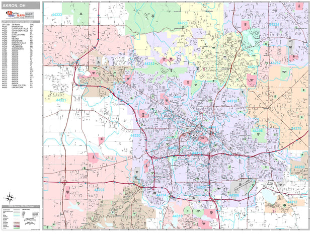
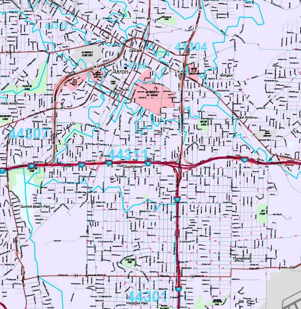
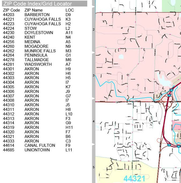
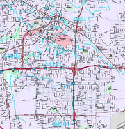
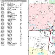
Color Cast Style Wall Map of Akron, Ohio by Market Maps
OHWM108-1
Regular price
$118.75
Save money on our full line of wall maps from one of the industry leaders in wall maps. These always up to date, eye catching wall maps come in a variety of sizes and finishing options sure to meet your specific mapping needs.
The Color Cast Style Wall Map is a multi-colored display that shades each geographic area with its own background color. It is an ideal choice for applications that benefit from quickly and easily distinguishing one County or Zip Code from the others.
Features include:
Interstate/Us/State Highways
5-Digit ZIP Codes
County Names and boundaries
Cities and Towns as applicable
All water
ZIP Code index with grid locator
Premium Style Wall Map of Ohio by Market Maps
OHWM006-1
Regular price
$118.75
Save money on our full line of wall maps from one of the industry leaders in wall maps. These always up to date, eye catching wall maps come in a variety of sizes and finishing options sure to meet your specific mapping needs.
Features include:
Interstate/Us/State Highways
5-Digit ZIP Codes
County Names and boundaries
Cities and Towns as applicable
All water
Institutions
Cemetery
Airports
Golf Courses
Parks
Populated Places Shaded
ZIP Code index with grid locator
Premium Style Wall Map of Toledo, OH by Market Maps
OHWM107-1
Regular price
$118.75
Save money on our full line of wall maps from one of the industry leaders in wall maps. These always up to date, eye catching wall maps come in a variety of sizes and finishing options sure to meet your specific mapping needs.
Features include:
Interstate/Us/State Highways
5-Digit ZIP Codes
County Names and boundaries
Cities and Towns as applicable
All water
Institutions
Cemetery
Airports
Golf Courses
Parks
Populated Places Shaded
ZIP Code index with grid locator
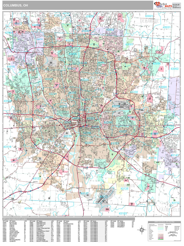
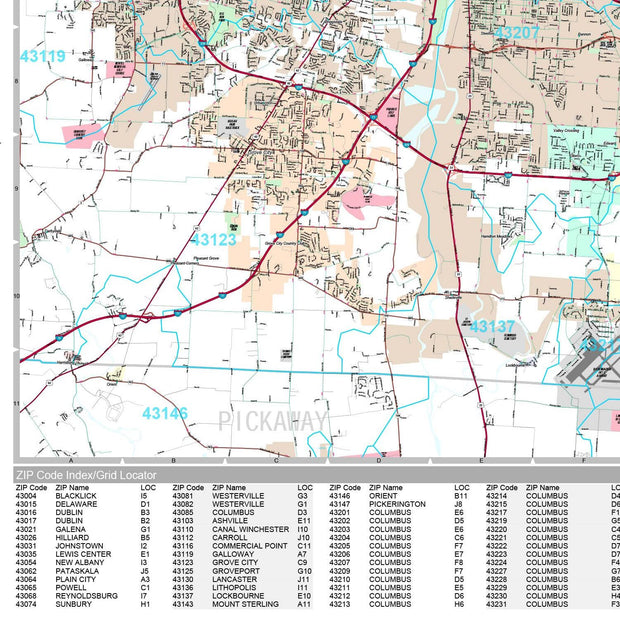
Premium Style Wall Map of Columbus, OH by Market Maps
OHWM106-1
Regular price
$118.75
Save money on our full line of wall maps from one of the industry leaders in wall maps. These always up to date, eye catching wall maps come in a variety of sizes and finishing options sure to meet your specific mapping needs.
Features include:
Interstate/Us/State Highways
5-Digit ZIP Codes
County Names and boundaries
Cities and Towns as applicable
All water
Institutions
Cemetery
Airports
Golf Courses
Parks
Populated Places Shaded
ZIP Code index with grid locator
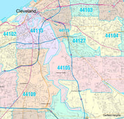
Premium Style Wall Map of Cleveland by Market Maps
OHWM105-1
Regular price
$118.75
Save money on our full line of wall maps from one of the industry leaders in wall maps. These always up to date, eye catching wall maps come in a variety of sizes and finishing options sure to meet your specific mapping needs.
Features include:
Interstate/Us/State Highways
5-Digit ZIP Codes
County Names and boundaries
Cities and Towns as applicable
All water
Institutions
Cemetery
Airports
Golf Courses
Parks
Populated Places Shaded
ZIP Code index with grid locator
Premium Style Wall Map of Cincinnati by Market Maps
OHWM104-1
Regular price
$118.75
Save money on our full line of wall maps from one of the industry leaders in wall maps. These always up to date, eye catching wall maps come in a variety of sizes and finishing options sure to meet your specific mapping needs.
Features include:
Interstate/Us/State Highways
5-Digit ZIP Codes
County Names and boundaries
Cities and Towns as applicable
All water
Institutions
Cemetery
Airports
Golf Courses
Parks
Populated Places Shaded
ZIP Code index with grid locator
Premium Style Wall Map of Akron by Market Maps
OHWM103-1
Regular price
$118.75
Save money on our full line of wall maps from one of the industry leaders in wall maps. These always up to date, eye catching wall maps come in a variety of sizes and finishing options sure to meet your specific mapping needs.
Features include:
Interstate/Us/State Highways
5-Digit ZIP Codes
County Names and boundaries
Cities and Towns as applicable
All water
Institutions
Cemetery
Airports
Golf Courses
Parks
Populated Places Shaded
ZIP Code index with grid locator
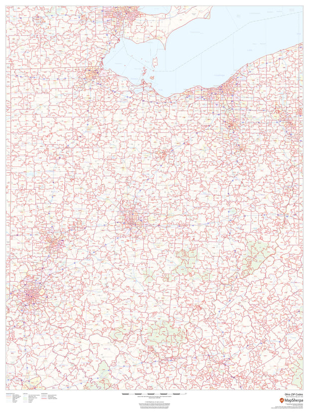
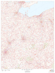
Ohio Zip Code Map
OHWM003-1
Regular price
$59.95
This map of Ohio shows ZIP codes overlaid on a road map. Base map features include municipality and county boundaries, major road network features, and state and national parks and conservation areas.
36"W x 48"H
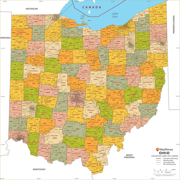
Ohio Zip Code Map with Counties
OHWM005-1
Regular price
$34.95
This map has been created and designed for business or reference use. Clear and clean colors & fonts matched with cartographic research makes this Ohio Zip Code Map with Counties easily readable and useful. The map shows the 88 counties of Ohio and the borders of the over 1,000 zip codes across the Buckeye State.
Ohio County Map
OHWM004-1
Regular price
$29.95
This map has been created and designed for reference or business use. Clear and clean colors & fonts matched with cartographic research makes this map of Ohio Counties Map easily readable and useful. The map shows the 88 counties of Ohio and their borders across the Buckeye State.
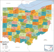
Ohio Wall Map by Globe Turner
OHWM002-1
Regular price
$29.95
This colorful, easy-to-read state map of Ohio identifies all major thoroughfares, secondary roads, freeway interchanges, route numbers, landmarks, recreational areas, and more. Shaded relief on the state map provides a three-dimensional sense of Ohio's topography. Detailed inset maps of Akron, Canton, Cincinnati, Cleveland, Columbus, Dayton, Springfield, Toledo and Youngstown are based on the latest street information from our cartographic experts. County and city indices make it simple to locate even the smallest town.