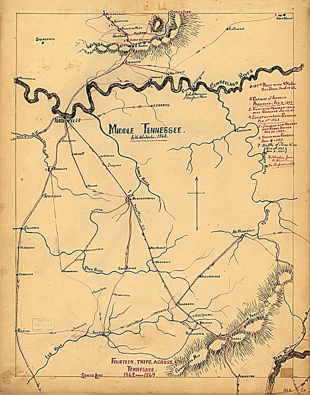
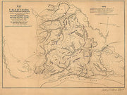
Middle Tennessee by G. H. Blakeslee, 1863 This beautiful antique map reproduction is printed on heavy acid-free stock with fade proof inks and is excellent for framing.
17"W x 22"H
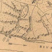
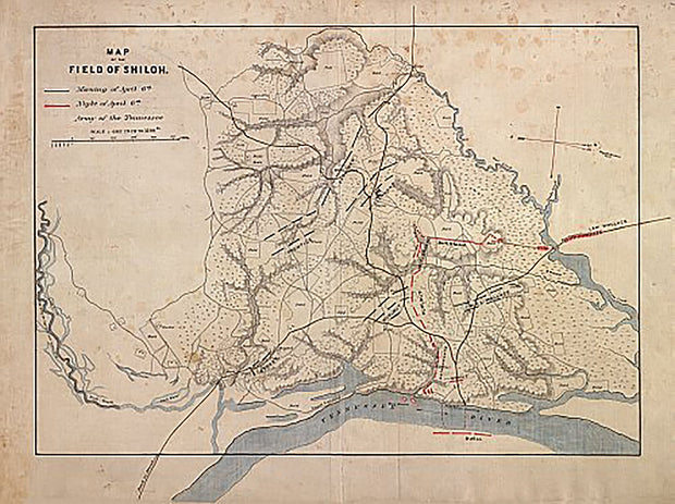
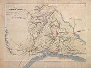
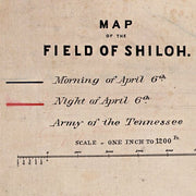
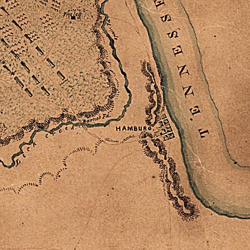
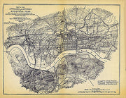
Map of the field of Shiloh, near Pittsburgh Landing, Tenn. on the 6th and 7th of April 1862
TNCW015
Regular price
$39.95
Map of the field of Shiloh, near Pittsburgh Landing, Tenn. on the 6th and 7th of April 1862 This beautiful antique map reproduction is printed on heavy acid-free stock with fade proof inks and is excellent for framing.
27"W x 20"H
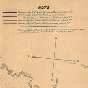
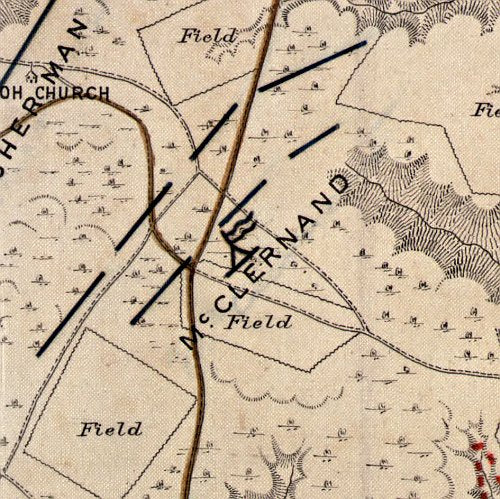
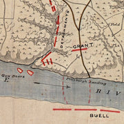
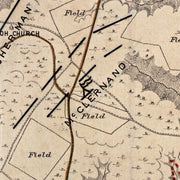
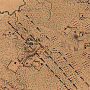
Map of the field of Shiloh. April 6, 1862
TNCW014
Regular price
$39.95
Map of the field of Shiloh. April 6, 1862 This beautiful antique map reproduction is printed on heavy acid-free stock with fade proof inks and is excellent for framing.
27"W x 20"H
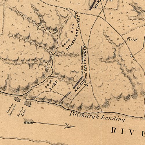
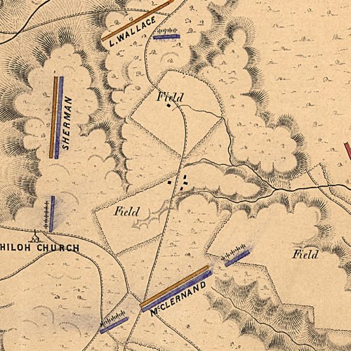
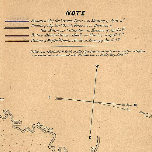
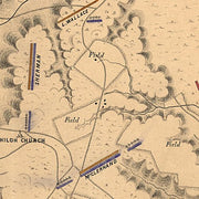
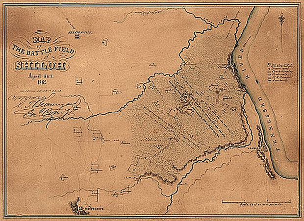
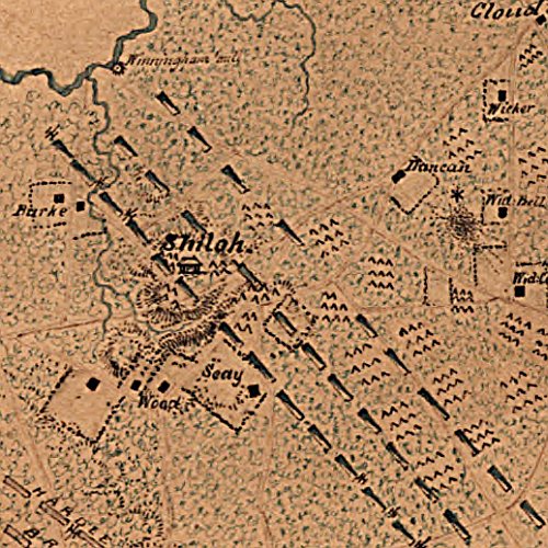
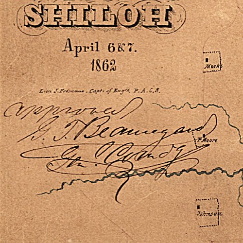
Map of the battle field of Shiloh, April 6 & 7, 1862 by Léon J. Frémaux, Capt. of Engrs. P.A.C.S.
TNCW013
Regular price
$39.95
Map of the battle field of Shiloh, April 6 & 7, 1862 by Léon J. Frémaux, Capt. of Engrs. P.A.C.S. This beautiful antique map reproduction is printed on heavy acid-free stock with fade proof inks and is excellent for framing.
16"W x 12"H
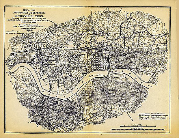
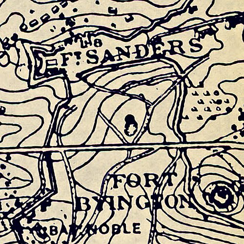
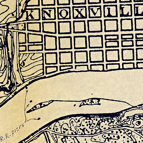
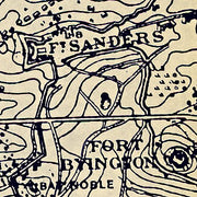
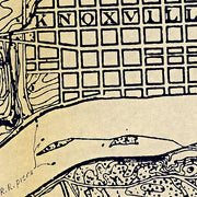
Map of the approaches and defences of Knoxville, Tenn.
TNCW012
Regular price
$39.95
Map of the approaches and defences of Knoxville, Tenn. This beautiful antique map reproduction is printed on heavy acid-free stock with fade proof inks and is excellent for framing.
30"W x 23"H
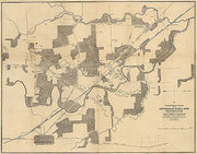
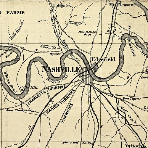
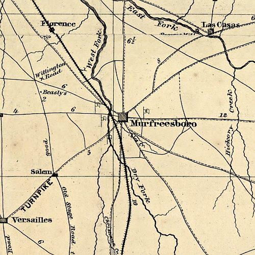
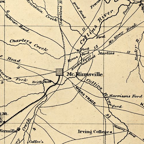
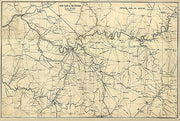
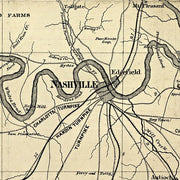
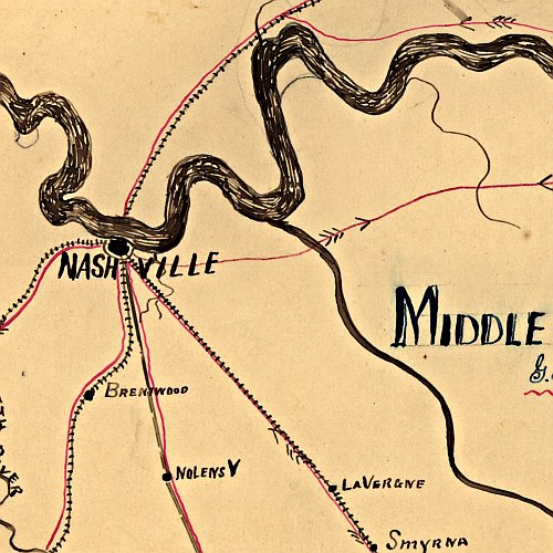
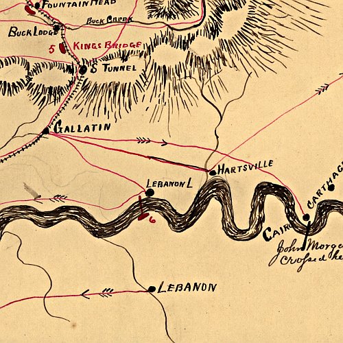
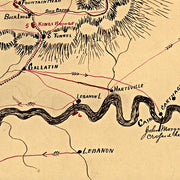
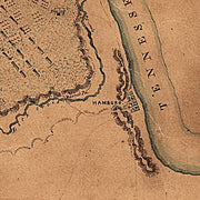
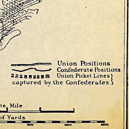
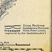
From Mitchelsville [sic] to Gallatin, Sumner Co., Tenn., 1862 by G. H. Blakeslee (G.H.B.)
TNCW010
Regular price
$39.95
From Mitchelsville [sic] to Gallatin, Sumner Co., Tenn., 1862 by G. H. Blakeslee (G.H.B.) This beautiful antique map reproduction is printed on heavy acid-free stock with fade proof inks and is excellent for framing.
22"W x 17"H
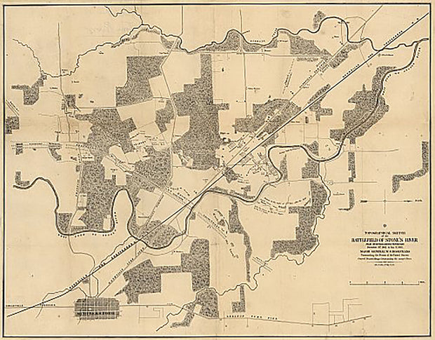
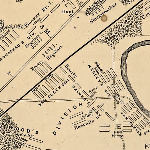
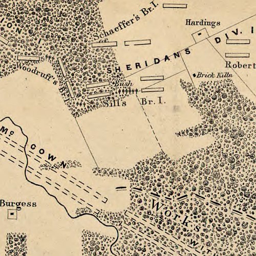
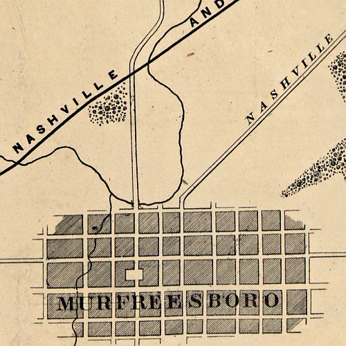
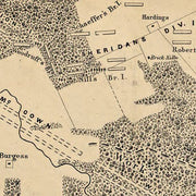
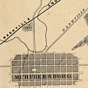
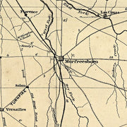
Topographical sketch of the battlefield of Stone's River near Murfreesboro, Tennessee
TNCW007
Regular price
$39.95
Topographical sketch of the battlefield of Stone's River near Murfreesboro, Tennessee This beautiful antique map reproduction is printed on heavy acid-free stock with fade proof inks and is excellent for framing.
24"W x 19"H
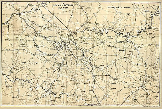
A new map of Tennessee by Capt. Michler
TNCW001
Regular price
$39.95
A new map of Tennessee by Capt. Michler This beautiful antique map reproduction is printed on heavy acid-free stock with fade proof inks and is excellent for framing.


![From Mitchelsville [sic] to Gallatin, Sumner Co., Tenn., 1862 by G. H. Blakeslee (G.H.B.)](http://www.americanmapstore.com/cdn/shop/products/TNCW010-2_620x.jpg?v=1626120622)
![From Mitchelsville [sic] to Gallatin, Sumner Co., Tenn., 1862 by G. H. Blakeslee (G.H.B.)](http://www.americanmapstore.com/cdn/shop/products/TNCW010-3_620x.jpg?v=1626120622)
![From Mitchelsville [sic] to Gallatin, Sumner Co., Tenn., 1862 by G. H. Blakeslee (G.H.B.)](http://www.americanmapstore.com/cdn/shop/products/TNCW010-4_620x.jpg?v=1626120622)
![From Mitchelsville [sic] to Gallatin, Sumner Co., Tenn., 1862 by G. H. Blakeslee (G.H.B.)](http://www.americanmapstore.com/cdn/shop/products/TNCW010-5_620x.jpg?v=1626120622)
![From Mitchelsville [sic] to Gallatin, Sumner Co., Tenn., 1862 by G. H. Blakeslee (G.H.B.)](http://www.americanmapstore.com/cdn/shop/products/TNCW010-2_180x.jpg?v=1626120622)
![From Mitchelsville [sic] to Gallatin, Sumner Co., Tenn., 1862 by G. H. Blakeslee (G.H.B.)](http://www.americanmapstore.com/cdn/shop/products/TNCW010-3_180x.jpg?v=1626120622)
![From Mitchelsville [sic] to Gallatin, Sumner Co., Tenn., 1862 by G. H. Blakeslee (G.H.B.)](http://www.americanmapstore.com/cdn/shop/products/TNCW010-4_180x.jpg?v=1626120622)
![From Mitchelsville [sic] to Gallatin, Sumner Co., Tenn., 1862 by G. H. Blakeslee (G.H.B.)](http://www.americanmapstore.com/cdn/shop/products/TNCW010-5_180x.jpg?v=1626120622)