Skip to content
  • Home
  • Choose A State
    • Alabama
    • Alaska
    • Arizona
    • Arkansas
    • California
    • Colorado
    • Connecticut
    • Delaware
    • Florida
    • Georgia
    • Hawaii
    • Idaho
    • Illinois
    • Indiana
    • Iowa
    • Kansas
    • Kentucky
    • Louisiana
    • Maine
    • Maryland
    • Massachusetts
    • Michigan
    • Minnesota
    • Mississippi
    • Missouri
    • Montana
    • Nebraska
    • Nevada
    • New Hampshire
    • New Jersey
    • New Mexico
    • New York
    • North Carolina
    • North Dakota
    • Ohio
    • Oklahoma
    • Oregon
    • Pennsylvania
    • Rhode Island
    • South Carolina
    • South Dakota
    • Tennessee
    • Texas
    • Utah
    • Vermont
    • Virginia
    • Washington
    • Washington, DC
    • West Virginia
    • Wisconsin
    • Wyoming
    • USA Maps
  • Choose A Category
    • US Regional Maps
    • USA Maps
    • Educational Maps
      • US, World & Continents Combo Pull Down Maps
    • Topographic Maps
      • Any USA Topographic Map
      • Alabama Topographic Maps
      • Arizona Topographic Maps
      • Arkansas Topographic Maps
      • California Topographic Maps
      • Colorado Topographic Maps
      • Delaware Topographic Maps
      • Florida Topographic Maps
      • Georgia Topographic Maps
      • Hawaii Topographic Maps
      • Idaho Topographic Maps
      • Illinois Topographic Maps
      • Indiana Topogrpahic Maps
      • Iowa Topographic Maps
      • Kansas Topographic Maps
      • Kentucky Topographic Maps
      • Louisiana Topographic Maps
      • Maine Topographic Maps
      • Maryland Topographic Maps
      • Massachusetts Topographic Maps
      • Michigan Topographic Maps
      • Minnesota Topographic Maps
      • Mississippi Topographic Maps
      • Missouri Topographic Maps
      • Montana Topographic Maps
      • Nebraska Topographic Maps
      • Nevada Topographic Maps
      • New Hampshire Topographic Maps
      • New Jersey Topographic Maps
      • New Mexico Topographic Maps
      • New York Topographic Maps
      • North Carolina Topographic Maps
      • North Dakota Topographic Maps
      • Ohio Topographic Maps
      • Oklahoma Topographic Maps
      • Oregon Topographic Maps
      • Pennsylvania Topographic Maps
      • Rhode Island Topographic Maps
      • South Carolina Topographic Maps
      • South Dakota Topographic Maps
      • Tennessee Topographic Maps
      • Texas Topographic Maps
      • Utah Topographic Maps
      • Vermont Topographic Maps
      • Virginia Topographic Maps
      • Washington Topographic Maps
      • West Virginia Topographic Maps
      • Wisconsin Topographic Maps
      • Wyoming Topographic Maps
    • World Wall Maps
    • International Maps
    • War Maps
  • Helpful Info
    • Our Printing Process
    • Shipping
    • Returns
    • Purchase Orders
    • Custom Maps
  • Log in
Cart
American Map Store American Map Store
Log in Search Cart
Home / Colorado: Wall Maps / California: Wall Maps

Colorado: Wall Maps

Colorado Wall Maps

  • View all
  • California
  • California City Wall Maps
  • California: Wall Maps
  • Colorado
  • Colorado City Wall Maps
  • Colorado: Wall Maps
Quick view
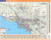
Los Angeles Regional by Rand McNally
$229.00
Los Angeles Regional by Rand McNally

Los Angeles Regional by Rand McNally

CAWM101

Regular price $229.00
Rand McNally's regional wall map of Los Angeles is ideal for anyone needing a comprehensive representation of the area for planning, routing, or reference. It's a great choice for business and sales strategy, urban development, social work outreach, education, and marketing. Los Angeles residents, businesses, and government offices are sure to find this wonderful reference tool irreplaceable.
  • The laminated wall map is printed with UV-resistant ink to help prevent color fading.
  • Map details include state highways, federal highways, county highways, county boundaries, city shading, cities and towns, major waterways, state/national parks, campsites, exit numbers, rest areas, military installations, airports, golf courses, universities, and much more.
  • You'll also find a city/county index on the map and a driving times map between major cities in the region.
  • This truly complete wall map even includes a hanging kit with rails for easy mounting just about anywhere.

This map is rolled and shipped in a sturdy cardboard tube.

Coverage Area

Coverage area extends approximately 106 miles north-to-south and 155 miles east-to-west and is roughly bounded by the Los Padres National Forest north of Ventura, CA; east to Barstow, CA; south to Temecula, CA; and west to the Pacific Coast.

Product Details

  • Dimensions: 60" x 46"

Powered by Shopify

Main menu

  • Home
  • Choose A State
  • Choose A Category
  • Helpful Info

More Stuff Here

  • Custom Maps
  • Purchase Orders
  • Search for Product
  • Shipping
  • Refunds & returns
  • Contact Us

Join AMS Newsletter

Sign-up for Discounts, Coupons, New Product Arrivals and Recent News.

Powered by Shopify

  • american express
  • apple pay
  • diners club
  • discover
  • google pay
  • master
  • paypal
  • visa

All of our maps have a Free Shipping Option!