

COWM007
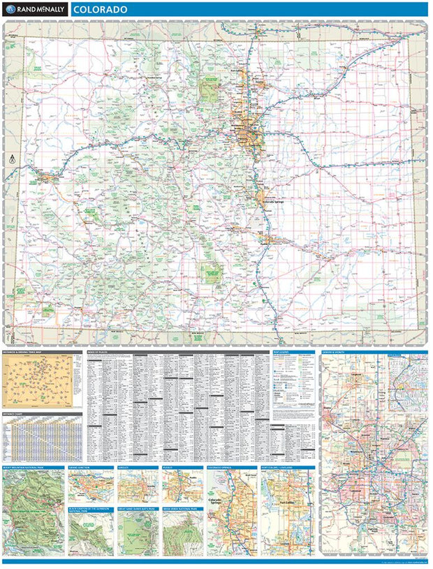
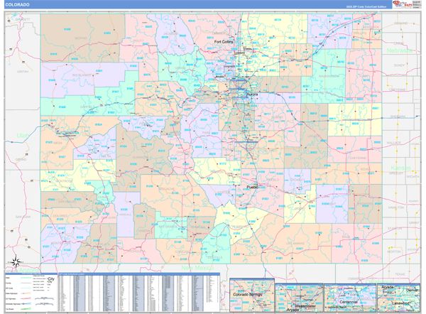
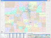
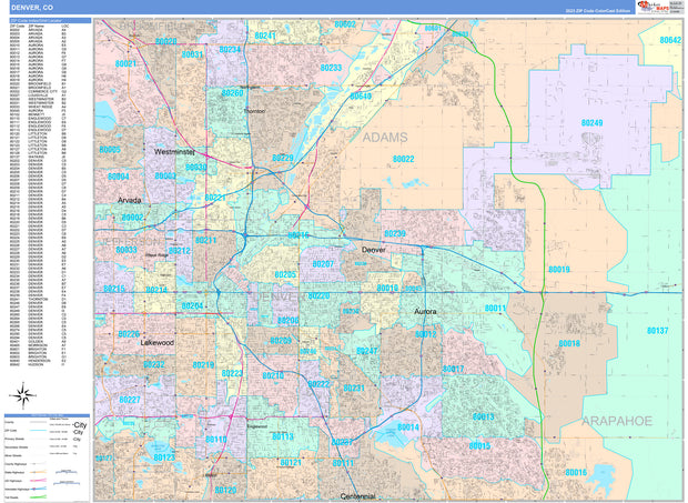
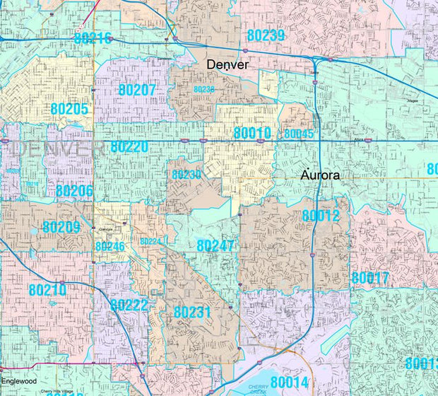
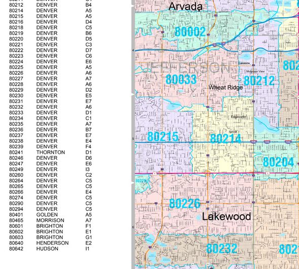
With its capital city Denver one mile above sea level (1,609 m), fifteen separate mountain ranges, and more than fifty peaks that reach above 14,000 ft (4,267 m), Colorado attracts travelers from around the world seeking their own “Rocky Mountain High” experience. This wall map illustrates The Centennial State’s vast network of highways and byways, and the diverse public lands that make the Colorado Rockies accessible to all.
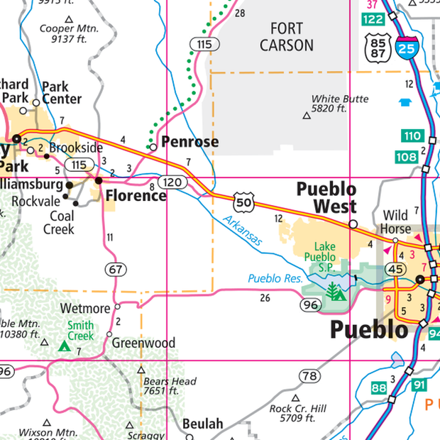
If outdoor adventure and recreation is your thing, this is the map for you. This map is loaded with points of interest from camping sites, hiking trails, fishing spots, and bird watching locations ( see legend shown on 2nd picture) this map depicts all the best recreation locations. Not only functional this exquisite map uses shaded relief to portray the land a technique which combines shading with elevation tints that portray landforms much more clearly than contour lines. These techniques and elevation colors make mountains, highlands and valleys immediately obvious.
Beautiful as well as functional this map will look great in a home, office, cabin, RV or wherever you choose to hang it.
This map is rolled and shipped in a sturdy cardboard tube.
CAWM101
This map is rolled and shipped in a sturdy cardboard tube.
Coverage area extends approximately 106 miles north-to-south and 155 miles east-to-west and is roughly bounded by the Los Padres National Forest north of Ventura, CA; east to Barstow, CA; south to Temecula, CA; and west to the Pacific Coast.
COWM001
Description
Rand McNally's state wall map of Colorado is ideal for anyone needing a comprehensive representation of the area for planning, routing, or reference. It is an excellent choice for business and sales strategy, urban development, social work outreach, education, and marketing. State residents, businesses, and government offices are sure to find this wonderful reference tool irreplaceable.
The laminated wall map is printed with UV-resistant ink to help prevent color fading.
Map details include federal, state, and county highways, county boundaries, cities and towns, major waterways, state/national parks, campsites, exit numbers, rest areas, military installations, airports, golf courses, universities, and much more.
You will also find a city/county index on the map, a comprehensive map legend, a distance chart with mileages between various cities, and a mileage/driving times map.
This truly complete wall map even includes a hanging kit with rails for easy mounting just about anywhere.
Coverage Area
Inset maps: Black Canyon of the Gunnison National Park, Colorado Springs, Denver, Central Denver, Fort Collins/Loveland, Grand Junction, Great Sand Dunes National Park, Greeley, Mesa Verde National Park, Pueblo, and Rocky Mountain National Park.
This map is rolled and shipped in a sturdy cardboard tube.
COWM006CC-1
Save money on our full line of wall maps from one of the industry leaders in wall maps. These always up to date, eye catching wall maps come in a variety of sizes and finishing options sure to meet your specific mapping needs.
The Colorcast Style is perfect when you want to distinguish quickly and easily between counties.
Colorado map includes inset maps of Denver and Colorado Springs
This map is rolled and shipped in a sturdy cardboard tube.
COWM104CC-1
Save money on our full line of wall maps from one of the industry leaders in wall maps. These always up to date, eye catching wall maps come in a variety of sizes and finishing options sure to meet your specific mapping needs.
Features include:
Note: Major streets & highways available in all sizes. All streets & highways only available in larger sizes and will show unavailable in smaller sizes.
This map is rolled and shipped in a sturdy cardboard tube.
COWM103CC-1
Save money on our full line of wall maps from one of the industry leaders in wall maps. These always up to date, eye catching wall maps come in a variety of sizes and finishing options sure to meet your specific mapping needs.
Features include:
Note: Major streets & highways available in all sizes. All streets & highways only available in larger sizes and will show unavailable in smaller sizes.
This map is rolled and shipped in a sturdy cardboard tube.