Skip to content
  • Home
  • Choose A State
    • Alabama
    • Alaska
    • Arizona
    • Arkansas
    • California
    • Colorado
    • Connecticut
    • Delaware
    • Florida
    • Georgia
    • Hawaii
    • Idaho
    • Illinois
    • Indiana
    • Iowa
    • Kansas
    • Kentucky
    • Louisiana
    • Maine
    • Maryland
    • Massachusetts
    • Michigan
    • Minnesota
    • Mississippi
    • Missouri
    • Montana
    • Nebraska
    • Nevada
    • New Hampshire
    • New Jersey
    • New Mexico
    • New York
    • North Carolina
    • North Dakota
    • Ohio
    • Oklahoma
    • Oregon
    • Pennsylvania
    • Rhode Island
    • South Carolina
    • South Dakota
    • Tennessee
    • Texas
    • Utah
    • Vermont
    • Virginia
    • Washington
    • Washington, DC
    • West Virginia
    • Wisconsin
    • Wyoming
    • USA Maps
  • Choose A Category
    • US Regional Maps
    • USA Maps
    • Educational Maps
      • US, World & Continents Combo Pull Down Maps
    • Topographic Maps
      • Any USA Topographic Map
      • Alabama Topographic Maps
      • Arizona Topographic Maps
      • Arkansas Topographic Maps
      • California Topographic Maps
      • Colorado Topographic Maps
      • Delaware Topographic Maps
      • Florida Topographic Maps
      • Georgia Topographic Maps
      • Hawaii Topographic Maps
      • Idaho Topographic Maps
      • Illinois Topographic Maps
      • Indiana Topogrpahic Maps
      • Iowa Topographic Maps
      • Kansas Topographic Maps
      • Kentucky Topographic Maps
      • Louisiana Topographic Maps
      • Maine Topographic Maps
      • Maryland Topographic Maps
      • Massachusetts Topographic Maps
      • Michigan Topographic Maps
      • Minnesota Topographic Maps
      • Mississippi Topographic Maps
      • Missouri Topographic Maps
      • Montana Topographic Maps
      • Nebraska Topographic Maps
      • Nevada Topographic Maps
      • New Hampshire Topographic Maps
      • New Jersey Topographic Maps
      • New Mexico Topographic Maps
      • New York Topographic Maps
      • North Carolina Topographic Maps
      • North Dakota Topographic Maps
      • Ohio Topographic Maps
      • Oklahoma Topographic Maps
      • Oregon Topographic Maps
      • Pennsylvania Topographic Maps
      • Rhode Island Topographic Maps
      • South Carolina Topographic Maps
      • South Dakota Topographic Maps
      • Tennessee Topographic Maps
      • Texas Topographic Maps
      • Utah Topographic Maps
      • Vermont Topographic Maps
      • Virginia Topographic Maps
      • Washington Topographic Maps
      • West Virginia Topographic Maps
      • Wisconsin Topographic Maps
      • Wyoming Topographic Maps
    • World Wall Maps
    • International Maps
    • War Maps
  • Helpful Info
    • Our Printing Process
    • Shipping
    • Returns
    • Purchase Orders
    • Custom Maps
  • Log in
Cart
American Map Store American Map Store
Log in Search Cart
Home / Louisiana: Wall Maps / Louisiana

Louisiana: Wall Maps

Louisiana Wall Maps

  • View all
  • Louisiana
  • Louisiana: Wall Maps
  • Texas
  • Texas City Wall Maps
  • Texas: Wall Maps
Quick view
Louisiana by Rand McNally
$229.00
Quick view
Premium Style Wall Map of New Orleans by Market Maps
from $118.75
Quick view
Premium Style Wall Map of Louisiana by Market Maps
from $118.75
Quick view
Premium Style Wall Map of Baton Rouge by Market Maps
from $118.75
Quick view
Louisiana Zip Code Map
from $64.95
Quick view
Louisiana Recreation Map by Benchmark Maps
from $64.95
Quick view
Lousiana Zip Code Map with Parishes (Counties)
from $64.95
Quick view
Louisiana Parish (County) Map
from $54.95
Quick view
Louisiana Wall Map by Globe Turner
from $54.95
Quick view
Color Cast Zip Code Style Wall Map of Baton Rouge by Market Maps
from $118.75
Quick view
Colorcast Zip Code Style Wall Map of New Orleans by Market Maps
from $118.75
Quick view
Color Cast Style Wall Map of Louisiana by Market Maps
from $118.75
Quick view
Louisiana State Wall Map
from $79.95
Quick view
New Orleans Greater Metro Area Wall Map
from $79.95
Quick view
Beaumont, Port Arthur and Lake Charles Area Wall Map
from $94.95
Louisiana by Rand McNally

Louisiana by Rand McNally

LAWM001

Regular price $229.00
  • Laminated with Hanging Rails
  • 60" W x 46" H
  • Index of Counties and Cities
  • Fully Indexed Counties, Cities, Mileage Chart
  • Inset Maps of All Major Cities
  • Free Shipping!

Description  

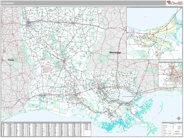
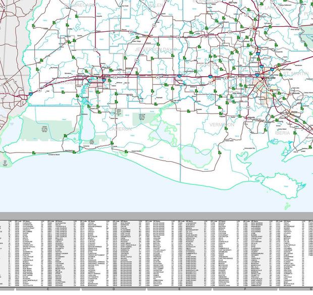
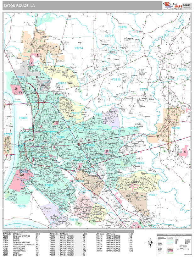
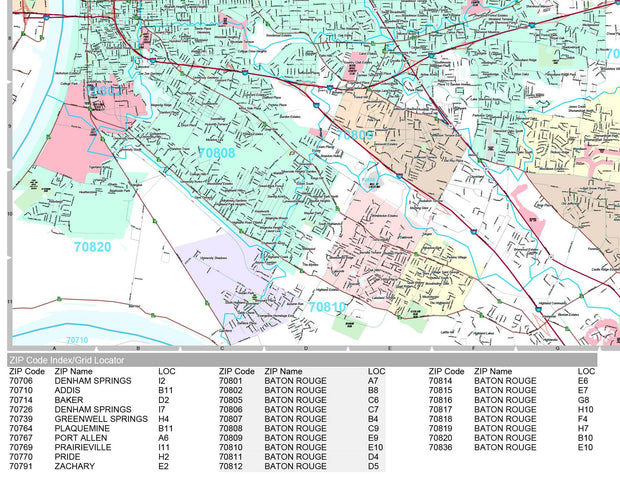
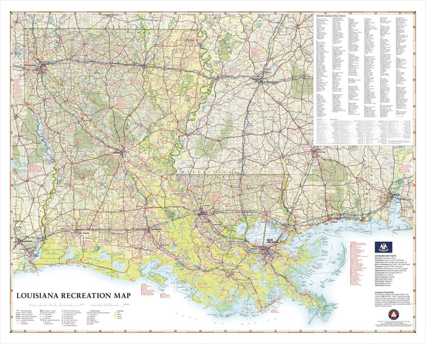
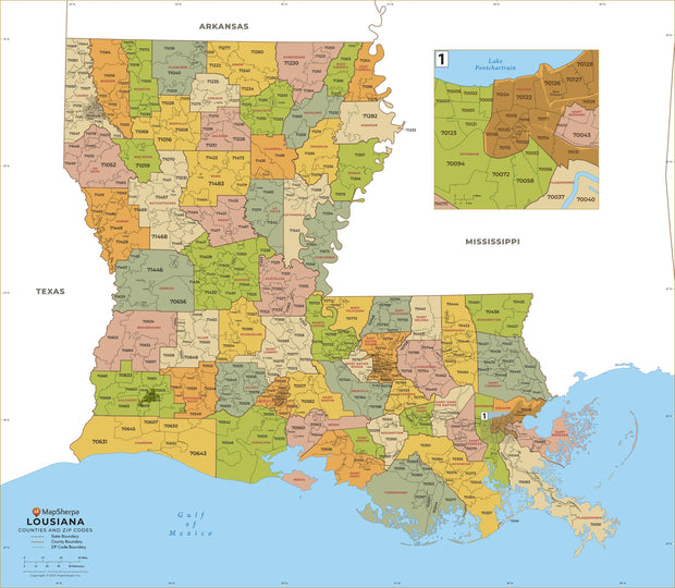
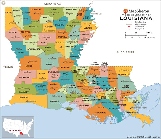
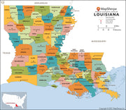
Rand McNally's state wall map of Louisiana is ideal for anyone needing a comprehensive representation of the area for planning, routing, or reference. It is an excellent choice for business and sales strategy, urban development, social work outreach, education, and marketing. State residents, businesses, and government offices are sure to find this wonderful reference tool irreplaceable. 

  • The laminated wall map is printed with UV-resistant ink to help prevent color fading. 

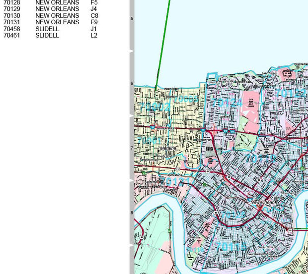
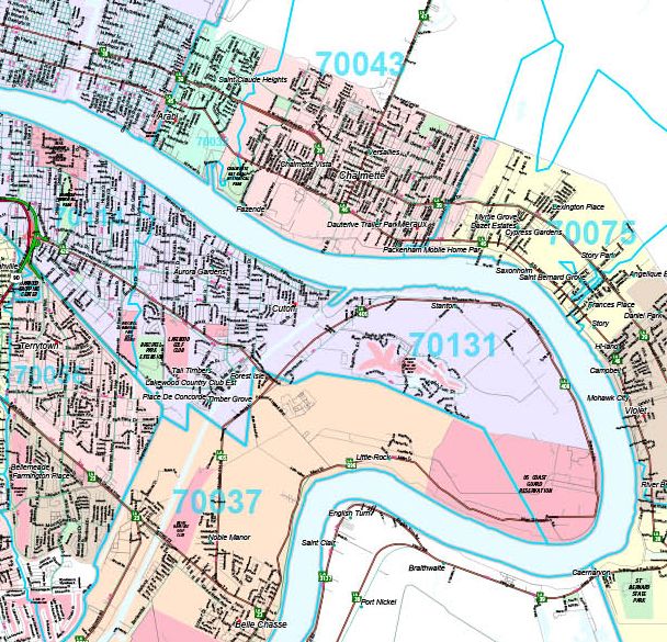
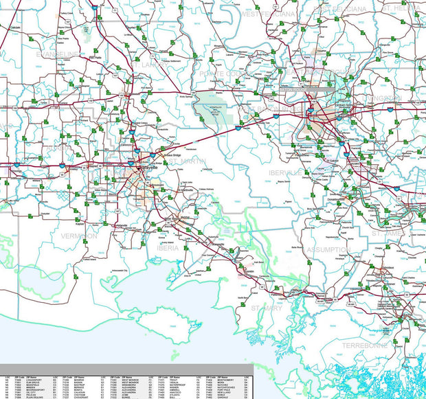
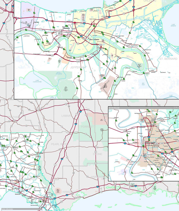
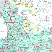
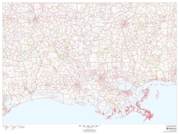
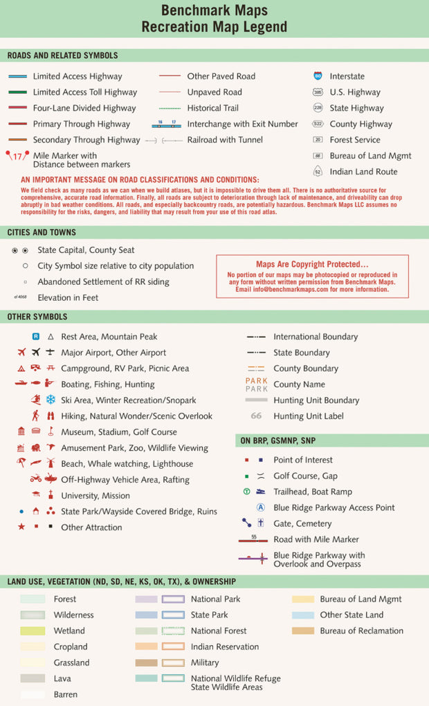
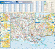
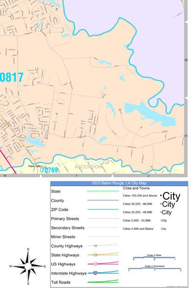
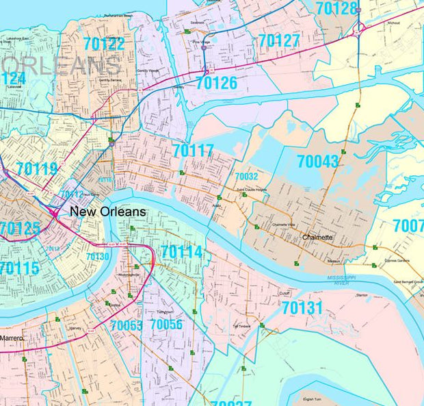
  • Map details include federal, state, and county highways, county boundaries, cities and towns, major waterways, state/national parks, campsites, exit numbers, rest areas, military installations, airports, golf courses, universities, and much more. 

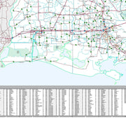
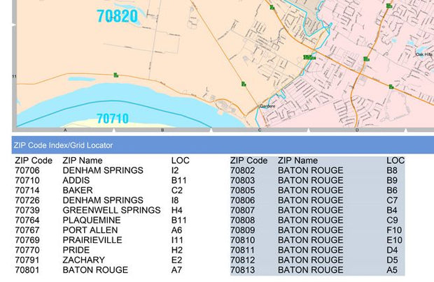
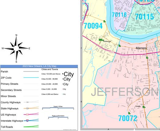
  • You will also find a city/county index on the map, a comprehensive map legend, a distance chart with mileages between various cities, and a mileage/driving times map. 

  • This truly complete wall map even includes a hanging kit with rails for easy mounting just about anywhere. 

Coverage Area 

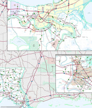
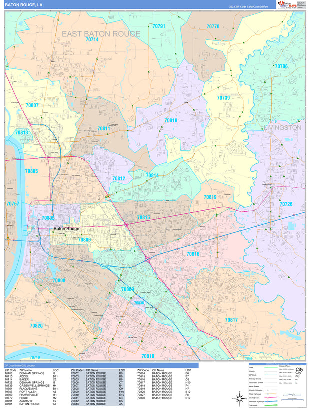
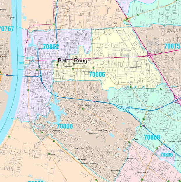
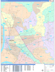
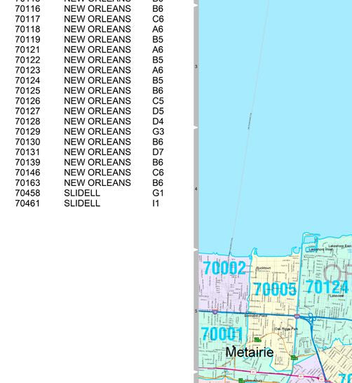
Inset maps: Alexandria, Baton Rouge, Houma/Thibodaux, Lafayette, Lake Charles, Monroe, New Orleans, Central New Orleans, Shreveport, and Slidell. 

This map is rolled and shipped in a sturdy cardboard tube.

Premium Style Wall Map of New Orleans by Market Maps

Premium Style Wall Map of New Orleans by Market Maps

LAWM101-1

Regular price $118.75

Save money on our full line of wall maps from one of the industry leaders in wall maps. These always up to date, eye catching wall maps come in a variety of sizes and finishing options sure to meet your specific mapping needs.


Features include:

  • Interstate/Us/State Highways
  • 5-Digit ZIP Codes
  • County Names and boundaries
  • Cities and Towns as applicable
  • All water
  • Institutions
  • Cemetery
  • Airports
  • Golf Courses
  • Parks
  • Populated Places Shaded
  • ZIP Code index with grid locator

Note: Major streets & highways available in all sizes. All streets & highways only available in larger sizes and will show unavailable in smaller sizes.

This map is rolled and shipped in a sturdy cardboard tube.

Premium Style Wall Map of Louisiana by Market Maps

Premium Style Wall Map of Louisiana by Market Maps

LAWM006-1

Regular price $118.75

Save money on our full line of wall maps from one of the industry leaders in wall maps. These always up to date, eye catching wall maps come in a variety of sizes and finishing options sure to meet your specific mapping needs.


Features include:

  • Interstate/Us/State Highways
  • 5-Digit ZIP Codes
  • County Names and boundaries
  • Cities and Towns as applicable
  • All water
  • Institutions
  • Cemetery
  • Airports
  • Golf Courses
  • Parks
  • Populated Places Shaded
  • ZIP Code index with grid locator


Premium Style Wall Map of Baton Rouge by Market Maps

Premium Style Wall Map of Baton Rouge by Market Maps

LAWM100-1

Regular price $118.75

Save money on our full line of wall maps from one of the industry leaders in wall maps. These always up to date, eye catching wall maps come in a variety of sizes and finishing options sure to meet your specific mapping needs.

Note: Major streets & highways available in all sizes. All streets & highways only available in larger sizes and will show unavailable in smaller sizes

Features include:

  • Interstate/Us/State Highways
  • 5-Digit ZIP Codes
  • County Names and boundaries
  • Cities and Towns as applicable
  • All water
  • Institutions
  • Cemetery
  • Airports
  • Golf Courses
  • Parks
  • Populated Places Shaded
  • ZIP Code index with grid locator

Note: Major streets & highways available in all sizes. All streets & highways only available in larger sizes and will show unavailable in smaller sizes.

This map is rolled and shipped in a sturdy cardboard tube.

Louisiana Zip Code Map

Louisiana Zip Code Map

LAWM003

Regular price $64.95

This map of Louisiana shows ZIP codes overlaid on a road map. Base map features include municipality and county boundaries, major road network features, and state and national parks and conservation areas.

This map is rolled and shipped in a sturdy cardboard tube.

Louisiana Recreation Map by Benchmark Maps

Louisiana Recreation Map by Benchmark Maps

LAWM007

Regular price $64.95

Rich with fishing and hunting opportunities in its diverse waters and expansive woodlands, Louisiana is truly a Sportsman’s Paradise. This wall map illustrates the physical features and recreation highlights of The Pelican State, from the northern Piney Hills to the Mississippi River Delta and Gulf Coast.

If outdoor adventure and recreation is your thing, this is the map for you. This map is loaded with points of interest from camping sites, hiking trails, fishing spots, and bird watching locations ( see legend shown on 2nd picture) this map depicts all the best recreation locations. Not only functional this exquisite map uses shaded relief to portray the land a technique which combines shading with elevation tints that portray landforms much more clearly than contour lines. These techniques and elevation colors make mountains, highlands and valleys immediately obvious.

Beautiful as well as functional this map will look great in a home, office, cabin, RV or wherever you choose to hang it

This map is rolled and shipped in a sturdy cardboard tube.

Lousiana Zip Code Map with Parishes (Counties)

Lousiana Zip Code Map with Parishes (Counties)

LAWM005

Regular price $64.95

This map has been created and designed for business or reference use. Clear and clean colors & fonts matched with cartographic research makes this Louisiana Zip Code Map with Parishes (Counties) easily readable and useful. The map shows the 64 parishes of Louisiana and the borders of the 509 zip codes across the Pelican State.

This map is rolled and shipped in a sturdy cardboard tube.

Louisiana Parish (County) Map

Louisiana Parish (County) Map

LAWM004

Regular price $54.95

This map has been created designed for reference or business use. Clear and clean colors & fonts matched with cartographic research makes this map of Louisiana Parishes (Counties) Map easily readable and useful. The map shows the 64 parishes of Louisiana and their borders across the Pelican State.

This map is rolled and shipped in a sturdy cardboard tube.

Louisiana Wall Map by Globe Turner

Louisiana Wall Map by Globe Turner

LAWM002

Regular price $54.95

This colorful, easy-to-read state map of Louisiana identifies all major thoroughfares, secondary roads, freeway interchanges, rest areas, distance markers, landmarks, recreational areas, and more. Shaded relief on the state map provides a three-dimensional sense of Louisiana’s topography. Detailed city inset maps of Baton Rouge, Lafayette, Lake Charles, Monroe, and New Orleans are based on the latest street information from our cartographic experts. An up-to-date inset of the French Quarter and Central Business District provides must-see information on downtown New Orleans. County and city indices make it simple to locate even the smallest town.

This map is rolled and shipped in a sturdy cardboard tube.

Color Cast Zip Code Style Wall Map of Baton Rouge by Market Maps

Color Cast Zip Code Style Wall Map of Baton Rouge by Market Maps

LAWM100CC-1

Regular price $118.75

Save money on our full line of wall maps from one of the industry leaders in wall maps. These always up to date, eye catching wall maps come in a variety of sizes and finishing options sure to meet your specific mapping needs.

Features include:

  • Interstate/Us/State Highways
  • 5-Digit ZIP Codes
  • County Names and boundaries
  • Cities and Towns as applicable
  • All water
  • ZIP Code index with grid locator
    Note: Major streets & highways available in all sizes. All streets & highways only available in larger sizes and will show unavailable in smaller sizes.
    This map is rolled and shipped in a sturdy cardboard tube.
    Colorcast Zip Code Style Wall Map of New Orleans by Market Maps
    Colorcast Zip Code Style Wall Map of New Orleans by Market Maps
    Colorcast Zip Code Style Wall Map of New Orleans by Market Maps
    Colorcast Zip Code Style Wall Map of New Orleans by Market Maps
    Colorcast Zip Code Style Wall Map of New Orleans by Market Maps
    Colorcast Zip Code Style Wall Map of New Orleans by Market Maps
    Colorcast Zip Code Style Wall Map of New Orleans by Market Maps
    Colorcast Zip Code Style Wall Map of New Orleans by Market Maps

    Colorcast Zip Code Style Wall Map of New Orleans by Market Maps

    LAWM101CC-1

    Regular price $118.75

    Save money on our full line of wall maps from one of the industry leaders in wall maps. These always up to date, eye catching wall maps come in a variety of sizes and finishing options sure to meet your specific mapping needs.

    Steve Ross
    1510 East County Road 109
    Venus, TX

    Features include:

    • Interstate/Us/State Highways
    • 5-Digit ZIP Codes
    • County Names and boundaries
    • Cities and Towns as applicable
    • All water
    • ZIP Code index with grid locator
      Note: Major streets & highways available in all sizes. All streets & highways only available in larger sizes and will show unavailable in smaller sizes.
      This map is rolled and shipped in a sturdy cardboard tube.
      Color Cast Style Wall Map of Louisiana by Market Maps
      Color Cast Style Wall Map of Louisiana by Market Maps
      Color Cast Style Wall Map of Louisiana by Market Maps
      Color Cast Style Wall Map of Louisiana by Market Maps

      Color Cast Style Wall Map of Louisiana by Market Maps

      LAWM006CC-1

      Regular price $118.75

      The Color Cast Style Louisiana State Map is a multi-colored display that shades each county with its own background color. It is an ideal choice for applications that benefit from quickly and easily distinguishing one county from the others. 

      This wall map comes laminated on both sides using 3mm hot lamination, which protects your wall map and allows you to write on it with dry-erase markers.

      Includes inset maps of all major cities.

      Features include:

      • Cities and Towns
      • Interstate/Us/State Highways
      • Color Coded & Labeled Counties
      • 5-Digit ZIP Codes Labeled with Boundaries
      • Fully Indexed Cities, Towns and Zip Codes

      This map is rolled and shipped in a sturdy cardboard tube.

      Louisiana State Wall Map
      Louisiana State Wall Map
      Louisiana State Wall Map
      Louisiana State Wall Map
      Louisiana State Wall Map
      Louisiana State Wall Map
      Louisiana State Wall Map
      Louisiana State Wall Map
      Louisiana State Wall Map
      Louisiana State Wall Map
      Louisiana State Wall Map
      Louisiana State Wall Map

      Louisiana State Wall Map

      LAWM008

      Regular price $79.95

      Laminated wall map of Louisiana, showing parishes, towns, cities, villages, hamlets, major roads and highways. Includes community index

      This map comes in a variety of sizes and finishing options. It is shipped rolled in a sturdy cardboard tube.

      New Orleans Greater Metro Area Wall Map
      New Orleans Greater Metro Area Wall Map
      New Orleans Greater Metro Area Wall Map
      New Orleans Greater Metro Area Wall Map
      New Orleans Greater Metro Area Wall Map
      New Orleans Greater Metro Area Wall Map
      New Orleans Greater Metro Area Wall Map
      New Orleans Greater Metro Area Wall Map
      New Orleans Greater Metro Area Wall Map
      New Orleans Greater Metro Area Wall Map
      New Orleans Greater Metro Area Wall Map
      New Orleans Greater Metro Area Wall Map

      New Orleans Greater Metro Area Wall Map

      LAWM102

      Regular price $79.95
      Wall map of the New Orleans Metro Area showing locations within 45 - 60 miles of downtown New Orleans, including the area from Baton Rouge to Gulfport, south to the Gulf. The map covers much of East Baton Rouge Parish, Livingston Parish, southern Tangipahoa Parish, St. Tammany Parish, Ascension Parish, St. James Parish, St. John the Baptist Parish, St. James Parish, Assumption Parish, Terrebonne Parish, Lafourche Parish, St. Charles Parish, Jefferson Parish, Orleans Parish, St. Bernard Parish, Plaquemines Parish, and Hancock and Harrison Counties in Mississippi.
      Features shown include cities, towns, major roads and highways, zip codes, and major points of interest. An index of community names is included.

      This map comes in a variety of sizes and finishing options. It is shipped rolled in a sturdy cardboard tube.

      Beaumont, Port Arthur and Lake Charles Area Wall Map
      Beaumont, Port Arthur and Lake Charles Area Wall Map
      Beaumont, Port Arthur and Lake Charles Area Wall Map
      Beaumont, Port Arthur and Lake Charles Area Wall Map
      Beaumont, Port Arthur and Lake Charles Area Wall Map
      Beaumont, Port Arthur and Lake Charles Area Wall Map
      Beaumont, Port Arthur and Lake Charles Area Wall Map
      Beaumont, Port Arthur and Lake Charles Area Wall Map
      Beaumont, Port Arthur and Lake Charles Area Wall Map
      Beaumont, Port Arthur and Lake Charles Area Wall Map
      Beaumont, Port Arthur and Lake Charles Area Wall Map
      Beaumont, Port Arthur and Lake Charles Area Wall Map

      Beaumont, Port Arthur and Lake Charles Area Wall Map

      TXWM124

      Regular price $94.95
      Our Beaumont - Port Arthur - Lake Charles Area wall map shows a 90 mile wide by 50 mile high area of southeast Texas and western Louisiana. The map shows towns, counties, major and secondary highways and routes, as well as major points of interest. Note: due to the vast extent of this map, local street names are not shown. 

      This map comes in a variety of sizes and finishing options. It is shipped rolled in a sturdy cardboard tube.

      Powered by Shopify

      Main menu

      • Home
      • Choose A State
      • Choose A Category
      • Helpful Info

      More Stuff Here

      • Custom Maps
      • Purchase Orders
      • Search for Product
      • Shipping
      • Refunds & returns
      • Contact Us

      Join AMS Newsletter

      Sign-up for Discounts, Coupons, New Product Arrivals and Recent News.

      Powered by Shopify

      • american express
      • apple pay
      • diners club
      • discover
      • google pay
      • master
      • paypal
      • visa

      All of our maps have a Free Shipping Option!