Skip to content
  • Home
  • Choose A State
    • Alabama
    • Alaska
    • Arizona
    • Arkansas
    • California
    • Colorado
    • Connecticut
    • Delaware
    • Florida
    • Georgia
    • Hawaii
    • Idaho
    • Illinois
    • Indiana
    • Iowa
    • Kansas
    • Kentucky
    • Louisiana
    • Maine
    • Maryland
    • Massachusetts
    • Michigan
    • Minnesota
    • Mississippi
    • Missouri
    • Montana
    • Nebraska
    • Nevada
    • New Hampshire
    • New Jersey
    • New Mexico
    • New York
    • North Carolina
    • North Dakota
    • Ohio
    • Oklahoma
    • Oregon
    • Pennsylvania
    • Rhode Island
    • South Carolina
    • South Dakota
    • Tennessee
    • Texas
    • Utah
    • Vermont
    • Virginia
    • Washington
    • Washington, DC
    • West Virginia
    • Wisconsin
    • Wyoming
    • USA Maps
  • Choose A Category
    • US Regional Maps
    • USA Maps
    • Educational Maps
      • US, World & Continents Combo Pull Down Maps
    • Topographic Maps
      • Any USA Topographic Map
      • Alabama Topographic Maps
      • Arizona Topographic Maps
      • Arkansas Topographic Maps
      • California Topographic Maps
      • Colorado Topographic Maps
      • Delaware Topographic Maps
      • Florida Topographic Maps
      • Georgia Topographic Maps
      • Hawaii Topographic Maps
      • Idaho Topographic Maps
      • Illinois Topographic Maps
      • Indiana Topogrpahic Maps
      • Iowa Topographic Maps
      • Kansas Topographic Maps
      • Kentucky Topographic Maps
      • Louisiana Topographic Maps
      • Maine Topographic Maps
      • Maryland Topographic Maps
      • Massachusetts Topographic Maps
      • Michigan Topographic Maps
      • Minnesota Topographic Maps
      • Mississippi Topographic Maps
      • Missouri Topographic Maps
      • Montana Topographic Maps
      • Nebraska Topographic Maps
      • Nevada Topographic Maps
      • New Hampshire Topographic Maps
      • New Jersey Topographic Maps
      • New Mexico Topographic Maps
      • New York Topographic Maps
      • North Carolina Topographic Maps
      • North Dakota Topographic Maps
      • Ohio Topographic Maps
      • Oklahoma Topographic Maps
      • Oregon Topographic Maps
      • Pennsylvania Topographic Maps
      • Rhode Island Topographic Maps
      • South Carolina Topographic Maps
      • South Dakota Topographic Maps
      • Tennessee Topographic Maps
      • Texas Topographic Maps
      • Utah Topographic Maps
      • Vermont Topographic Maps
      • Virginia Topographic Maps
      • Washington Topographic Maps
      • West Virginia Topographic Maps
      • Wisconsin Topographic Maps
      • Wyoming Topographic Maps
    • World Wall Maps
    • International Maps
    • War Maps
  • Helpful Info
    • Our Printing Process
    • Shipping
    • Returns
    • Purchase Orders
    • Custom Maps
  • Log in
Cart
American Map Store American Map Store
Log in Search Cart
Home / Montana: Wall Maps

Montana: Wall Maps

Montana Wall Maps

  • View all
  • Montana
  • Montana: Wall Maps
Quick view
Montana Recreation Map by Benchmark Maps
from $64.95
Quick view
Glacier National Park
from $49.95
Quick view
Montana Wall Map by Globe Turner
from $54.95
Quick view
Montana State Wall Map
from $79.95
Quick view
Montana Zip Code Map
from $64.95
Quick view
Montana Zip Code Map with Counties
from $59.95
Quick view
Montana Counties Map
from $59.95
Quick view
Color Cast Style Wall Map of Montana by Market Maps
from $118.75
Quick view
Premium Style Wall Map of Montana by Market Maps
from $118.75
Quick view
Montana by Rand McNally
$229.00
Montana Recreation Map by Benchmark Maps

Montana Recreation Map by Benchmark Maps

MTWM005

Regular price $64.95

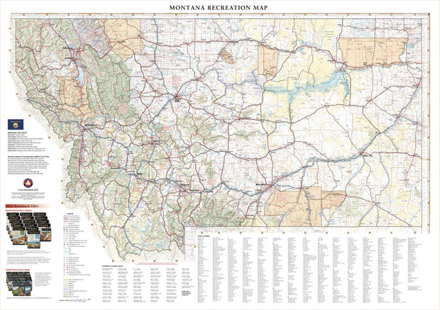
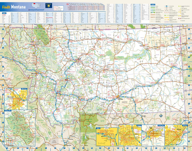
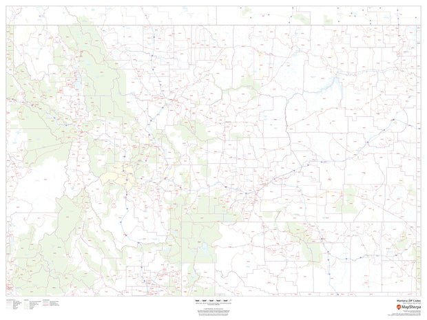
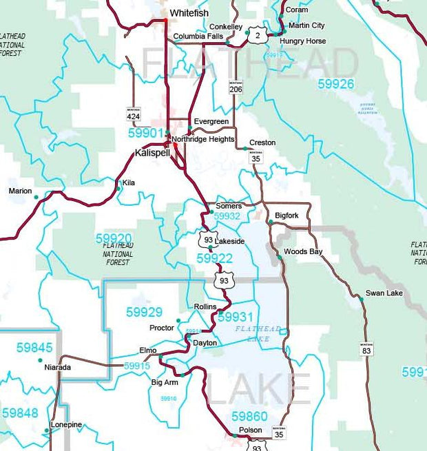
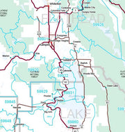
Montana covers a massive area (4th largest state in the USA) from its eastern Great Plains to the Rocky Mountains in the west. This wall map illustrates Big Sky County’s vast landscapes and scenic roads that connect world class destinations including Glacier and Yellowstone National Parks.

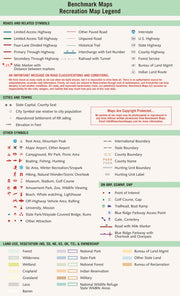
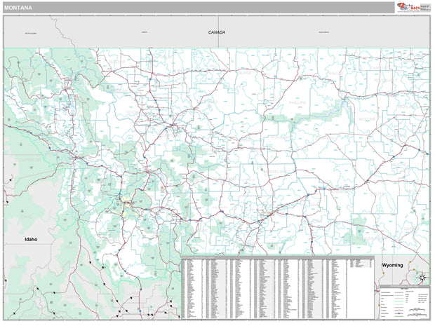
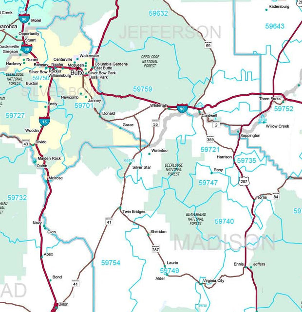
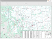
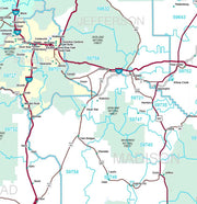
If outdoor adventure and recreation is your thing, this is the map for you. This map is loaded with points of interest from camping sites, hiking trails, fishing spots, and bird watching locations ( see legend shown on 2nd picture) this map depicts all the best recreation locations. Not only functional this exquisite map uses shaded relief to portray the land a technique which combines shading with elevation tints that portray landforms much more clearly than contour lines. These techniques and elevation colors make mountains, highlands and valleys immediately obvious.

Beautiful as well as functional this map will look great in a home, office, cabin, RV or wherever you choose to hang it.

This map is rolled and shipped in a sturdy cardboard tube.

Glacier National Park

Glacier National Park

Regular price $49.95

This wall map details the rugged landscapes of Glacier National Park, the crown jewel of Montana’s Rocky Mountains. Map features include public land ownership, recreation points of interest, campgrounds, peak and river names, and the network of highways and back roads that provide access to this stunning mountainous region at the U.S. – Canada border.


Montana Wall Map by Globe Turner

Montana Wall Map by Globe Turner

MTWM002

Regular price $54.95

This colorful, easy-to-read state map of Montana identifies all major thoroughfares, secondary roads, freeway interchanges, rest areas, distance markers, landmarks, recreational areas, and more. Shaded relief on the state map provides a three-dimensional sense of Montana's topography. Detailed city inset maps of Billings, Butte, Great Falls, Helena and Missoula are based on the latest street information from our cartographic experts. The map also includes up-to-date inset of Glacier National Park. County and city indices make it simple to locate even the smallest town.

This map is rolled and shipped in a sturdy cardboard tube.

Montana State Wall Map

Montana State Wall Map

MTWM006

Regular price $79.95
Wall map of Montana, showing counties, towns, cities, villages, major roads and highways. A community index is included.

This map comes in a variety of sizes and finishing options. It is shipped rolled in a sturdy cardboard tube.

Montana Zip Code Map

Montana Zip Code Map

MTWM003

Regular price $64.95

This map of Montana shows ZIP codes overlaid on a road map. Base map features include county boundaries, major road network features, and state and national parks and conservation areas.

This map is rolled and shipped in a sturdy cardboard tube.

Montana Zip Code Map with Counties

Montana Zip Code Map with Counties

MTWM008

Regular price $59.95

This map has been created and designed for reference or business use. Clear and clean colors & fonts matched with cartographic research makes this map of Montana's counties and ZIP codes easily readable and useful.

Montana Counties Map

Montana Counties Map

MTWM007

Regular price $59.95

This map has been created and designed for reference or business use. Clear and clean colors & fonts matched with cartographic research makes this map of the 56 Montana counties easily readable and useful.

Color Cast Style Wall Map of Montana by Market Maps

Color Cast Style Wall Map of Montana by Market Maps

MTWM004CC-1

Regular price $118.75

The Color Cast Style Montana State Map is a multi-colored display that shades each county with its own background color. It is an ideal choice for applications that benefit from quickly and easily distinguishing one county from the others. 

This wall map comes laminated on both sides using 3mm hot lamination, which protects your wall map and allows you to write on it with dry-erase markers.

Includes inset maps of all major cities.

Features include:

  • Cities and Towns
  • Interstate/Us/State Highways
  • Color Coded & Labeled Counties
  • 5-Digit ZIP Codes Labeled with Boundaries
  • Fully Indexed Cities, Towns and Zip Codes

This map is rolled and shipped in a sturdy cardboard tube.


Premium Style Wall Map of Montana by Market Maps

Premium Style Wall Map of Montana by Market Maps

MTWM004-1

Regular price $118.75

Save money on our full line of wall maps from one of the industry leaders in wall maps. These always up to date, eye catching wall maps come in a variety of sizes and finishing options sure to meet your specific mapping needs.

Features include:

  • Interstate/Us/State Highways
  • 5-Digit ZIP Codes
  • County Names and boundaries
  • Cities and Towns as applicable
  • All water
  • Institutions
  • Cemetery
  • Airports
  • Golf Courses
  • Parks
  • Populated Places Shaded
  • ZIP Code index with grid locator

This map is rolled and shipped in a sturdy cardboard tube.


Montana by Rand McNally

Montana by Rand McNally

MTWM001-3

Regular price $229.00
  • Laminated with Hanging Rails
  • 46" W x 60" H
  • Index of Counties and Cities
  • Fully Indexed Counties, Cities, Mileage Chart
  • Inset Maps of All Major Cities
  • Free Shipping!

Description  

Rand McNally's state wall map of Montana is ideal for anyone needing a comprehensive representation of the area for planning, routing, or reference. It is an excellent choice for business and sales strategy, urban development, social work outreach, education, and marketing. State residents, businesses, and government offices are sure to find this wonderful reference tool irreplaceable. 

  • The laminated wall map is printed with UV-resistant ink to help prevent color fading. 

  • Map details include federal, state, and county highways, county boundaries, cities and towns, major waterways, state/national parks, campsites, exit numbers, rest areas, military installations, airports, golf courses, universities, and much more. 

  • You will also find a city/county index on the map, a comprehensive map legend, a distance chart with mileages between various cities, and a mileage/driving times map. 

  • This truly complete wall map even includes a hanging kit with rails for easy mounting just about anywhere. 

Coverage Area 

Inset maps: Boise, Butte, Great Falls, Helena, Missoula, and Waterton-Glacier Int’l Peace Park. 

This map is rolled and shipped in a sturdy cardboard tube.

Powered by Shopify

Main menu

  • Home
  • Choose A State
  • Choose A Category
  • Helpful Info

More Stuff Here

  • Custom Maps
  • Purchase Orders
  • Search for Product
  • Shipping
  • Refunds & returns
  • Contact Us

Join AMS Newsletter

Sign-up for Discounts, Coupons, New Product Arrivals and Recent News.

Powered by Shopify

  • american express
  • apple pay
  • diners club
  • discover
  • google pay
  • master
  • paypal
  • visa

All of our maps have a Free Shipping Option!