Skip to content
  • Home
  • Choose A State
    • Alabama
    • Alaska
    • Arizona
    • Arkansas
    • California
    • Colorado
    • Connecticut
    • Delaware
    • Florida
    • Georgia
    • Hawaii
    • Idaho
    • Illinois
    • Indiana
    • Iowa
    • Kansas
    • Kentucky
    • Louisiana
    • Maine
    • Maryland
    • Massachusetts
    • Michigan
    • Minnesota
    • Mississippi
    • Missouri
    • Montana
    • Nebraska
    • Nevada
    • New Hampshire
    • New Jersey
    • New Mexico
    • New York
    • North Carolina
    • North Dakota
    • Ohio
    • Oklahoma
    • Oregon
    • Pennsylvania
    • Rhode Island
    • South Carolina
    • South Dakota
    • Tennessee
    • Texas
    • Utah
    • Vermont
    • Virginia
    • Washington
    • Washington, DC
    • West Virginia
    • Wisconsin
    • Wyoming
    • USA Maps
  • Choose A Category
    • US Regional Maps
    • USA Maps
    • Educational Maps
      • US, World & Continents Combo Pull Down Maps
    • Topographic Maps
      • Any USA Topographic Map
      • Alabama Topographic Maps
      • Arizona Topographic Maps
      • Arkansas Topographic Maps
      • California Topographic Maps
      • Colorado Topographic Maps
      • Delaware Topographic Maps
      • Florida Topographic Maps
      • Georgia Topographic Maps
      • Hawaii Topographic Maps
      • Idaho Topographic Maps
      • Illinois Topographic Maps
      • Indiana Topogrpahic Maps
      • Iowa Topographic Maps
      • Kansas Topographic Maps
      • Kentucky Topographic Maps
      • Louisiana Topographic Maps
      • Maine Topographic Maps
      • Maryland Topographic Maps
      • Massachusetts Topographic Maps
      • Michigan Topographic Maps
      • Minnesota Topographic Maps
      • Mississippi Topographic Maps
      • Missouri Topographic Maps
      • Montana Topographic Maps
      • Nebraska Topographic Maps
      • Nevada Topographic Maps
      • New Hampshire Topographic Maps
      • New Jersey Topographic Maps
      • New Mexico Topographic Maps
      • New York Topographic Maps
      • North Carolina Topographic Maps
      • North Dakota Topographic Maps
      • Ohio Topographic Maps
      • Oklahoma Topographic Maps
      • Oregon Topographic Maps
      • Pennsylvania Topographic Maps
      • Rhode Island Topographic Maps
      • South Carolina Topographic Maps
      • South Dakota Topographic Maps
      • Tennessee Topographic Maps
      • Texas Topographic Maps
      • Utah Topographic Maps
      • Vermont Topographic Maps
      • Virginia Topographic Maps
      • Washington Topographic Maps
      • West Virginia Topographic Maps
      • Wisconsin Topographic Maps
      • Wyoming Topographic Maps
    • World Wall Maps
    • International Maps
    • War Maps
  • Helpful Info
    • Our Printing Process
    • Shipping
    • Returns
    • Purchase Orders
    • Custom Maps
  • Log in
Cart
American Map Store American Map Store
Log in Search Cart
Home / Virginia State Maps

Virginia State Maps

Virginia State Maps

  • View all
  • Maryland
  • Maryland: Historical Maps
  • Revolutionary War
  • Virginia
  • Virginia: Virginia State Maps
Quick view
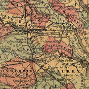
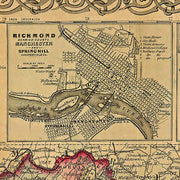
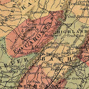
Colton's Virginia, 1862
$39.95
Quick view
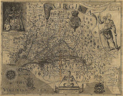
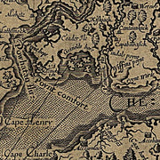
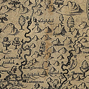
Virginia, discovered and discribed by Captayn John Smith, 1606; graven by William Hole
$39.95
Quick view
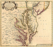
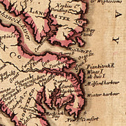
A new map of Virginia, Mary-Land, and the improved parts of Pennsylvania & New Jersey 1719
$39.95
Quick view
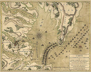
Carte de la partie de la Virginie...1781
$39.95
Quick view
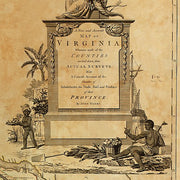
A new and accurate map of Virginia...1770 by John Henry
$39.95
Quick view
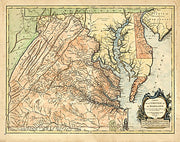
Carte de la Virginie et du Maryland, 1757
$39.95
Quick view
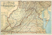
Map of the state of Virginia, 1863
$39.95
Quick view
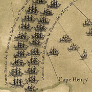
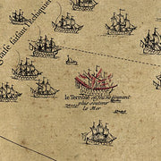
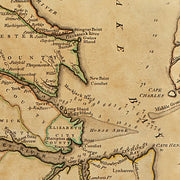
A Plan of the entrance of Chesapeak [sic] Bay with James and York Rivers 1781
$39.95
Colton's Virginia, 1862

Colton's Virginia, 1862

VA00017

Regular price $39.95

Colton's Virginia, 1862
This beautiful antique map reproduction is printed on heavy acid-free stock with fade proof inks and is excellent for framing.

23"W x 19"H

Virginia, discovered and discribed by Captayn John Smith, 1606; graven by William Hole

Virginia, discovered and discribed by Captayn John Smith, 1606; graven by William Hole

VA00003

Regular price $39.95

Virginia, discovered and discribed by Captayn John Smith, 1606; graven by William Hole
This beautiful antique map reproduction is printed on heavy acid-free stock with fade proof inks and is excellent for framing.

25"W x 20"H


A new map of Virginia, Mary-Land, and the improved parts of Pennsylvania & New Jersey 1719

A new map of Virginia, Mary-Land, and the improved parts of Pennsylvania & New Jersey 1719

VA00008

Regular price $39.95

A new map of Virginia, Mary-Land, and the improved parts of Pennsylvania & New Jersey 1719
This beautiful antique map reproduction is printed on heavy acid-free stock with fade proof inks and is excellent for framing.

26"W x 30"H

Carte de la partie de la Virginie...1781

Carte de la partie de la Virginie...1781

VA00005

Regular price $39.95

Carte de la partie de la Virginie...1781
This beautiful antique map reproduction is printed on heavy acid-free stock with fade proof inks and is excellent for framing.

25"W x 20"H

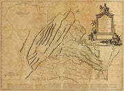
A new and accurate map of Virginia...1770 by John Henry

A new and accurate map of Virginia...1770 by John Henry

VA00009

Regular price $39.95

A new and accurate map of Virginia...1770 by John Henry
This beautiful antique map reproduction is printed on heavy acid-free stock with fade proof inks and is excellent for framing.

35"W x 26"H


Carte de la Virginie et du Maryland, 1757

Carte de la Virginie et du Maryland, 1757

MD00012

Regular price $39.95

Carte de la Virginie et du Maryland. Dressée sur la grande carte angloise de Mrs. Josué Fry et Pierre Jefferson, par le Sr. Robert de Vaugondy, géographe ordinaire du roi. Avec privilege 1755. Gravé E. Haussard.

Robert de Vaugondy, Gilles, 1688-1766.

CREATED/PUBLISHED
Paris, 1757
This beautiful antique map reproduction is printed on heavy acid-free stock with fade proof inks and is excellent for framing
Carte de la Virginie et du Maryland. Dressée sur la grande carte angloise de Mrs. Josué Fry et Pierre Jefferson, par le Sr. Robert de Vaugondy, géographe ordinaire du roi. Avec privilege 1755. Gravé E. Haussard.

Robert de Vaugondy, Gilles, 1688-1766.

CREATED/PUBLISHED
Paris, 1757

This beautiful antique map reproduction is printed on heavy acid-free stock with fade proof inks and is excellent for framing

26"W x 16"H
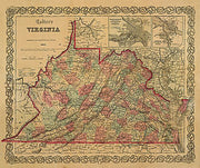
Map of the state of Virginia, 1863

Map of the state of Virginia, 1863

VA00028

Regular price $39.95

Map of the state of Virginia, 1863
This beautiful antique map reproduction is printed on heavy acid-free stock with fade proof inks and is excellent for framing.

35"W x 23"H

A Plan of the entrance of Chesapeak [sic] Bay with James and York Rivers 1781

A Plan of the entrance of Chesapeak [sic] Bay with James and York Rivers 1781

VA00007

Regular price $39.95

A Plan of the entrance of Chesapeak [sic] Bay with James and York Rivers 1781
This beautiful antique map reproduction is printed on heavy acid-free stock with fade proof inks and is excellent for framing.

25"W x 20"H

Powered by Shopify

Main menu

  • Home
  • Choose A State
  • Choose A Category
  • Helpful Info

More Stuff Here

  • Custom Maps
  • Purchase Orders
  • Search for Product
  • Shipping
  • Refunds & returns
  • Contact Us

Join AMS Newsletter

Sign-up for Discounts, Coupons, New Product Arrivals and Recent News.

Powered by Shopify

  • american express
  • apple pay
  • diners club
  • discover
  • google pay
  • master
  • paypal
  • visa

All of our maps have a Free Shipping Option!